Curated OER
The Geography of the United States
Full of bright maps and interesting information, this presentation details U.S. Geography. Slides include basic facts about size, regions, topography, and demographics, as well as fascinating trivia about the United States, including...
Curated OER
U.S. Geography: The Northeast
Learners investigate U.S. Geography by creating a map in class. For this natural resource lesson, students create a map of the United States and research the Northeast based on their resources and recyclable materials. Learners...
Curated OER
U.S. Geography for Children: The Northeast
For this map skills of the northeastern United States worksheet, students observe an outline map, locate and label the states, and designated landforms and bodies of water; and create symbols and a map key for sources of economy and...
Curated OER
U.S. Geography for Children: State Capitals
For this United States map skills worksheet, students locate and label specified states and their capitals, and create icons and a map key to show something for each state that is famous. Students answer 5 questions.
Curated OER
U.S. Geography- The Northeast
Students investigate the geography of the Northeast states. In this map skills lesson, students are shown a map of the Northeast states and identify the state names and borders. Students construct individual maps of the Northeast using...
Curated OER
Plotting Slave Population Density in Connecticut in the 1700's
Tenth graders explore slavery in the U.S. by researching the web. In this U.S. history lesson plan, 10th graders identify the geography of Connecticut and the overall involvement the state had in the slavery process. Students view data...
Curated OER
Where Did My Lunch Come From? A U.S. Regional Tour
Students explore the regions from which their food comes. In this social studies lesson, students identify the different agricultural products that are found in the major regions of the United States. Students create a lunch menu.
Curated OER
Northeast States and Tribes Word Search
For this geography worksheet, students find the words that are used to describe places in the Northeastern United States. The answers are found at the bottom of the page.
Curated OER
Transportation's affect on the Growth of Cities in the United States
Eighth graders identify the major advancements that have been made in transportation throughout U.S. history (waterways, horses, steam power, railroads, automobiles, etc.) They access websites imbedded in this plan and answer questions...
Curated OER
GEOGRAPHY GOES TO THE DOGS
Students use countries and dogs from around the world to answer the questions.
Curated OER
FROM SEA TO SHINING SEA
Identify agricultural products grown in each region of the country.
Discuss how geography affects what is grown or raised in a particular area.1. Hand out a copy of the two activity sheets "Food From Sea to Shining Sea" to each student....
Curated OER
Find a Cave
Students locate their own communites and the nearest caves on a United States map. They calculate the distance to the nearest cave using rough scale.
Curated OER
The Cost of Raising a Child
Students study the cost of raising students based on different geographic locations and income levels. They study tables from the USDA and listen to audio tapes.
Curated OER
George Washington Teaches Map Directions
Students follow teacher given directions, either oral or written to plot points on a grid to create a profile of George Washington. They apply cardinal and ordinal directions to find the points on the grid.
Curated OER
How the West Was One: A Layered Book
Students create a layered book about the information they learn about the Western region of the United States. In this Western states lesson plan, students create a book about the land, economy, and culture.
Curated OER
States and Territories
In this United states learning exercise, 5th graders read a short script pertaining to the states and territories. Students complete 10 fill in the blank questions and self check this online interactive learning exercise.
Curated OER
Cultural America
Seventh graders investigate the cultural differences that can be found in America. They discuss what it means to be called an American. The patterns of migration to America are discussed with the use of maps and geographical terms....
Houghton Mifflin Harcourt
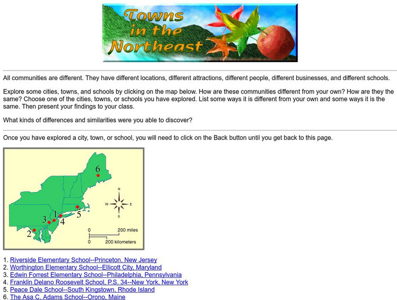
Harcourt: School Publishers: Towns in the Northeast
"All communities are different. They have different locations, different attractions, different people, different businesses, and different schools." This site is about some of the cities in the Northeast section of the United States....


