Curated OER
Views of the American West: True or False?
Students explain that a landscape painting may or may not accurately represent a specific place. They identify techniques that create the illusion of three-dimensional space on a flat surface.
Curated OER
Geography: Why Is the Sacremento Valley a Good Place to Grow Rice?
Third graders locate the Sacramento Valley in California where rice is grown. In this rice growing location lesson plan, 3rd graders locate the Sacremento Valley, California on a map, and color the mountain ranges and terrain that is...
Curated OER
Transportation's affect on the Growth of Cities in the United States
Eighth graders identify the major advancements that have been made in transportation throughout U.S. history (waterways, horses, steam power, railroads, automobiles, etc.) They access websites imbedded in this plan and answer questions...
Curated OER
Lake Tahoe Then and Now
Students investigate the differences in Lake Tahoe from the past to the present. In this geography lesson, students read the book Washoe Seasons of Life and identify the descriptions of the land and lake. Students create a Venn diagram...
Curated OER
Wild Habitats
Students research and Illustrate the natural habitats of giraffes and other animals imported into ancient Rome. They draw a map of Europe, North Africa, and West Asia and draw the animals that come from each region in their proper places.
Curated OER
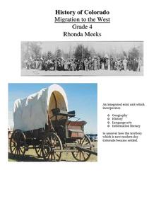
History of Colorado-Migration to the West
Fourth graders identify reasons for people moving to the Colorado Territory and examine how moving in the 1800's is different than moving today. They also practice reading maps and gathering information from maps, as well as, describe...
Curated OER
Cultural Anthropology Study Using the Fundamentals of Geography and GPS
Students, in groups, operate the GPS unit, plotting each head stone with accompanying description. Two other students to log in data that corresponds to the given points. One student to note general observations
Curated OER
Lewis and Clark: Meeting the Indians of the Northwest
Eighth graders examine the relationships forged with Native Americans by Lewis and Clark. In this Westward Expansion lesson, 8th graders research digital and print sources to study details regarding the Native American tribes that Lewis...
Curated OER
"Across Oregon On The 45th N Parallel" A Transect of Oregon
Students explore the physical geography of Oregon. In groups, students collect weather and elevation information on Oregon. They organize the data and create maps and graphs of the information. Afterward, students compare the...
Curated OER
FROM SEA TO SHINING SEA
Identify agricultural products grown in each region of the country.
Discuss how geography affects what is grown or raised in a particular area.1. Hand out a copy of the two activity sheets "Food From Sea to Shining Sea" to each student....
Curated OER
Out in the Middle of Nowhere: Inevitable Lifestyle Changes
Eleventh graders examine the interaction between Utah's geography and its inhabitants. They explain how looking at cause/effect relationships is an example of historical thinking.
Curated OER
Nigerian Elections Critical Analysis
Students examine the recent history of Nigeria and determine how its history and geography have effect current events in the area. They look at the challenges facing Nigeria as a new democracy and a developing nation. They determine...
Curated OER
Weather and Water in Ghana
Students research the rainy and dry season to investigate Africa's weather. In this African weather lesson, students use the given websites to research the rainy and dry seasons of Ghana in Africa. Students then read stories about life...
Curated OER
Maps
Maps, globes, and computer software aid young explorers as they locate state capitols, major cities, geographic features, and attractions for states they are researching. They then use desktop publishing software to create a map to share...
Peace Corps
Weather and Water in Ghana
Students investigate the climate of their region. Students research statistics and conduct interviews. Students take a virtual tour of Ghana and discuss its climate. Students consider water conservation and the role it plays in both...
Curated OER
New Food Saves Lives, Could End Hunger
Young scholars locate the country of Niger, then read a news article about a new type of food that is being used to fight childhood hunger in Africa. In this current events lesson, the teacher introduces the article with map and...
Curated OER
George Washington Teaches Map Directions
Students follow teacher given directions, either oral or written to plot points on a grid to create a profile of George Washington. They apply cardinal and ordinal directions to find the points on the grid.
Curated OER
The Constitution on Trial: The Internment of the Japanese During World War II
Eleventh graders analyze primary source documents during the Second World War. Students recall statements of Japanese-Americans who were placed into internment camps during the war.
Curated OER
Geological Forces and Topography
Students discuss and research the Earth's geological processes. In this geology lesson, students study maps of Utah and the United States to learn about geological features. Students then complete the research cards for each area of...
Curated OER
The Cost of Raising a Child
Students study the cost of raising students based on different geographic locations and income levels. They study tables from the USDA and listen to audio tapes.
Curated OER
Make a Community Almanac
Students gather geographic information about their community. They work together to create a community almanac.
Curated OER
The Expansion of The United States, 1846-1848
Students interpret historical maps,identify territories acquired by the United States in the 1840s. Also they identify states later formed from these territories. The primary sources for the instructional activity are the maps found in...
Curated OER
Mount Auburn Cemetery
Students use photos, maps and reading materials to examine the history and role of Mount Auburn Cemetery. They analyze the landscape of the cemetery, consider how it affects visitor's emotions and feelings and then design an original...


