Education World
The African American Population in US History
How has the African American population changed over the years? Learners use charts, statistical data, and maps to see how populations in African American communities have changed since the 1860s. Activity modifications are included to...
Curated OER
California's Golden History: 1848-1880
Using a variety of online resources, learners study life and society in California during the gold rush. They use a map to identify area where gold was located, explore pre-selected websites, describe mining practices, and create an...
Curated OER
Basic U.S. Geography
Provide your 11th graders with a basic understanding of U.S. Geography. They label the state, regions, and boundaries found in the contiguous U.S. as well as Hawaii and Alaska. Then, they complete two Internet related activities.
Curated OER
The Arkansas State Flag
Young historians take a look at the history of the Arkansas state flag. Pupils color, cut, and paste together their own versions of the flag. They learn about the meaning of the flag's colors, and what the various symbols on the flag...
Curated OER
Maps Can Help Us
First graders explore the geography of Montana by analyzing geographic maps of the area. In this Native American reservation lesson plan, 1st graders discuss the similarities and differences between reservations in the state of Montana....
Curated OER
Desert Fever: A Student-Centered Approach to Learning About the Middle East
Explore the exciting and diverse geography, people, history, governments, and economies of the Middle East. Curious minds develop a basic vocabulary of Arabic terms and work with various materials to create an aesthetically pleasing,...
Curated OER
My Important Place
The story of Chief Joseph and the Nez Perce Indians of Oregon is told here. Pupils are shown pictures of the ancestral lands of the Nez Perce, and they learn about how they were forced to leave it. Students complete an essay which...
Curated OER
U.S. Geography: The West
Students explore the national parks of the American West. In this geography skills lesson, students watch "U.S. Geography: The West," and examine print and Internet sources about the national parks found there. Students feature their...
Curated OER
Discovering American Symbols
Help youngsters get to know their states and capitals, explore their own country, and study American symbolism. They take a "trip" across America collecting symbols, images, and information about each state as they go (through text and...
Curated OER
Early America: Jeopardy Game
Fifth graders can put their knowledge of early American life, the 13 colonies, and maps to the test when they play this Jeopardy game. The game covers terminology, famous people, and geography related to Colonial American times. Note:...
Curated OER
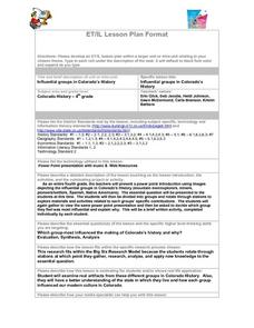
Influential Groups In Colorado's History
Fourth graders watch a teacher made PowerPoint presentation that introduces the study of Colorado's history. They view images and listen to music that is indicative of the mountain men, miners, pioneers, the Spanish, and Native Americans...
New York State Education Department
TASC Transition Curriculum: Workshop 11
You'll C-E-R a difference in classroom achievement after using a helpful lesson. Designed for economics, civics, government, and US history classes, participants practice using the CER model to craft arguments about primary and secondary...
Curated OER
Settlement Exploration: Then and Now
NASA has crafted an imaginative and memorable series of lessons, "NASA and Jamestown Education Module." This instructional activity is one of the five components. In it, middle schoolers connect history and science by comparing the...
Curated OER
Puerto Rico: The 51st State?
Learners research the history of Puerto Rico, its culture, and geography. In this Puerto Rico lesson, students find Puerto Rico on a map and find specific regions or cities. Learners discuss Puerto Rico's statehood and listen to salsa...
Curated OER
Family History
Eighth graders examine immigration patterns. In this family history lesson, 8th graders investigate their own family histories and then compare and contrast immigration patterns of their class to national immigration patterns between...
Curated OER
Places in Arkansas: A Tour of Our Unique State
A great activity focuses on important cultural and historical places in the state of Arkansas. Learners are introduced to six important places in Arkansas, then create a report on a place in Arkansas. Some excellent photographs, resource...
Curated OER
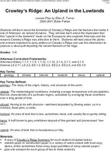
Crowley's Ridge: An Upland in the Lowlands
This clever lesson combines elements of geography, art, literature, and storytelling. Pupils take a close look at the six geographical regions of Arkansas, and pay close attention to Crowley's Ridge - which is one of the six. In groups,...
Alabama Department of Archives and History
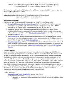
Military Conscription in World War I: Alabamians Express Their Opinions
If called, would you go? Should the US government have the power to impose a draft during any war? The Selective Service Act of 1917 (aka the Conscription Act of 1917) authorized the drafting of men into the military for only the second...
Curated OER
Texas Commemorative Maps: Honoring Our Past
To celebrate Texas, groups plan and create a commemorative map for a topic or theme in Texas history. The richly detailed plan and the approach could easily be adapted to any state. Samples are included.
Curated OER
Nature and Place Names in Arkansas
Middle schoolers examine the way that many place names in Arkansas came to be. By looking at Arkansas highway maps, they find names that come from the characteristics of each of the state's six geographical divisions. This interesting...
Curated OER
Arkansas: A Changing Climate, a Changing Land
Here is a lesson on the climate zones and geography of Arkansas. In it, learners look at maps (embedded) of different climate zones found throughout Arkansas. They engage in discussions regarding how global warming and climate change is...
Curated OER
US Immigration
Students examine the history of immigration in the United States. Using primary source documents, they identify the areas of origin for people settling in Minnesota and describe the push and pull factors that brought them there. They...
Curated OER
Egypt
A fascinating presentation on the historical, physical, and cultural geography of Egypt awaits your pupils in this fine PowerPoint. Some excellent photographs of the landscape are included, as well as some fine examples of the Egyptian...
Curated OER
Establishing Borders: The Expansion of the United States 1846-48
Students investigate how the United States acquired land after the Revolutionary War ended. In this establishing borders instructional activity, students use maps to identify territories acquired by the US and the states that later...


