Curated OER
Exploring a Map of Canada
In this exploring a map of Canada worksheet, students find and label the capital city, bodies of water, the U.S., the provinces and the territories of Canada.
Curated OER
Connecticut: Crossword Puzzle
In this United States history learning exercise, students use the 14 clues in order to fill in the crossword puzzle with the appropriate answers pertaining to Connecticut.
Curated OER
Portrait Analysis of Lincoln in Richmond, VA
Students view and analyze a portrait of Abraham Lincoln made during his visit to Richmond, Va. Students determine the historical significance of his visit and create fictional newspaper accounts from various perspectives.
Curated OER
North America Puzzle
For this geography worksheet, students complete a crossword puzzle in reference to North America. They identify capitals of some countries, the specific landforms of different areas, and languages spoken. There are 21 clues to solving...
Curated OER
Move Around the Map
Fourth graders, while working with a partner, label and identify on a tarp map six major cities and five major rivers in Indiana. They traverse along the rivers utilizing a different locomotor skill (hop, skip, walk, run, leap, gallop,...
Curated OER
Ohio Vocabulary
After selecting State Unit Studies and choosing Ohio, you'll find a plethora of information on The Buckeye State. There's an information sheet, an Ohio state map, and several sheets that detail the capital, flag, flower, bird, tree,...
Curated OER
Ybor City Historic District
Students analyze the role cigar making played in Ybor City. They examine how cigars are made and the different societies who helped immigrants keep their identify. They compare and contrast their own community to Ybor City.
Curated OER
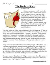
The Buckeye State
In this reading comprehension worksheet, 3rd graders read a short passage and answer questions about what they have read. Students respond to 5 multiple choice questions assessing understanding of what has been read.
Curated OER
South US Region Map
In this United States regional outline map, students examine the state boundaries of the states in the Southern Region. Capital cities are denoted with stars.
Curated OER
The Battle for New Orleans
In this Battle for New Orleans worksheet, students read a 3 page article on the battle and then answer 10 true or false statements referring to the article.
Curated OER
Cory in the House: "New Kid in Town"
Students, after watching the program "New Kid in Town," are introduced to the White House in Washington, D.C. They explore the difficulties of fitting into a new environment along with new acquaintances. They stress and address the...
Curated OER
A Dream and an Idea: Searching for a Roadmap to Create a Country
Young scholars listen in on American historical events. In this colonial America lesson, students participate in an activity that requires them to watch video segments that feature Revolutionary War battles and the Constitutional...
Curated OER
Traveling Across America
Students plan a trip to a state capital of their choice with a budget of $2,000. The budgets include site seeing, lodging, food and all necessary expenses. Students keep a daily journal and maintain their budget.
Curated OER
Get Ready for the Great Outdoors!
Learners discuss what is a map and what they already know about maps. They brainstorm together to compile a list of responses for the board and observe a map of the United States, including states, capitals, and some of the National Parks.
Curated OER
Bank On It! Worksheet Cinco de Mayo
In this Cinco de May worksheet, students read a passage about the celebration of Cinco de Mayo in the United States. Students fill in ten missing words to make the text understandable. The words will be of the student's own choice; there...
Curated OER
Cultural Maps
Fifth graders examine map elements. In small groups they create a map of an imaginary country that includes a title, legend, directional indicator, scale, boundaries, capital cities, country name, and icons of five natural resources. ...
Curated OER
Indiana Travel Guide
Fourth graders, after exploring and researching the state of Indiana, create a travel guide about the state of Indiana including its capital, major rivers, governors and two famous people from the state. They utilize a variety of art...
Curated OER
President Who? Forgotten Founders and Their Capitols
Students explore the beginning of the United Colonies that were formed in 1774. In this history instructional activity, students discuss the Articles of Confederation and then answer questions about the events surrounding the...
Curated OER
Alaska Challenge
In this Alaska learning exercise, students complete 10 multiple choice questions about the state of Alaska. A reference web site is given for additional activities.
Curated OER
Indiana Travel Guide
Fourth graders create a travel guide about the state of Indiana with 100% accuracy. They label the capital within the travel guide with 100% accuracy. Students label one major river in the right location with 100% accuracy. They circle...
Curated OER
I Spy with my Little Eye…
Students read an article on Vienna. In this ESL lesson plan, students explore a recent incident between Russia and the United States, then complete several activities that reinforce the information in the article.
Curated OER
Barack Obama
In this online interactive Barack Obama activity, students respond to 15 fill in the blank and multiple choice questions regarding the information included in the provided paragraphs.
Curated OER
Sami and the Time of Troubles
Students read Florence Parry Heide and Judith Heide Gilliland's, Sami and the Time of Troubles before discussing it as a class. They brainstorm ideas for a letter to the main character, Sami. Next, they write a rough draft of a letter to...
Curated OER
4-H Citizenship Activity Page
In order to understand how our government works, students need to delve into the intricacies at both the local and federal level. Using this 20 question activity learners explore how government affects their daily life.


