Curated OER
Come One, Come All
Students analyze information from core map and other sources and construct routes from New York and Boston to Cincinnati as they might have existed in 1835.
Curated OER
Water and Land 207
Students examine maps of different projections, mathematically calculate distortions, and note the advantages and disadvantages of each map. They study the different maps and transfer the map to graph paper.
Curated OER
BOUND TO BE NEW HAMPSHIRE
Pupils identify neighborhood, town, and state boundaries. They distinguish between natural and man-made boundaries. They identify major state geological features and explain how NH boundaries have changed over time.
Curated OER
The Battle of Brandywine
Students explore the Battle of Brandywine, how to analyze maps, and construct a model of a battlefield.
Curated OER
States of Fitness
Students participate in physical activities coordinating to divisions on a map.
Curated OER
A Place Called Fairfax
Students use maps to locate Virginia, its surrounding states and Fairfax County. Individually, they describe the absolute and relative location of the county and why it is important to know both. As a class, they brainstorm the...
Curated OER
Urban Geo Worksheet
In this urban geography worksheet, students respond to 20 short answer questions about urban geography after they have read a related article. The article is not included.
Curated OER
Order Out of Borders
Students examine the differences between natural and man-made borders by investigating the Texas quarter. They create clay models of the state of Texas.
Curated OER
Boilermaker Geography
Fifth graders investigate the geography of central Indiana with an emphasis upon finding the location of Purdue. They make a connection to literature with the reading of a newspaper article to create the context for the lesson plan while...
Curated OER
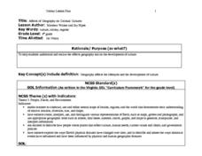
Affects of Geography on Colonial Cultures
Sixth graders examine the effects of geography on the development of culture. They discuss how geography can affect the lifestyles and development of a society's culture. Students examine the geography and climate of New England and the...
Curated OER
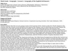
Geography of the English Settlements
Third graders locate several important American colonial cities on a map and research how their proximity to water and nearby arable land affected the rate and success of settlement.
Curated OER
Where Is Japan? How Far Is That?
First graders use literature and hands-on activities with maps and globes to explain distance and tools used to measure distance. They select tools to measure various objects in the classroom, then apply those concepts to their map...
Curated OER
New York Earns Title: Empire State
Seventh graders study the Erie Canal and New York state. They design a three-day vacation itinerary using tourism sites, which highlight historical facts and include the modern remains of the New York Canal system.
Curated OER
NAFTA Trade Unit
Middle schoolers research the geography, economics and government of Canada and how that affects US/Canadian trade relations. In this NAFTA lesson, students play a game, read about Canadian history, and creat a graph.
Curated OER
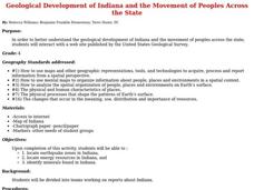
Geological Development of Indiana and the Movement of Peoples Across the State
Learners are introduced to the geological development of the state of Indiana. Using the internet, they visit the U.S. Geological Survey and locate the earthquake zones in the state. In groups, they locate and identify the energy...
Curated OER
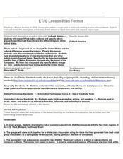
Cultural America
Seventh graders investigate the cultural differences that can be found in America. They discuss what it means to be called an American. The patterns of migration to America are discussed with the use of maps and geographical terms....
Curated OER
Geography
Second graders study and review geographical terms for features. They classify those features and locate them on a map. They review geographical features of Tall Tales.
Curated OER
Geography and AIDS
Learners use Internet research to complete and compare maps and view a video to explore the AIDS/HIV crisis in parts of Africa. They discuss their findings.
Curated OER
Camp Chase Confederate Cemetery
Students use maps, readings and photographs to locate prisoner of war camps in the North during the Civil War. They identify the camp's population sizes and mortality rates and how the camps' uses have changed over time.
Curated OER
The Role of International Organizations in Peacekeeping
Eighth graders are given two case studies. They determine if the United Nations should become involved, and if so, in what capacity? students explain their decisions based on a set of criteria determined by the class.
Curated OER
Exploration Watershed
Students discuss what a watershed is, and locate watersheds on a map. In this watershed lesson plan, students use the information they have been introduced to and create a color coded watershed map of their own.
Curated OER
Civil War Battles: The Reporter's Perspective A WebQuest
Students interpret historical evidence presented in primary and secondary resources. In this research skills lesson, students research the job of reporting for new agencies during the American Civil War as they complete the provided...
Curated OER
Reasons to Settle in America
Students complete a research project. In this American History instructional activity, students work in groups to research reasons that people wanted to settle in America. Students record the information, share what they found and...
Curated OER
Thematic Unit: Beginning Holocaust Studies
Fifth graders discuss concepts of diversity, culture, and prejudice, gain understanding of harm caused by prejudice, and demonstrate ability to think critically and a desire to act morally.


