Curated OER
social studies: Life in Colonial America
Students explore the trials and tribulations early colonial life and note its successes. Through literature, Internet research, and interactive software, they engage in various activities to evaluate early social and cultural development.
Curated OER
Sparta and Athens
Sixth graders study Ancient Greece. For this Ancient Greece lesson, 6th graders complete 16 lessons to learn about Ancient Greece. Students complete a quiz for assessment.
Curated OER
Clean Kansas Water
Students gain an understanding of ways we can be responsible custodians of our water supply. Students explore the governor's clean water initiative involving the Lower Kansas/Republican river basin and the pollutants present there.
Curated OER
Native Americans - People of the Plains
Students explore Plains Indians and practice computer skills by reading creation and migration stories on People of the Plains CD-ROM, and watching Plains video. Students examine village life of Plains Indians, and view different...
Curated OER
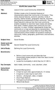
Lesson 9-Our Local Community
Second graders brainstorm and create a list of important features/characteristics that they would want to include in a community setting. They include physical features, economic activities, kinds of housing, etc. This lesson is a...
Curated OER
Oregon City: A Convergence of Endings
Students describe the activities that occurred in the Willamette Valley before the establishment of the Oregon Trail and agricultural settlement and explain the impact that American settlement had on the landscape and native groups who...
Other
National Atlas of the United States
The National Atlas of the United States provides comprehensive information collected by the Federal Government and delivered through interactive maps. Select from a variety of scientific, societal, and historical information to be...
Central Intelligence Agency
Cia: World Factbook: United States
This resource from the CIA World Factbook provides a detailed fact sheet of United States. The content covers the country's geography, people, government, economy, communications, transportation, military, and transnational issues. It...
Kidport
Kidport: United States of America Geography
This site contains a fun way to learn about the states within the United States. Click on the state that you want to learn more about and it provides facts, geographic landmarks, points of interest, major industries, a quiz and more.
World Atlas
World Atlas: United States of America
A comprehensive guide to the United States of America including a variety of maps, statistics, facts, and information on history, geography, flags, symbols, travel, and much more.
A&E Television
History.com: The States
Learn unique facts about each American state. You can also read a more in-depth history of each state, watch videos and play a game about all the states.
Library of Congress
Loc: Maps of Cities and Towns
Looking for old maps of somewhere in the United States? Check out this huge collection of maps! Search by the name of a city or town, another keyword, subject, title, or geographic location.
Annenberg Foundation
Annenberg Learner: u.s. History Map Interactive
Become a geography whiz as you learn how the United States was settled. Discover how the continent was irrevocably changed by European colonization, the events that caused the wholesale displacement and decimation of the land's original...
Other
Topo Zone: Free Usgs Topo Maps for the Entire United States
A huge collection of topographic maps for each of the US states. Scroll down to see a map of the United States and click on the state you are interested in. From there, you can search for a particular location, choose a featured map, or...
ClassFlow
Class Flow: How Well Do You Know the United States?
[Free Registration/Login Required] This flipchart works with the map of the United States and asks students to complete activities identifying the states. A brief student assessment component is included.
US Geological Survey
United States Geoglogical Survey: Resources for Teachers
USGS provides lesson plans, activities, maps, podcasts, online lectures, videos and animations, and lots more. Covers all grade levels.
University of Texas at Austin
Perry Castaneda Library Map Collection: u.s. Maps
At this site find any type of map on the U.S. and any of its states here. Great site for teachers to print out maps to use in the classroom.
Encyclopedia of Earth
Encyclopedia of Earth: Northern Marianna Islands (United States)
The Encyclopedia of Earth provides an overview of Northern Marianna Islands (United States), including its geography, natural resources, history, government, economy, and much more. Maps and images are also included, along with sources...
Encyclopedia of Earth
Encyclopedia of Earth: Navassa Island (United States)
The Encyclopedia of Earth provides an overview of Navassa Island (United States), including its geography, natural resources, history, government, economy, and much more. Maps and images are also included, along with sources used to...
Encyclopedia of Earth
Encyclopedia of Earth: United States
The Encyclopedia of Earth provides an overview of United States, including its geography, natural resources, history, government, economy, and much more. Maps and images are also included, along with sources used to create the entry.
Encyclopedia of Earth
Encyclopedia of Earth: Wake Island (United States)
The Encyclopedia of Earth provides an overview of Wake Island (United States), including its geography, natural resources, history, government, economy, and much more. Maps and images are also included, along with sources used to create...
Encyclopedia of Earth
Encyclopedia of Earth: Guam (United States)
The Encyclopedia of Earth provides an overview of Guam (United States), including its geography, natural resources, history, government, economy, and much more. Maps and images are also included, along with sources used to create the entry.
Encyclopedia of Earth
Encyclopedia of Earth: American Samoa (United States)
The Encyclopedia of Earth provides an overview of American Samoa (United States), including its geography, natural resources, history, government, economy, and much more. Maps and images are also included, along with sources used to...
Library of Congress
Loc: Mapping the National Parks
A rich and historically significant collection of maps of various national parks throughout the United States. Features special sections on Yellowstone, Acadia, the Grand Canyon and the Smoky Mountains. Includes historical photographs of...


