Curated OER
Using Google Squared to Compare and Contrast Canada and the US
Sixth graders compare and contrast Canada and the United States. In this geography skills instructional activity, 6th graders use Google Squared to research information so that they may compare the geography of Canada and the United States.
Curated OER
Welcome to New York State
Students choose one region of New York state, and create a travel brochure that includes information such as geographical features, tourist attractions, accesibility, economic features, and historical events that occured in that region.
Curated OER
Train Of States
Fourth graders create a class book with information about each of the United States. After students draw a state name out of a hat, they use various resources to fill in a facts chart about their state. Students draw the state flag and...
Curated OER
U.S. Possessions
Ninth graders research the United States acquisition of the Philippines and their fight for independence. They locate the Philippines on a map and brainstorm how its geography has benefits. They access the Internet and complete a student...
Curated OER
Finding Our Way Home: Immigration to the United States, 1815-1860
Students break into families of 4 members. They brainstorm issues that they would encounter as an immigrant family by creating a web. Students are given roles to research focusing on that perspective: father, mother, grandparent, and child.
Curated OER
Quarters from the Coast
Young scholars discuss Fifty State Quarters Program, compare and contrast location of land and water on map of United States, while also becoming aware of physical shape of nation and home state, and explore coastal areas in United States.
Education World
Mystery State #29
In this United States mystery worksheet, young scholars determine which state is described by the 5 clues listed on the sheet and then mark it on the outline map of the United States.
Curated OER
Title: Rivers as Borders
Students are introduced to the concept of borders. They read maps and identify rivers that separate different countries and states. They examine how or why a landform such as a river border might be the reason for different cultures.
Curated OER
The War of 1812
A good addition to a unit on the War of 1812, this slideshow details causes, specific battles, political contexts, and several campaigns of the war. Maps and pictures with broad topics allow teachers to bring their own discussion topics...
Curated OER
The Original 13 Colonies and 3 Regions
Seventh graders review the content of American History and focus upon the original thirteen colonies. They also study the geography of the region. It is recommended that students have other lessons delivered on the topic prior to this one.
Curated OER
The Vietnam War: Causes and US Involvement
Students are introduced to the origins of the Vietnam War, including causes and US involvement. They are given a reading handout over the Vietnam war with questions to answer. Students are shown picture of important people, maps, and...
Curated OER
Freed Slaves
Students are given the identify of a newly freed slave at the end of the Civil War. Students participate in a discussion to explore some of the difficulties and decision making freed slaves had to consider. Students present their...
Curated OER
The Brief American Pageant: The Rise of a Mass Democracy
Focusing on the 1828 election of Andrew Jackson, the removal of Southern Native American tribes (Trail of Tears), and the Texas Revolution, these three slides are full of good information for your lecture. Though brief, the maps featured...
Tennessee State Museum
Deciphering the Document: Unlocking the Meaning of the Emancipation Proclamation
Help your learners truly understand the Emancipation Proclamation by asking them the put it into their own words. After reading the document out loud to the class, and briefly discussing the legal language, split your class into small...
Curated OER
Louisiana History-Unit 4: Early People of Louisiana and a Meeting of Different Worlds
The Poverty Point Culture of Louisiana is described in detail within four slides of this six-slide PowerPoint. Four detailed paragraphs help describe the economic legacy that existed in Louisiana. A table, map, and photo are included to...
Curated OER
Edible Resource Maps
Third graders work in groups to create an edible resource map showing locations of at least five resources in the United States. Students research on the internet different regions and the resources that are found in those areas. They...
Curated OER
The Expansion of The United States, 1846-1848
Young scholars interpret historical maps,identify territories acquired by the United States in the 1840s. Also they identify states later formed from these territories. The primary sources for the lesson are the maps found in the...
Curated OER
State Research
Learners apply previous knowledge of the United States to label a classroom map and then work independently to complete an online scavenger hunt. This lesson is intended for an upper-elementary classroom studying American History and/or...
Curated OER
Temperature Zones
Students read and make inferences about a map showing various temperature zones across the United States.
Curated OER
Distinguished Discoveries: Florida quarter reverse
Florida's state quarter has an image of a space shuttle and a Spanish Galleon on its reverse side. Pupils will examine the state quarter and think about how the Spanish explorers and Space explorers are the same and different. The class...
Curated OER
Understanding Stereotypes
Pupils confront age-related stereotypes, explore how stereotyping impacts their lives, and discuss how they can make changes to reduce over-generalizations, unfair assumptions, and critical judgments about people groups. They use a...
Science Matters
Energy and Winds
In the study of wind energy, scholars build a small windmill and observe how it transfers wind into mechanical energy. Learners will make connections to the previous lesson with concepts such as the creation of wind through convection.
Curated OER
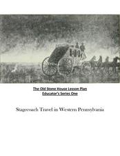
Old Stone House Lesson Plan
From stagecoach to railroad tracks, your class will discover how advancements in travel in the United States during the nineteenth century played an integral role in the industrialization and development of American society. The main...
Curated OER
Rock Around the Map
Students research the geographical histories of various musical genres and make maps that note important places in music history. They Write geographical biographies about one of their favorite musical artists.


