Curated OER
Lesson Ten: Direction
Students explore the concept of relative location. In this map lesson, students read I Hate English by Ellen Levine and consider how maps and globes help people to familiarize themselves with an area.
Curated OER
Where Did My Lunch Come From? A U.S. Regional Tour
Students explore the regions from which their food comes. For this social studies lesson, students identify the different agricultural products that are found in the major regions of the United States. Students create a lunch menu.
Curated OER
Follow the Yellow Brick Road
Students watch a portion of "The Wizard of Oz" and discuss how a map could be useful to Dorothy. They identify key components of maps and design a map of their classroom, including a key.
Curated OER
Lesson Nine: Size and Scale
Young scholars investigate scale as it is related to maps. In this map instructional activity, students read Jack and the Beanstalk by Carol North. Young scholars then compare the setting in the story to a landscape picture map to help...
Curated OER
Texas, Our Texas
Students explore U.S. geography by completing a coloring activity in class. In this Texas history lesson plan, students utilize the web to locate Texas on a map of the U.S. Students view a PowerPoint presentation which showcases the...
Curated OER
CHARTING THE COURSE
Students uses atlases, maps, and Web resources to determine the distance, driving time, and amount of money they need to make the trip (estimates should include hotel/motel stays, meals, and souvenirs).
Curated OER
Trailblazers - Now and Then
Students, working in pairs, use maps to determine the most efficient routes between two cities. They research which route would have been used by early trailblazers. They present a first person account of one of the trailblazers place in...
Curated OER
Labor Needs in Colonial America
Students examine the labor needs in colonial America. Using primary and secondary resources, they explore the major events and life in the United States during colonial times. They complete a chart listing the pros and cons of a slave...
Curated OER
Geographics in Arkansas
Third graders discuss where Arkansas is located on the United States map. They use geographic tools to participate in activities.
Illustrative Mathematics
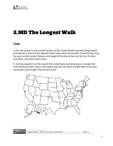
The Longest Walk
How long of a line can you draw within this activity? Learners pick two points outside and within the map to create the longest line they can. After drawing 10 lines, learners plot the length of each line on a line plot. Then they...
Echoes & Reflections
Contemporary Antisemitism
Despite the recognized atrocities of the Holocaust, anti-semitism continues. The 11th and final installment of the Teaching the Holocaust series explores the long-term effects of the Holocaust on modern anti-semitism, asking pupils to...
Houghton Mifflin Harcourt
Celebrating Traditions: Challenge Activities (Theme 2)
Here's a packet of activities, designed to be used with the Houghton Mifflin Harcourt textbook, that will engage and challenge learners who have already mastered the basic skills in a thematic unit study of traditions.
Curated OER
How To Write a Social Studies Outline
One of the keys to success in school is organization. This resource leads learners through the process of creating an outline for a chapter from a social studies text. In addition, they review facts they have learned in their class...
International Technology Education Association
Become a Weather Wizard
Accurate weather forecasting is something we take for granted today, making it easy to forget how complex it can be to predict the weather. Learn more about the terms and symbols used to forecast the weather with an earth science lesson...
Museum of Disability
Looking Out for Sarah
Perry the dog is Sarah's best friend and her guide to the visual world. Young readers learn about guide dogs and communication with Looking Out for Sarah by Glenna Lang, through a series of discussion questions and activities.
Illinois Department of Natural Resources
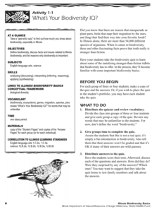
Section One: What is Biodiversity?
Four intriguing and scientific activities invite learners to explore the natural resources of their town. The activities cover concepts such as genetic traits, organizing species in a taxonomy, the differences between different species...
Curated OER
Chancellorsville 360
Experience a Civil War battlefield up close. Chancellorsville 360 allows scholars to explore the battlefield in an interactive format. The site demonstrates the layout of the battlefield, strategies, and key events. Created for high...
Curated OER
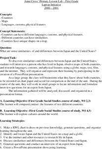
Japan
First graders investigate the similarities and differences between Japan and the United States. They develop a KWL chart, locate Japan and the U.S. on a globe, conduct Internet research on life in Japan, conduct an interview, and create...
Curated OER
Canada, O Canada
Students study the similarities and differences between Canada and the United State in this unit. They examine geography, government and culture as they "travel" through Canada.
Curated OER
Migrating to Texas
Fourth graders explore the migration to Texas from other parts of the United States. Through journal entries they write about the trip as if they were the settlers coming to a new and foreign country. Working in small groups, 4th graders...
Curated OER
Making Lewis and Clark's Journals Come Alive
Students are presented daily excerpts from Lewis and Clark's experiences. The dates and activities are tracked on a classroom map.
Curated OER
Culture Regions of the U.S.
Students identify the location of different cultural groups within the United States (agricultural, retirement, urban, etc.) They map these areas and analyze the correlation between the landscape of a given region and the type of...
Curated OER
Geography of China (Tibet)
Sixth graders study the geography of Tibet. They create maps of Tibet. Students predict population, land area, water area and coastline length of the United States and Tibet. Students compare and contrast the day-to-day lives of people...
Curated OER
Splish Splash
Students study drinking water. In this environment lesson, students draw the path of drinking water from the place of precipitation to the tap after researching a map and information from the United States Geological Survey water...


