Curated OER
Making Lewis and Clark's Journals Come Alive
Students are presented daily excerpts from Lewis and Clark's experiences. The dates and activities are tracked on a classroom map.
Curated OER
Geography of China (Tibet)
Sixth graders study the geography of Tibet. They create maps of Tibet. Students predict population, land area, water area and coastline length of the United States and Tibet. Students compare and contrast the day-to-day lives of people...
Curated OER
Splish Splash
Pupils study drinking water. In this environment activity, students draw the path of drinking water from the place of precipitation to the tap after researching a map and information from the United States Geological Survey water...
Curated OER
The Constitution
Eighth graders watch as their teacher presents information on the Constitution, government and laws through a PowerPoint presentation. In groups, they discuss the importance of government and laws and identify the main ideas in the...
Curated OER
Excerpt from Eyewitness Accounts of Slavery in the Danish West Indies"
Use the power of primary sources to help young historians understand the conditions Africans endured while being shipped during the slave trade. After reading an excerpt from Eyewitness Accounts of Slavery in the Danish West Indies,...
Curated OER
Maps In Our Everyday Lives
Students break into groups and complete a chart about information on maps of their hometown.
Curated OER
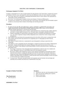
Creating and Comparing Climographs
Students are introduced to the importance and usefulness of climographs. In groups, they create a climograph of two cities on about the same latitude. They compare and contrast the locations and climates of the two cities and write a...
Curated OER
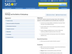
Geology and the Battle of Gettysburg
Young scholars create geologic maps of the Gettysburg battlefield. In this geologic skills lesson, students consider the variations of Earth's surfaces and explore strategies employed by the North and South in the Battle of Gettysburg to...
Curated OER
Getting from Place to Place
Students examine modes of transportation. In this transportation instructional activity, students listen to their instructor present a lecture on modes of transportation over the past 300 years. Students respond to questions about the...
Curated OER
"Potato Mountain": Reading/Understanding Topographic Maps
Students investigate how to read topographic maps. In this map reading lesson students complete a topographic map activity.
Curated OER
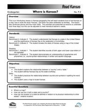
Where is Kansas?
Students explore U.S. Geography by analyzing a map. In this state vs. country lesson, students utilize a U.S. map and locate the state of Kansas before researching the history and customs of the state. Students collaborate as a class to...
Curated OER
Mapping the Human Movement
Students research data on African-American emigration, place the data in a chart and create a human movement map. They also create another map using research on current immigration information.
Curated OER
Ancient Greece: Athens as a City State
Sixth graders find Greece on the map and recognize how the geography of Greece was important in its development. In this ancient Greece lesson, 6th graders research Greece and compare to the civilization of ancient Egypt. Students answer...
Curated OER
The Rise of the City States in Greece
Sixth graders examine Ancient Greece and its development of democracy. In this Greek History instructional activity, 6th graders explore the rise of city-states in Greece and its overall effect on the development of democracy. The class...
Curated OER
Lesson 2: Mapping Our Home
Students recognize the importance of community participation in the census. In this U. S. Census lesson plan, students use map-reading skills to find answers and learn the difference between senators and members of Congress.
Curated OER
Cardinal and Ordinal Directions
Students use a compass to locate cardinal and ordinal directions. In small groups, they describe and create a journey for their classmates using their compass. Groups create a scale map for their classmates to follow and relate this...
Curated OER
Regions of South Carolina
Third graders explore the 5 regions of South Carolina. In this regions instructional activity, 3rd graders locate the regions on a map and compare and contrast the areas. Students have sentence strips that have facts about the regions on...
Curated OER
A Question, Mr. Lincoln!
Learners discuss Abraham Lincoln. In this social science lesson, students describe key events in Lincoln's life. Learners practice using interviewing skills to gather information pretending to be Lincoln.
Curated OER
Landmarks of the Underground Railroad
Students explore Civil Rights by reading several books in class. In this Underground Railroad lesson plan, students discuss The Story of Henry Box Brown and identify the location and functionality of the Underground Railroad. Students...
Curated OER
An Internet Activity for The Introduction Of The Civil War
Students research, using the Internet, specified Civil War battles in order to prepare an oral presentation for the class. They, in small groups, present using images and maps. They take a quiz on the subject matter and evaluate the web...
Curated OER
Immigrating to America
Students study the American immigration experience. In this Ellis Island lesson plan, students research primary documents from the immigration station, take a tour of the station, and then prepare and perform dramatic presentations based...
Curated OER
If I Had Been at Ellis Island
Students examine what it was like to enter the U.S. as an immigrant. They conduct Internet research, develop a concept map, list the ways children occupied their time while at Ellis Island, and create a diorama.
Curated OER
The Presidents of Mount Rushmore
Students understand the importance of Mount Rushmore as a national symbol. In this Mount Rushmore lesson, students locate Mount Rushmore on the map and investigate each of the four Presidents on Mount Rushmore. Students understand how...
Curated OER
Ellis Island: Gateway To America
Fifth graders study the immigration station on Ellis Island. Through several activities, they see that immigrants who arrived at Ellis Island came to America from different countries, mostly those in Europe, for a variety of reasons.


