Curated OER
Pennsylvania Watersheds
Students identify the major watersheds of Pennsylvania. In this forestry lesson, students learn what a watershed is and are assigned one of the major watersheds of Pennsylvania. Groups then need to determine the boundaries of the...
Curated OER
G'Day Mate
Students understand that Australia is the smallest continent, locate it on a map and sing about the continents. In this Australia lesson, students listen to facts about Australia and complete a book about information they have learned.
Curated OER
Letters from Rifka
Fourth graders read Letters from Rifka and discuss the feelings of people forced to leave their homes and countries. In this migration instructional activity, 4th graders relate their feelings about moving from their home forever....
Curated OER
Biomes: Coastlines and Seas
Students study the different types of coastlines and their territories. In this marine coasts instructional activity students identify life forms that are in the coastal regions.
Curated OER
Water: A Necessity for Life
Students examine types of aquifers and make a model landfill. In this water usage lesson, students determine the difference between confined and unconfined aquifers. They build a model landfill, observe it for two weeks, and analyze what...
Curated OER
Santa Claus Around the World
Students investigate how students in various countries celebrate their winter holiday traditions, locate various countries on a map, and draw and tell about various Santa Claus legends.
Curated OER
Raton Pass and Glorieta Battlefield
Students complete a variety of activities that go along with the study of and possible fieldtrip to Raton Pass and Glorieta Battlefield on the Sante Fe Trail in New Mexico.
Curated OER
The Battle of Corydon
Fourth graders study the Battle of Corydon, its military leaders, and its influence on the town. In this Battle of Corydon lesson, 4th graders develop vocabulary needed to complete the lesson, listen as the teacher reads The Battle of...
Curated OER
Mining Riches
Students research and map how various mining ventures have changed local geographies and populations. First they read the article provided--Examining the Environmental and Social Impact of the Mining Industry.
Curated OER
Comparing the Impact of Multiple Uses
Students study multiple land uses and their effects on one another. They assess multiple land uses in National Forests and Grasslands and evaluate the effects of each use on all other uses. They develop a comprehensive list of human...
Curated OER
Bushy Run: A Decisive Battle of Pontiac's Rebellion
Students study the battle at Bushy Run. In this Pontiac's Rebellion lesson, students examine an 1765 map of the Bushy Run battle as well as letters and a modern topographic map of the area in order to simulate the event and research how...
Curated OER
Holidays: Ramadan and Eid
Students study ways some holidays are celebrated in this country, and share their experiences, the lesson focuses on Bangla students' celebration of Eid, an important holiday in Bangladesh for the Muslim People. Students make a class...
Curated OER
Field Trip to Mammoth Cave
Students, when given a microscope or a camera, write two observations they have seen using technology that they did not see with just their eyes with 100% accuracy. When given a blank map, they mark the location of Mammoth Cave along...
Curated OER
Popular Sovereignty Under the Kansas-Nebraska Act
Seventh graders examine the implications of the Kansas-Nebraska Act. In this slavery instructional activity, 7th graders examine a map of 1820 America and discuss the balance of power implied by the map. Students then read Stephen...
Curated OER
More Than One Grain of Rice
Students explore mathematics, geography and agriculture by studying world rice production. In this production of rice instructional activity, students read One Grain of Rice and use a worksheet grid to calculate how much rice was...
Curated OER
Gullah People of the Sea Islands
Students examine the history and culture of the Gullah people. They study the geography, impact of industrialization and effects of tourism on the people of Gullah. They view films, use a large map of West Africa,. Students will listen...
Curated OER
Earthquakes And Fault Lines
Young scholars discuss major causes of earthquakes and identify famous fault lines, access and map information about ten largest earthquakes in world from 1989 to 1998, and theorize about location of these earthquakes as they relate to...
Curated OER
Economics: What is done to rice to get it ready to eat?
Third graders create a map showing the journey of rice from the field to the grocery store. In this agriculture instructional activity, 3rd graders discover and map the process of harvesting and preparing rice to be packaged and...
Curated OER
Biomes: the Threat of the Sea
Middle schoolers study global warming including its causes and effects. In this creative lesson students make posters on global warming.
Curated OER
Social Studies: Lesson 2
Learners explore the beginning of Communism. In this World History lesson, students exhibit their knowledge of Communism and the Marshall Plan through completion of a map activity.
Curated OER
Westward Ho!
Second graders use a minimum of three maps of Kansas developed during the 1800's. They plot five major settlements that developed near water sources. Students brainstorm reason settlements may have developed near water sources.
Curated OER
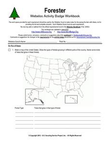
Forester
In this forester learning exercise, students illustrate a map that shows the types of forests growing in various parts of the country. They also identify six forest trees common to the area where they live and explain how both wildlife...
Curated OER
Invasive Mussels
In this ecology worksheet, students study a fact sheet on invasive mussels. They answer 8 short answer questions about it after reading the provided information.
Curated OER
A Colony is Born : Lesson 4 - What Went Wrong?
Fifth graders compare and contrast two early colonies and make a T chart. They list examples of worked well and what did not, and significant historical events. They use higher order thinking skills by deducing how different scenarios...


