Curated OER
Etc: Maps Etc: Economic and Commercial Activity in the Philippine Islands, 1920
A map from 1920 of the Philippine Islands showing the principal commercial products in the region, with the products named in red. The map shows major cities and chief seaports, railroads, navigable rivers, islands and coastal features....
Curated OER
Educational Technology Clearinghouse: Maps Etc: The Civil War, 1861 1865
A map of the southeastern part of the United States showing important sites of the Civil War (1861-1865). The map shows major cities, railroads, rivers, and terrain of the region. An inset map shows northeastern Virginia, with forts and...
Curated OER
Educational Technology Clearinghouse: Maps Etc: West Indies, 1920
A map from 1920 of the Greater and Lesser Antilles, and the Bahama Island group, showing capitals, major cities, towns and ports, railroads, steamship routes, submarine telegraph routes, terrain, and coastal features. The foreign...
Curated OER
Educational Technology Clearinghouse: Maps Etc: North America, 1921
A map from 1921 of North America, Central America, Greenland, and the Caribbean showing political borders, capitals and major cities, railroads, canals, mountain systems, lakes, rivers, islands, and coastal features of the region. An...
Curated OER
Educational Technology Clearinghouse: Maps Etc: North America, 1910
A map from 1910 of North America showing the Dominion of Canada, Greenland, the United States, Mexico, Guatemala, British Honduras (Belize), San Salvador (El Salvador), Honduras, Nicaragua, Costa Rica, Panama, and the islands of the...
Curated OER
Etc: Maps Etc: The Surface of North America, 1912
A base relief map from 1912 of North America, Central America, Greenland, and the Caribbean to Puerto Rico showing the general surface terrain, including mountain systems, highlands, plains, and major river systems of the region....
Curated OER
Etc: Maps Etc: War of 1812 Map of Main Operations, 1812
A map of the Great Lakes region showing the main operations during the War of 1812 (1812-1814). It also shows some of the inland waters. This war was between the United States and Great Britain because of "Great Britain's attitude in...
Curated OER
Educational Technology Clearinghouse: Maps Etc: Coal , 1899
Coal regions of United States, coded to show amounts of coal mined in tons.
Curated OER
Educational Technology Clearinghouse: Maps Etc: Iron Ore, 1899
Iron ore regions of United States, coded to show amounts of iron ore mined in tons.
Curated OER
Educational Technology Clearinghouse: Maps Etc: Iron Mining, 1906
Iron ore regions of the United States.
Curated OER
Educational Technology Clearinghouse: Maps Etc: Iron Mining, 1904
Iron ore mining regions of the United States.
Curated OER
Educational Technology Clearinghouse: Maps Etc: Metal and Mining , 1916
The metal production and mining regions of the United States in 1916.
University of Minnesota
University of Minnesota: Urbanization & Migration in the Developing World
This lesson presents the scale of recent urbanization in different global regions and the diverse roles that migrants play in contributing to urbanization. The following graph, map, video, and news report provide a general overview of...
Harvard University
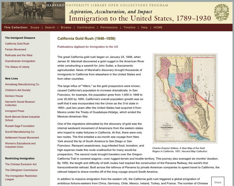
Harvard Univ.: Immigration to Us, 1789 1930: California Gold Rush (1848 1858)
Describes the California Gold Rush and the impact it had on immigration to the United States and to the future demographics of California. Includes a high-resolution map of the gold region of California in 1851.
Curated OER
Etc: Maps Etc: United and Central Provinces of India, 1912
A map from 1912 of the British provinces of Bengal, Assam, Bihar and Orissa, Central India and the United Provinces of Agra and Oudh at the time. The map also shows the countries of Nepal and Bhutan, and the Indian state of Sikkim. The...
Curated OER
Educational Technology Clearinghouse: Maps Etc: Austrian Netherlands, 1792
A map of the Austrian Netherlands in 1792 at the onset of the French Revolutionary Wars. The map is color-coded to show the territories under Austrian possession, the Ecclesiastical States of the Holy Roman Empire, the United...
Curated OER
Educational Technology Clearinghouse: Maps Etc: Napoleon's Campaign, 1814
A map of France at the end of the War of the Sixth Coalition (1812-1814) between the French Empire under Napoleon Bonaparte and the coalition forces of Austria, Prussia, Russia, Sweden, United Kingdom, and several German States,...
PBS
Pbs Learning Media: The Lowdown: Life Expectancy: Finding Ratio Relationships
In this interactive map, learn how life expectancy, obesity, hypertension, and physical activity rates have changed dramatically throughout the United States over the last three decades. The accompanying classroom activity supports...
Curated OER
Etc: Oregon Trail and Other Routes, 1832 1842
A map of western North America between the opening of the Oregon Trail in 1832 to 1842, prior to the establishment of the Provisional Government of Oregon by American settlers in 1843. The map shows the boundary of the Oregon Country,...
Curated OER
Etc: Mountain Passes & Overland Routes in the West, 1841 1850
A map of the Pacific region of the United States west of the Rocky Mountains in 1841-1850. The map shows the Old Spanish Trail from Los Angeles to Santa Fe, the Pioneer Route from the Platte River to San Francisco, the routes of Fremont...
University of Nebraska Omaha
Ec Ed Web: Places and Production
In this lesson from the University of Omaha, "Middle schoolers calculate United States GDP and GDP per capita, use a choropleth map to acquire information, and create choropleth maps of GDP per capita in South America. They identify...
Curated OER
Etc: Indian Empire Central Portion, 1920
A map from 1920 of the central portion of the Indian Empire from Benares in the United Provinces to Mandalay in central Burma (Myanmar). The map shows Feudatory Native States in yellow, the province boundaries at the time, major cities,...


