Curated OER
The Geography of the United States
Full of bright maps and interesting information, this presentation details U.S. Geography. Slides include basic facts about size, regions, topography, and demographics, as well as fascinating trivia about the United States, including...
Curated OER
Midwest Region Commercials
Third graders research their assigned state using a variety of resources including a website, books, and travel brochures. They complete questions on a worksheet to use when writing a commercial for the state. They film the commercial...
Curated OER
United States Identifier
Fifth graders examine and research a major region of the Unites States in groups of four. In addition, they locate the states, capitals, mammals and two bodies of water or mountain ranges found within their region. After the research,...
Curated OER
US Geography: The Midwest
Students investigate the geography and agricultural products of the Midwestern United States. In this US geography lesson, students watch and discuss a video that depicts the Midwest of the US as the breadbasket of the country. They make...
Curated OER
Touring the Regions of the United States
Fifth graders explore the regions of the United States. They use maps, research on the Internet and use measurements and estimations. Students create a presentation using spreadsheets and publishing software.
Curated OER
Travelogs
Learners make travelog journals to send to acquaintances in other states in order to receive mail in return. They make scrapbooks with the return mail they receive.
Curated OER
US: Midwest Region
In this United States political map worksheet, students examine the state boundaries of the Midwestern Region. The map also highlights each of the state capitals denoted by stars.
Curated OER
States and Capitals, Mountains and Rivers
Students identify geographical locations in the midwestern United States. In this geography lesson, students identify 12 states and capitals and geographical features in the region by using U.S. maps. Students use blank maps to fill in...
Curated OER
Touring the Regions of the United States
Fifth graders explore the regions of the United States. For this geography skills lesson, 5th graders examine the landforms, climates, and economies of the regions of the United States. Students conduct Internet research in order to...
Curated OER
Where Did My Lunch Come From? A U.S. Regional Tour
Students explore the regions from which their food comes. In this social studies lesson, students identify the different agricultural products that are found in the major regions of the United States. Students create a lunch menu.
Curated OER
Map Memory
Fifth graders, working in a whole class setting, label a United States map with the names of all the states that they know. They transfer the names of the states to an individual map and color it. Next, they receive directions on how to...
Curated OER
Social Studies: Regions of the United States
Third graders create Powerpoint presentations of various geographic regions of the United States. They focus on the Northeast, Southeast, and Midwest regions. Students combine their individual slides into a class presentation.
Curated OER
Geography of the United States
Students examine the population growth of the United States. In this Geography lesson, students construct a map of the fifty states. Students create a graph of the population of the USA.
Curated OER
State Cards
In this state cards worksheet, students cut out 9 cards, each of which has a picture of one state in the United States on it. These states are all located in the Midwest and Northwest regions. These cards could be used for a matching game.
Curated OER
U.S. Geography for Children: State Capitals
For this United States map skills worksheet, students locate and label specified states and their capitals, and create icons and a map key to show something for each state that is famous. Students answer 5 questions.
Curated OER
Regions, Regions, Regions!
Young scholars use regions to analyze the locational patterns of culture
groups at various scales. They discern the basics of region identity by discovering his/her "Home" Region through the examination of
criteria in his/her "backyard."...
Curated OER
Natural Features as a Resource
Students identify resources provided by nature for basic human needs. In this natural features lesson plan, students discuss the various regions of the United States. They explore one region in depth and complete activities that...
Curated OER
From Sea to Shining Sea
Students study the geography of the United States of America. Students write letters, create travel brochures, make maps, graph population numbers, read fiction and nonfiction selections, complete KWL charts, and watch films.
Curated OER
Social Studies: Geographic Regions
Third graders create Powerpoint presentations about the five themes of geography in regions of the United States. They focus on the Northeast, Southeast, and Midwest regions. Students use both pictures and words in their shows.
Curated OER
Fourth Grade Social Studies
In this social studies worksheet, 4th graders complete multiple choice questions about the climate, landforms, regions, government, and more. Students complete 25 multiple choice questions.
Curated OER
Fourth Grade Social Studies
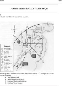
In this social studies worksheet, 4th graders answer multiple choice questions on state maps, city maps, road maps, political maps, and more. Students complete 25 multiple choice questions.
Curated OER
Find a Cave
Students locate their own communites and the nearest caves on a United States map. They calculate the distance to the nearest cave using rough scale.
Curated OER
States and Territories
In this United states learning exercise, 5th graders read a short script pertaining to the states and territories. Students complete 10 fill in the blank questions and self check this online interactive learning exercise.
Curated OER
Journey to Gettysburg
Young scholars use latitude and longitude to map the path of the Battle of Gettysburg.


