Curated OER
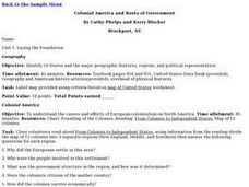
Colonial America and Roots of Government
Students identify 50 States and the major geographic features, regions, and political representation of each. In connection, they investigate the causes and effects of European colonization on North America. They identify the formation...
Curated OER
High Five Burger
Fifth graders investigate agricultural sources. In this agricultural instructional activity, 5th graders read the book Have a Hamburger and See the U.S.A. and record each component of a hamburger. Students use a map of the U.S.A. to...
Curated OER
Pennsylvania Watersheds
Students identify the major watersheds of Pennsylvania. In this forestry lesson, students learn what a watershed is and are assigned one of the major watersheds of Pennsylvania. Groups then need to determine the boundaries of the...
Curated OER
Push/Pull Factors and Welsh Emigration
Students view and discuss short sections of movies that relate to immigration. Working in groups, students create a map that shows directions of internal migration in their assigned geographical area. Students review ads/booklets created...
Curated OER
What Was South Carolina's Role in the Spanish American War?
Seventh graders investigate the role of South Carolina in the Spanish American War. In this imperialism lesson plan, 7th graders analyze primary documents and photographs, in collaborative groups, to determine how the state was involved...
Curated OER
Reforms of the Mid-1800's
Seventh graders complete a unit of lessons on the reform movements of the mid-1800's in the U.S. They participate in an Internet scavenger hunt, analyze primary source documents, and develop and perform a simulation of a mid-19th century...
Curated OER
Welcome to the Americas
Students research and map the North and South American continents. In this geography lesson on the Americas, students can locate North, Central and South American countries and states. Students choose a location to research and prepare a...
Curated OER
Mining Riches
Students research and map how various mining ventures have changed local geographies and populations. First they read the article provided--Examining the Environmental and Social Impact of the Mining Industry.
Curated OER
Alaska
Fourth graders explore how humans adapt to variations in physical environment, compare how people in different communities adapt to or modify the physical environment and identify and compare the human characteristics of selected regions.
Curated OER
Ping!
Seventh graders study side-scan sonar and discover how it can be used to locate objects underwater. They complete a sonar simulation activity in which they create and map mystery landscapes inside shoeboxes.
Curated OER
Field Trip to Mammoth Cave
Students, when given a microscope or a camera, write two observations they have seen using technology that they did not see with just their eyes with 100% accuracy. When given a blank map, they mark the location of Mammoth Cave along...
Curated OER
Mayor Puts City on Diet to Lose a Million Pounds
Students read a story called Mayor Puts City on Diet to Lose a Million Pounds and answer vocabulary and comprehension questions about it. In this current event Lose a Million Pounds lesson plan, students respond to literature by...
Curated OER
Traditional Tribal Homelands of Washington's Plateau Nations
Students investigate the Plateau tribes. In this Native American lesson, students use a political map of Washington state to identify the location of the Plateau tribes. Students brainstorm the needs and wants of the tribes and use an...
Curated OER
Becoming A Local Historian
Pupils practice the art of being a historian. They compare primary and secondary resources to conduct a critical thinking assignment. Students compare the map of the Baton Rouge area to a modern one in order to make inferences about the...
Curated OER
North America Knowledge
Second graders move around a large map of the North America drawn on the playground. They follow the directions called out by the teacher. They may also develop their own tasks for other students to follow.
Curated OER
Rivers And Capitals
Pupils become familiar with the use of GIS for research and become aware of the importance of rivers to cities. They also analyze the placement of cities and learn the names of rivers in the United States.
Curated OER
River Study
Students study physical features of a local stream. They study how to identify water features on topographic maps.
Curated OER
Alternative Energy
Students identify the five major alternative energy sources. In this physical science instructional activity, students assess the advantages and disadvantages for each type of energy. They complete a concept map using information they...
Curated OER
Eating Up Energy
Pupils will compare and contrast amount of energy consumption and CO2 emissions among the top ten user countries to understand global effects of emissions. They also map the global impact of energy consumption and CO2 emissions.
Curated OER
Hazard Alert
Students examine data regarding the occurrence of natural hazards as they occur in the United States. They record data on a classroom chart, map the areas affected by the hazards, and analyze and discuss conclusions drawn from the...
Curated OER
Fallout!
Students plot the locations of fallout from two disasters that polluted much of the world's air. They plot the ash fallout from the 1980 Mt. St. Helen's eruption to see what the wind patterns in the United States look like overall. Next...
Curated OER
Desert Views - First Impressions: Travelers on the Gila Trail
Students draw animals and plants that are described to them as they read passages of people who traveled across the Gila Trail in the Southwest. In this Gila Trail lesson plan, students also write a letter describing a plant or animal in...
Curated OER
Creating Community - A Function Of Design
High schoolers discuss the physical and human impacts of community design. They identify traditional neighborhood design elements and evaluate them with features of conventional suburban development.
Curated OER
Where the Red Fern Grows: A 4th Grade Literary Focus Unit
Fourth graders explore the human and animal connection along with the idea that death is a part of the life cycle. They read "Where the Red Fern Grows." Students examine the feelings and emotions surrounding death and they discover the...


