Curated OER
Alaska Trade
Young scholars spend two days traveling throughout Alaska, trading as they go. They explore universal principles related to trade and commerce while studying about Alaska's geography and indigenous people. At the end of the lesson,...
Curated OER
Political Geography of Europe
Fifth graders listen to a lecture that traces the political geography of Europe from 814 through 1997. They incorporate these themes into a research project on Western Europe.
Curated OER
River Basin to Reservoirs: A Profile of the Kansas Republican River Basin and Reservoirs
Students examine the role the river played in the settlement of towns in the basin. Student groups prepare an oral presentation on Milford Lake, Tuttle Creek Lake or Perry Lake.
Curated OER
From the Sea to the Summit, Land Use on Maui
Fourth graders examine the how the land is used on the islands of Hawaii. Using this information, they discover how elevation affects how the land is used and represent this data in a visual form. They describe existing and alternative...
Curated OER
Chemical Changes by Gems
Seventh graders observe that heat is produced when two substances are combined. They brainstorm how, and then experiment to find out which of two chemicals created the heat.
Curated OER
Clean Kansas Water
Students gain an understanding of ways we can be responsible custodians of our water supply. Students explore the governor's clean water initiative involving the Lower Kansas/Republican river basin and the pollutants present there.
Curated OER
Banpo Village: Gone, But Not Forgotten
Sixth graders plan a trip to China and prepare yourself for the Banpo excavation site competition by studying prehistoric and ancient Chinese history.
Curated OER
Powering a Green Earth
Pupils compare and contrast renewable and nonrenewable energy. In this environmental science lesson, students discuss the importance of going green. They identify the different components in a power grid system.
Other
Topo Zone: Free Usgs Topo Maps for the Entire United States
A huge collection of topographic maps for each of the US states. Scroll down to see a map of the United States and click on the state you are interested in. From there, you can search for a particular location, choose a featured map, or...
ClassFlow
Class Flow: Maps of the United States
[Free Registration/Login Required] This is a collection of physical and political maps of the United States broken up by region.
Library of Congress
Loc: America the Beautiful
A resource page of online map resources, lesson plans, students activities and the transcript of a live chat on the geography of the United States.
Houghton Mifflin Harcourt
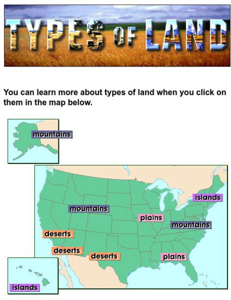
Harcourt: School Publishers: Types of Land
This clickable map of the United States defines different geographic features such as mountains, plains, islands, and deserts.
Johns Hopkins University
John Hopkins University: Color Landform Atlas of the u.s.
This site from John Hopkins University provides detailed maps of and physical information on each of the 50 states. Maps range from relief maps to satellite images, to historical maps.
Curated OER
Etc: Maps Etc: Physical Features of the United States, 1898
A map from 1898 of the United States showing general elevations, water depths, and terrain features, including the Pacific Slope, Great Basin, Rocky Mountain Plateau, Great Plains, Mississippi Valley, Gulf Plain, Appalachian Highlands,...
Curated OER
Educational Technology Clearinghouse: Maps Etc: The United States, 1899
A map from 1899 of the United States showing the physical features of the area, including mountain systems and highlands, plateaus, basins, plains, lakes, rivers, and coastal features. This map also shows the six conventional state...
Curated OER
Educational Technology Clearinghouse: Maps Etc: The United States, 1890
A map from 1890 of the United States showing physical features, and annual mean temperatures and rainfall. The map shows high mountains and lower ranges, watershed division boundaries, rivers, lakes, coastal features, and is color-coded...
Curated OER
Etc: Maps Etc: Climate and Watersheds of the United States, 1868
A map from 1868 of the United States showing physical features, mean annual temperatures, rainfall distribution, watersheds, and principal products in the area. The average annual temperatures are shown by isotherms, with temperatures...
Curated OER
Educational Technology Clearinghouse: Maps Etc: United States, 1901
A map from 1901 of the United States showing the physical features of the area, including mountain systems and highlands, plateaus, basins, plains, lakes, rivers, and coastal features. The map is color-coded to show land elevations from...
Curated OER
Etc: Maps Etc: Relief of the United States, 1910
A relief map from 1910 of the United States showing the physical features of the New England Highlands, Adirondacks, Appalachian Plateau and Mountains, Piedmont Plateau, Coastal Plains, Lake Superior Highlands, Red River Valley Plains,...
Curated OER
Mountains, Plains, Rivers, Isothermal Lines of the United States, 1873
A map from 1873 of the United States showing the physical features of mountain systems, plateaus, basins, plains, rivers, lakes, and coastal features, with elevations given for prominent peaks given in feet above sea level. The map is...
Curated OER
Educational Technology Clearinghouse: Maps Etc: The United States, 1898
A map from 1898 of the United States showing physical features of mountain systems and highlands, basins, plains, prairies, limits of the glacial terminal moraines, lakes, rivers, and coastal features. The highlands above 2000 feet are...
Curated OER
Educational Technology Clearinghouse: Maps Etc: The United States, 1902
A map from 1902 of the United States showing physical features of mountain systems and highlands, basins, plains, prairies, limits of the glacial terminal moraines, lakes, rivers, and coastal features. The highlands above 2000 feet are...
Curated OER
Etc: Maps Etc: United States Virgin Islands, 1920
A map from 1920 of the U. S. Virgin Islands, showing physical features.
National Weather Service
National Weather Service:climate Prediction Center: Daily Precipitation Analysis
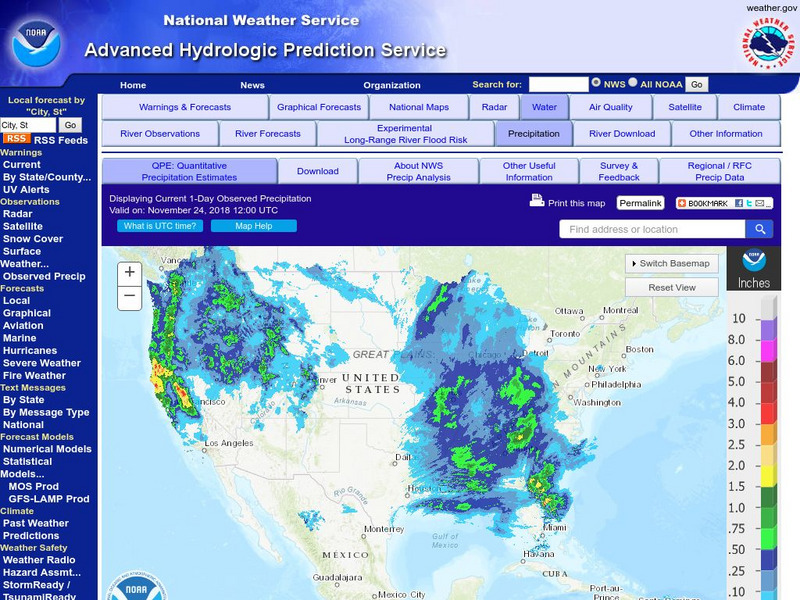
Find real-time daily precipitation analysis for the United States, Mexico, and South America as well as accumulated precipitation maps for the past 30 or 90 days.


