Curated OER
African American Women Before and After the Civil War: Slavery and Freedom
Students listen to data on African American women in Texas before the Civil War. In this Civil War lesson, students compare and contrast the lives of slave and free women, and discuss case studies, locating areas on a map. Students...
iCivics
Mini-Lesson: Gerrymandering
Who determines the structure of voting districts? The concept of gerrymandering brings to light the ongoing issue of how those running for office gain votes. Hands-on activities enable scholars to analyze the re-drawing of voting...
Curated OER
George Washington's Revolutionary Journeys
Students take a closer look at historical maps. In this American Revolution lesson plan, students examine the provided historical maps and documents to determine the assignments that George Washington assigned to subordinates during the...
Curated OER
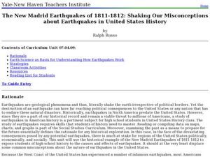
The New Madrid Earthquakes of 1811-1812: Shaking Our Misconceptions about Earthquakes in United States History
Students Examine how earthquakes work and what plate tectonics and fault lines are. In this earthquake lesson plan students complete an earthquake scavenger hunt.
Curated OER
Teaching Six Big Ideas in the Constitution
Learners debate the constitutional principles of the United States. In this U.S. government lesson, students examine the meaning of the text of the U.S. Constitution and analyze other primary documents of the era. Learners prepare for...
Curated OER
Summertime Travel
Third graders write about a summer event they participated in. In this paragraph writing lesson, the teacher models how to write about a place they have visited. Students then write their own paragraphs. Students will point out on...
Curated OER
The 1828 Campaign of Andrew Jackson: Issues in the Election of 1828 and Beyond
Learners research the campaign and election issues of Andrew Jackson. In this presidential election lesson, students research the campaign of 1828. Learners then list the important issues. Students discuss the political advertisements in...
Curated OER
Map Skills
High schoolers examine the nations, battlefields, troop movement of the Germans through Belgium and the location of both fronts during World War I by creating a map. They visualize the strength of the Germans early in the war.
Curated OER
Rivers, Maps, and Math
Students use maps to locate and label the major rivers of North and South America. Using the internet, they identify forests, grasslands, mountain ranges and other landforms on the continents as well. They compare and contrast the...
Curated OER
Countries of the World
Students define the meaning of the word country. For this countries of the world map lesson, students identify boundaries, countries, and symbols within countries on the map. Students distinguish the words country and continent.
Curated OER
1850s: Road to Secession
Detailing the political and social events leading up to the Civil War, this presentation provides students with maps, political cartoons, and photographs to put this time period into historical context. The Presidential Elections of...
College Board
2015 AP® Human Geography Free-Response Questions
How are population and political power related? What is the significance of the globalization of English? Why do refugees leave their home countries? Using structured short-answer questions, scholars unravel complicated dynamics with...
National Endowment for the Humanities
African-American Communities in the North Before the Civil War
Middle schoolers may be surprised to learn that before the American Civil War there were more slaves living in New York than there were in Kentucky! Young historians examine maps and census data to gather statistics about...
Digital Public Library of America
The Underground Railroad and the Fugitive Slave Act of 1850
Escaping Enslaved people attempting to escape didn't need a ticket to ride on the Underground Railroad. Here is a packet of primary sources that reveal the kind of courage and determination they did need to face the challenges to gain...
Curated OER
A State Divided - Maryland in the Civil War Era
Young scholars use primary sources to see how Maryland was a divided state during the time leading up to the Civil War. In this Civil War lesson plan, students go over vocabulary, and look at maps that show the division of opinions of...
Curated OER
Mapping Possible Solutions
Fourth graders propose possible sites for the heart of Florida state capital by mapping collected data onto a Florida state map and recording data in a Travel Log.
Curated OER
The Brief American Pageant: The Resurgence of Conservatism
Take a short trip back in time with this presentation, which details the political and electoral contexts of 1980's and 1990's America. Covering the Gulf War as well as domestic economics, these slides feature easy-to-read charts and...
BBC
Eu, Un, and Commonwealth: Keeping Peace
What are the UN, the EU, and Commonwealth? Have the class brainstorm all they know about these powerful international organizations. Then have them compare and contrast the ways in which different countries or political groups...
Curated OER
The Brief American Pageant: The Stormy Sixties
Intended for use with The American Pageant by David Kennedy, Lizabeth Cohen, and Mel Piehl, this slideshow includes maps and graphs that detail politics and social dynamics in 1960's America. The textbook is not necessary for...
Curated OER
The Brief American Pageant: The American People Face a New Century
The political landscape of Y2K is the focus of this series of slides, which cover the later years of the 20th century. Charts detail the poverty and social welfare rates in the 20th century, as well as a pie graph displaying the sources...
Curated OER
Lesson 3: Japan's "Southern Advance" and the March toward War, 1940-1941
High school historians interpret historical evidence presented in primary resources to decide if the southern advance was a reckless step toward war, or if it was reasonable. They research the Japanese southern advance tactics during the...
New York State Education Department
US History and Government Examination: January 2018
It's time to test those skills! Assess pupils' knowledge of US history and government with short answer questions, multiple-choice items, and essays. The resource serves as a standardized test that functions well for a final exam....
Curated OER
U.S. Geography: The Northeast
Students investigate U.S. Geography by creating a map in class. In this natural resource lesson, students create a map of the United States and research the Northeast based on their resources and recyclable materials. Students...
Curated OER
U.S. Possessions
Ninth graders research the United States acquisition of the Philippines and their fight for independence. They locate the Philippines on a map and brainstorm how its geography has benefits. They access the Internet and complete a student...


