Discovery Education
Sonar & Echolocation
A well-designed, comprehensive, and attractive slide show supports direct instruction on how sonar and echolocation work. Contained within the slides are links to interactive websites and instructions for using apps on a mobile device to...
Curated OER
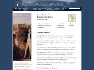
Between the Rivers
Second graders compare and contrast historical American cultures. In this American history lesson, 2nd graders participate in reading, writing, oral, and hands on activities. Students discuss the similarities and differences...
Curated OER
Learning from Maps and Timelines Time Travel
Students create timelines depicting the important events in the lives of the groups that arrived at the Fort St. Louis. They include the fate of La Salle and the colonists.
Curated OER
George Washington and the Beginnings of the French and Indian War
Students read about the causes of the French and Indian War. In this French and Indian war lesson plan, students read about the physical and human problems that lead to the war. They also learn about George Washington's role in the war.
Curated OER
Scenic Attractions in Four Corners
Fourth graders find and list scenic attractions in SE Utah and the Four-Corners-region. They identify geographic characteristics of Utah and other states in the western region of the United States. They review cardinal directions and...
Curated OER
VAcations in Northern California
Pupils explore the natural resources and National Parks of Northern California that are commonly visited by people traveling in the United States. They use maps to locate various sites, plan a highway travel route and use the internet to...
Curated OER
Life on the Border
Students discuss different types of boundaries. They research the United States/Mexico border and answer questions about their findings. They create collages, posters, or multimedia presentations showcasing various areas of concern...
Curated OER
Mining Riches
Students research and map how various mining ventures have changed local geographies and populations. First they read the article provided--Examining the Environmental and Social Impact of the Mining Industry.
Curated OER
Michigan Food: From Farm to You
Students recognize Michigan on a map and understand how its climate is affected by the Great Lakes. In this Michigan food lesson, students play a trivia game to identify the produce of Michigan. Students relate the climate in each part...
Curated OER
Field Trip to Mammoth Cave
Students, when given a microscope or a camera, write two observations they have seen using technology that they did not see with just their eyes with 100% accuracy. When given a blank map, they mark the location of Mammoth Cave along...
Curated OER
Lewis & Clark: The Louisiana Purchase
In this facts about the Louisiana Purchase and the Lewis and Clark expedition online interactive worksheet, students read information and observe a map of the Louisiana Purchase to answer questions showing their comprehension skills....
Curated OER
Iced In
Introduce junior oceanographers to ice conditions in The Great Lakes. The ice map links are no longer available, so you will not be able to have your class perform the mentioned data activity. You can, however, access the Canadian Ice...
Curated OER
Changing Geography
Students visually examine, identify and analyze the components of various images of the automobile. They discern how to use a road map by planning a route, then use road maps to explain how the state has developed over time.
Curated OER
Chesapeake and Ohio Canal
Students use maps, readings, drawings, plans and photos to research and the importance of canals in the early industrial economy of America. They consider the development of the Potomac River Canal and research early transportation methods.
Curated OER
The Hunter-Dunbar Expedition of 1804-1805
Students explain the origins of the Hunter-Dunbar Expedition and why it was so important. They map George Hunter and William Dunbar's expedition route on the Ouachita River and examine excerpts of George Hunter's journal.
Curated OER
Geography: How do Louisiana Rice Farmers Help the Environment after they Harvest Rice?
Third graders study maps of the United States locating Louisiana, the East Coastal Plain, the Mississippi Alluvial Plain, the West Gulf Coastal Plain, and five of the main rivers. In this geography lesson, 3rd graders create a...
Curated OER
Find the Way
Fourth graders, after discussing different places to visit and being given a map of Indiana, draw the route to his/her destination within Indiana. They tell the directions in their own words and formulate pertinent questions to ask along...
Curated OER
Desert Views - First Impressions: Travelers on the Gila Trail
Learners draw animals and plants that are described to them as they read passages of people who traveled across the Gila Trail in the Southwest. In this Gila Trail lesson plan, students also write a letter describing a plant or animal in...
Curated OER
Native American Culture
Young scholars research Native American culture. In this Native Americans lesson, students read the folk tale, The Strongest One and identify the natural resources in the poem. Young scholars participate in a discussion of how Native...
Curated OER
Surrender at Yorktown
Eighth graders examine the start of the American Revolution. In this American History lesson, 8th graders analyze primary sources. Students prepare a narration of events leading up to the revolution.
Core Knowledge Foundation
Thanksgiving with the Pilgrims
Teach kindergartners about the First Thanksgiving with a series of lessons about the Pilgrims' journey to the New World. As they practice handwriting, CVC words, reading comprehension, and fun Thanksgiving songs, they learn about what...
Curated OER
Louisiana
Third graders study factual information about Louisiana including the state flag, bird, tree, and important geographical points using the Internet and maps. They explain the different groups that settled the state in this mini-unit.
Curated OER
Confucius Say... China Old
Students locate China on the map. In this Chinese geography, history and culture lesson, students read literature about China. Students participate in paper making, silk making and lantern making activities.
Curated OER
Getting to the Point
Students determine location by using the technique of triangulation. They imagine that they are out in the wilderness and have come to the top of a ridge. How can one identify the ridge on the topo map? How can one figure out where you...


