Curated OER
What I Did On My Summer Vacation
Students use the internet to research the location of their summer vacation trip. Given the demographics, they plot the location on a world map. They create a brochure using the information they collected. Using PowerPoint, they develop...
Curated OER
Everybody Cooks Rice
Students read the book, "Everybody Cooks Rice," and they participate in activities pertaining to the book. They identify countries mentioned in the text and locate them on a world map. They use an atlas to identify the climatic...
Curated OER
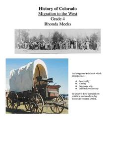
History of Colorado-Migration to the West
Fourth graders identify reasons for people moving to the Colorado Territory and examine how moving in the 1800's is different than moving today. They also practice reading maps and gathering information from maps, as well as, describe...
Curated OER
Country Comparison Venn Diagram
Fifth graders discuss different countries, their cultures, similarities and differences and choose a set of focus questions to research. They create a narrative story using their researched information in first person narrative stories.
Curated OER
Around the World Alphabet Book
Students explore the online dictionary portion of the EnchantedLearning.com website. They copy pictures and text to create an on-going, student-created classroom book which exposes them to different countries, cultures, animals, etc.
Curated OER
Seventh Grade Social Studies Test
In this Georgia social studies assessment worksheet, 7th graders respond to thirty multiple choice questions based on seventh grade social studies skills.
School Improvement in Maryland
Demographic Investigation
What are the factors that influence voting patterns? How do these factors influence government funding? Is participation the squeaky wheel gets the grease? Class members interpret graphs and analyze trends to determine what...
Roy Rosenzweig Center for History and New Media
Differences Among Colonial Regions
Classes look at and analyze primary source images to explore the differences between the colonial regions during the Revolutionary era. They break into groups to tackle each region and then present their findings to the class. A final...
Curated OER
Fertile Crescent Map Project
Sixth graders develop a multimedia presentation of the Fertile Crescent that compares modern day geography, economics, government, and transportation resources. They work in groups to research their specific topic.
Curated OER
Geography Lesson Plan
Students examine the history of the Aborigines. In this Australia lesson, students research selected websites and print materials regarding the lives of the Aborigines and create posters that showcase their findings.
Curated OER
The Revolving Door: U.S. Immigration
Students compare current cultural perceptions of the immigrant experience with ones of the past. They will relate current immigration stories as seen in the PBS documentary "The New Americans" to those of the historical past.
Curated OER
Learning from Artifacts Uncovering Clues, Large and Small
Learners observe artifacts from Fort St. Louis at a website in order to make inferences about the people who lived there. They paint pottery in the style which might have been used by one of the cultural groups who inhabited the fort.
Curated OER
Haiku
Students study various forms of poetry and the culture of Japan. They are introduced to a haiku- a traditional form of poetry and an art form in the Japanese culture. They write a haiku and create a student haiku booklet with the classes...
Curated OER
The Treaty Trail: U.S. Indian Treaty Councils in the Northwest
Students create a timeline with the major events of the 19th and 20th century dealing with Native Americans. They examine artifacts and discuss how they reflect culture. They also identify trade routes the Native Americans used.
Curated OER
Children in the United States and Japan
Students locate Japan on a map or globe and describe the relative location of Japan. They use the Internet to investigate cultural characteristics of children in the United States and in Japan. They use a Venn Diagram as an...
Curated OER
A Brief History of Los Angeles
Learners study the diverse cultures that make up the population of Los Angeles.
Curated OER
Multinational Corporation Relocation
Students examine and analyze the concept of why multinational corporations relocate production facilities from developed nations to less developed nations. They explore the patterns and networks of economic interdependence incorporating...
Curated OER
Cartoon and Political Poster Analysis
Students explore the late 1800s as a time of demographic change in the US. They view the role of media during this time in the form of posters and political cartoons. They create a political poster/cartoon that deals with current...
Curated OER
The City of New Haven
Students examine the geography, politics and history of their local town of New Haven, Connecticut. Using the internet, they explore the neighbors of New Haven and write directions from their house to school. In groups, they research...
Curated OER
Not Just Another Native American Lesson
Second graders focus on Native Americans through hands-on crafts. They also study various Native American tales and legends, geography, and fine arts of the different regions.
Curated OER
ADULT ESOL LESSON PLAN--Environment and the World
Students locate and trace Florida on a United States map as well as their local counties and city of residence on a state map. In addition, they label all the directions north, south, east and west on each map.
Curated OER
Ojala que viajemos a Mexico!
Students research the names and locations of Spanish speaking countries throughout the world. They use a world map to become familiar with the locations of these countries and use the Internet to conduct further research. They sing...
Curated OER
Mesoamerica
Students demonstrate knowledge of early Middle American civilizations. They study Mesoamerican i religions, governments, and achievements. They identify geographies of North and South America.


