Curated OER
Agriculture Cares for the World
Students explore world geography by analyzing agriculture. In this dietary habits lesson plan, students discuss the role parents play in their children's diet and where the food comes from. Students write agricultural research paragraphs...
Curated OER
Walking with the Emperors: Exploring Imperial Rome
Students travel Rome. For this geography skills lesson, students explore famous places in Rome with Google Earth tools. Students research the city of Rome and create touring videos that feature their findings.
Curated OER
Arkansas is Our State: Differentiating Between a State and a Country
An ambitious geography lesson is geared toward kindergartners. They discover what the differences are between states and countries. They look at maps of Arkansas, and learn what the shapes and lines mean. Additionally, they create a...
Curated OER
Using Literature to Introduce the Five Themes of Geography
Students listen to a read aloud of "If You Grew Up With Abraham Lincoln". Using the text, they identify examples of the five themes of geography and write them down. Using a map, they plot the places mentioned in the book and sort facts...
Curated OER
Using Google Squared to Compare and Contrast Canada and the US
Sixth graders compare and contrast Canada and the United States. In this geography skills lesson, 6th graders use Google Squared to research information so that they may compare the geography of Canada and the United States.
Curated OER
Themes of Geography in the News Contest
Students discuss current events in the world today. After choosing one to focus on, they identify the themes of Geography present in them and practice using new vocabulary. They use the internet to find all of the themes present in...
Curated OER
Geography and Artifacts of Mexico
Students review the structure of government in Mexico and discuss how it is different than the United States. Using artifacts, they must label and identify the city or state in which the artifact originated. They use the artifact clues...
Curated OER
Through the Forest and Home Again: Maps Help Us Find Our Ways
Students read Little Red Riding Hood, focusing on her path home to Grandma's house. In this language arts and geography lesson, students perform a reader's theater, re-creating the walk home and possible routes that could have been...
Curated OER
Historical Geography Scavenger Hunt
Learners are told that Geography is the science that deals with the differentiation of the surface of the earth due to the influence of things like population, vegetation, geology, and land use. They explore the Geography Basics page. ...
Curated OER
World Map and Globe-Equator, North Pole, and South Pole
Learners identify the Equator, North Pole, and South Pole on a map. In this geography lesson, students use a world map and circle the North and South Pole. Learners locate the Equator on a globe and use a map marker to highlight it.
Curated OER
The Water Around Us
Students discuss importance of reading maps and knowing about the geography of the United States, and locate bodies of water on different types of maps and examine how they are used in the state or local community.
Curated OER
Victims of Geography
Students examine the toll taken on New Orleans by Hurricane Katrina. In this current events activity, students visit selected websites to discover details about the geography of the city and the hurricane itself.
Curated OER
Flat Stanley
Students read Flat Stanley, and make a poster board Flat Stanley which they sent out to family members in different states. They create an adventure for their Flat Stanley based on his "travels" and map out his trip.
Curated OER
United States Geography and Topography
Fifth graders recognize the major regions of the US while reading a map. Students study the physical features of the US. Student research and report on states and their capitols.
Curated OER
World Map and Globe - Four Main Directions
Students study the four main directions on a map. In this map lesson, students locate the North and South pole, and learn the four cardinal directions. They use the compass rose on a map to help with the directions. (Map is not included...
Curated OER
Arkansas State Rock
Here is a lesson which shows the value of a mineral called bauxite to Arkansas during the early 1900's. Learners relate the five themes of geography to the history of bauxite and aluminum production in Arkansas. For teachers of...
Curated OER
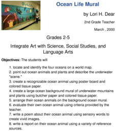
Ocean Life Mural
How many oceans can you name? First, have learners try to name as many oceans as they can, and then have them locate and identify the oceans on a world map. They create a recognizable ocean animal using poster board and tissue paper....
Curated OER
E-mailing the Chamber of Commerce
Encourage effective internet research and e-mail correspondence as scholars investigate a US capital city they've never visited to find pertinent and relevant information. They begin by picking a city, then visit that city's chamber of...
Curated OER
The Land and People Before Columbus
The major pre-Columbian settlements are studied in this excellente social studies lesson plan. Fifth graders explain how geography and climate influenced the way various nations lived and adjusted to the environment, and focus on eight...
Curated OER
A Ticket to Japan
Fourth graders discover similarities and differences in the lifestyles and geography of Utah and Japan. They use a Venn Diagram to compare and contrast daily life and geography in Utah with daily life and geography in Japan. They make...
Curated OER
Tactics in the Persian Gulf: From Diplomacy to Force
Students trace the United States' involvement in Iraq from 1991 to today. They interpret a map of Iraq, evaluate possible causes and effects of events. They participate in, collect and analyze a poll regarding the next steps the US...
Curated OER
Establishing Borders: The Expansion of the United States 1846-48
Students investigate how the United States acquired land after the Revolutionary War ended. In this establishing borders lesson, students use maps to identify territories acquired by the US and the states that later developed. Students...
Curated OER
Geography at Home: Buildings We See Around Us
Pupils explore architecture. For this architecture lesson, students examine photographs of buildings in their communities. Pupils collaborate to discuss their observations regarding the buildings. Students record their observations in...
Curated OER
US Immigration
Students examine the history of immigration in the United States. Using primary source documents, they identify the areas of origin for people settling in Minnesota and describe the push and pull factors that brought them there. They...
Other popular searches
- Us Geography Climate
- Us Geography Skills
- Geography Map Skills Us
- Us Geography Pdf
- Us Geography Scavenger Hunt
- Us Geography Northeast
- Us Geography Activity
- Us Geography Slavery
- Us Geography and Economics
- Geography Us
- Us Geography West
- Us Geography Southeast


