Curated OER
Geography and Artifacts of Mexico
Students review the structure of government in Mexico and discuss how it is different than the United States. Using artifacts, they must label and identify the city or state in which the artifact originated. They use the artifact clues...
Curated OER
Through the Forest and Home Again: Maps Help Us Find Our Ways
Students read Little Red Riding Hood, focusing on her path home to Grandma's house. In this language arts and geography lesson, students perform a reader's theater, re-creating the walk home and possible routes that could have been...
Curated OER
World Map and Globe-Equator, North Pole, and South Pole
Learners identify the Equator, North Pole, and South Pole on a map. In this geography lesson, students use a world map and circle the North and South Pole. Learners locate the Equator on a globe and use a map marker to highlight it.
Curated OER
The Water Around Us
Students discuss importance of reading maps and knowing about the geography of the United States, and locate bodies of water on different types of maps and examine how they are used in the state or local community.
Curated OER
US Immigration
Students examine the history of immigration in the United States. Using primary source documents, they identify the areas of origin for people settling in Minnesota and describe the push and pull factors that brought them there. They...
Smithsonian Institution
Borders with the World: Mexican-American War and U.S. Southern Borderlands
The Mexican-American War created social borders—not just physical ones. Scholars learn about the effects of the Mexican-American War on the people living in the borderlands using text excerpts, maps, and partnered activities. Academics...
Curated OER
States and Capitals, Mountains and Rivers
Students identify geographical locations in the midwestern United States. In this geography lesson, students identify 12 states and capitals and geographical features in the region by using U.S. maps. Students use blank maps to fill in...
Curated OER
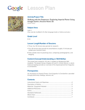
Walking with the Emperors: Exploring Imperial Rome
Students travel Rome. For this geography skills lesson, students explore famous places in Rome with Google Earth tools. Students research the city of Rome and create touring videos that feature their findings.
Curated OER
Arkansas is Our State: Differentiating Between a State and a Country
An ambitious geography lesson is geared toward kindergartners. They discover what the differences are between states and countries. They look at maps of Arkansas, and learn what the shapes and lines mean. Additionally, they create a...
Curated OER
Historical Geography Scavenger Hunt
Learners are told that Geography is the science that deals with the differentiation of the surface of the earth due to the influence of things like population, vegetation, geology, and land use. They explore the Geography Basics page. ...
Curated OER
World Map and Globe - Four Main Directions
Students study the four main directions on a map. In this map lesson, students locate the North and South pole, and learn the four cardinal directions. They use the compass rose on a map to help with the directions. (Map is not included...
Curated OER
Arkansas State Rock
Here is a lesson which shows the value of a mineral called bauxite to Arkansas during the early 1900's. Learners relate the five themes of geography to the history of bauxite and aluminum production in Arkansas. For teachers of...
Rutgers University
How the Allies Won World War II: Island-hopping in the Central Pacific
Using primary source documents, young historians explore the strategies the US used to defeat Japan during WWII. They also learn about the American military experience, and innovations that changed the style of warfare. Students benefit...
Alabama Department of Archives and History
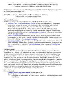
Military Conscription in World War I: Alabamians Express Their Opinions
If called, would you go? Should the US government have the power to impose a draft during any war? The Selective Service Act of 1917 (aka the Conscription Act of 1917) authorized the drafting of men into the military for only the...
Museum of Tolerance
Disenfranchised People of the New Nation
Why are some immigrant groups in the United States embraced while others become disenfranchised? To answer this question, teams investigate why groups emigrated to the US, why some of these these peoples were...
US Mint
Absolutely and Relatively: The Puerto Rico Quarter Reverse
How much does your class know about Puerto RIco? How much can they learn from the back of a 2009 quarter? Use the coin, part of a series of quarters that depict US territories, to teach learners about the geography, culture, and history...
Curated OER
A Ticket to Japan
Fourth graders discover similarities and differences in the lifestyles and geography of Utah and Japan. They use a Venn Diagram to compare and contrast daily life and geography in Utah with daily life and geography in Japan. They make...
Curated OER
Abigail Adams: Integrating Social Studies and Language Arts
Third graders increase reading strategies while learning about Abigail Adams and her role in history. In this Abigail Adams instructional activity, 3rd graders read about the American Revolution and Abigail Adams using all the balanced...
Curated OER
People Change the Landscape
Students examine ways in which humans have brought change to the natural environment. In this ecology and literacy lesson plan, students listen to the book Island Boy by Barbara Cooney. Students observe and define map-reading vocabulary...
Curated OER
The 50 States
Fifth graders use maps and music to learn the 50 states. In this US Geography lesson, 5th graders map out a region of the United States and practice singing the song, The 50 States that Rhyme.
Curated OER
Symbols of Our State: Arkansas
Here are a series of lessons designed to assist early elementary learners to discover the symbols of Arkansas. They learn about the state flag, insect, state seal, state bird, flower, tree, and gem. A booklet (emedded in the plan), is...
Curated OER
N is for Natural State
For any pupils who live in the state of Arkansas, this would be a fabulous educational experience to help them get to know their state better. Through the use of activities in literature, art, mathematics, science, social studies, and...
Curated OER
Island Animals
Students explore the concepts of endangered animals and conservation. For this animal conservation lesson, students complete activities to investigate the endangered animals of the US Virgin Islands. Students complete multiple worksheets...
Curated OER
A Tour of Rome Fit for an Emperor
Students travel to Rome. In this geography skills lesson, students explore famous places in Rome with Google Earth tools. Students research the city of Rome and create touring brochures of the city from the perspectives of past emperors...


