Curated OER
Mesoamerica
Students demonstrate knowledge of early Middle American civilizations. They study Mesoamerican i religions, governments, and achievements. They identify geographies of North and South America.
Curated OER
Mapping and Personifying Nations
Eleventh graders analyze the geography, actions, and relationships of countries involved in World War II. They create a map of Europe, Northern Africa, and the Pacific, and analyze and evaluate their self-made map of Europe and the...
Curated OER
Rainforest People
In this geography learning exercise, students read an excerpt about the rainforest people. Then, they respond to four short answer questions related to these people. Students explain what survival lessons the people learned from each...
Curated OER
Adventures on the Eastern Half of Planet Earth
Seventh graders explore a country in the Eastern hemisphere. They develop a packet that could be used by someone visiting that country during the month of December. Students explore the climate, foods, geography, customs and culture of...
Curated OER
How Far Away is Your College?
Eighth graders practice using atlases. In this geography skills lesson, 8th graders select a college they would like to attend and use an atlas to respond to questions about the geography of the place.
Curated OER
The New Canada Project
Students focus on one province/territory in Canada. They study the natural resources, location and geographical significance, physical geography, people, culture, climate, and the brief history.
Curated OER
Fertile Crescent Map Project
Sixth graders develop a multimedia presentation of the Fertile Crescent that compares modern day geography, economics, government, and transportation resources. They work in groups to research their specific topic.
Curated OER
Extreme Elevations
In this geography worksheet, 5th graders work in groups in order to locate and graph mountains found on all the continents of planet earth.
Curated OER
Cities of the World
Students identify the symbol for cities on a political map. In this world map lesson, students identify specific cities on the World Political Map. Students should identify the country in which the city is located. Students discuss the...
Curated OER
There's a Watershed in my Backyard!
Students explain what the term watershed is by creating a model. In this science, geography lesson plan, students demonstrate how the water moves in a watershed. Additionally, students learn about point source and nonpoint source...
Curated OER
"Go West, Young Man!"
Students examine reasons why people migrated west. They describe how the geography of the U.S. changed in the 19 th century and design a PowerPoint presentation to convey factors for westward expansion.
Curated OER
The Oceans Below
Students investigate the geological characteristics of the ocean environment and create a labeled drawing of the ocean floor's geography. Students view videos and conduct Internet research about the ocean's floor and then create their...
Curated OER
People in the World-Brazil
Second graders explore information about South America and choose a country to study. They explore culture, food, geography, clothing, language, and recreation of their country. Students visualize their learning by developing a slide...
Curated OER
Regions, Regions, Regions!
Pupils use regions to analyze the locational patterns of culture
groups at various scales. They discern the basics of region identity by discovering his/her "Home" Region through the examination of
criteria in his/her "backyard." In...
Curated OER
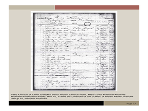
Chief Joseph and the Nez Perce
Eleventh graders explore the life of Chief Joseph and Nez Perce. In this US History lesson, 11th graders analyze paintings and photos detailing the flight of Nez Perce. Students create a narrative newspaper article based on...
Curated OER
Regions of the United States
Students explore the regions of the United States. In this geography lesson plan, students read the text When I Was Young in the Mountains and compare the setting of the story with their geographical setting. Students use a physical map...
Curated OER
Water Features - Lesson 2 - U.S. Political Map Grade 4-5
Learners locate water features on maps. In this geography lesson, students complete worksheets that require them to identify water features on a U. S. political map.
Curated OER
Oklahoma
In this geography worksheet, students read a 2 page selection detailing the location, history and early statehood of Oklahoma. They answer 10 true or false questions based on the reading.
Curated OER
Sparking a Revolution!
Students investigate the causes and events that lead to the US Revolutionary War. They use a number of study techniques in this unit to discuss why the colonies wanted freedom from Britain.
Curated OER
United States Map- State Capitals
Students explore the state capitals. In this geography lesson, students use a political map to identify the state capitals and place post-it notes on various capitals.
Curated OER
Things to Help Us Cross the Road
In this road safety worksheet, students solve the clues to identify four things which help them cross the street. Students draw and label them in the provided boxes.
Curated OER
Walking for Water Mini-Unit
Students participate in an activity that requires them to consider the availability of water. In this "walking for water" lesson, students read "Women Bear the Weight of Water," and respond to discuss questions regarding the article....
Curated OER
Canada Or Bust
Seventh graders answer the following problem based lesson with the essential question, "Which city or town in Canada would adequately meet my family's needs for relocation?" They present their city and provide rationale for its...
Curated OER
Great Monuments of the World
Young scholars explore the wonders of the world through inquiry. In this world monuments lesson, students investigate famous landmarks around the world as they conduct and apply research. Young scholars create products that feature their...


