Curated OER
Early Explorers
Fifth graders study early explorers. In this World history lesson plan, 5th graders draw an outline of a map labeling each part, build geographical features out of dough, and paint each of the land and water features.
Kids Discover
Ancient Egypt by KIDS DISCOVER
Discover Ancient Egypt! Learn about mummification and gods, visit pyramids and temples, examine cliff carvings and paintings, take quizzes and engage in activities. Colorful, interactive, and easy to use, this app is not just for kids!
Curated OER
The Great Depression and Everyday Life
Examine everyday life during the Great Depression, as well as the effects if the Depression on American population, society, and economy. Learners write who, what, where, when, and why summaries of a person who relocated to California...
Curated OER
Ragtime: 1880-1920
Build an understanding of the social, economic, and cultural changes that were incited by the American Industrial Revolution. Learners will research the historical context of the Ragtime Era, and compose an oral presentation in the...
Curated OER
Canada, O Canada
Students study the similarities and differences between Canada and the United State in this unit. They examine geography, government and culture as they "travel" through Canada.
Curated OER
Magical Maps
Second graders discuss the importance of using maps and how they are used. After they listen to a folktale, they develop their own story line maps and write their own folktale to accompany a map. They also identify and locate the seven...
Curated OER
Mapping Mistakes
Students examine early European maps and explore geographic errors. They also view maps of the geography of North America. Students discuss the obstacles faced by early explorers in mapping unexplored territory. They consider what the...
Curated OER
China is Unique
Sixth graders study the culture of China by comparing it to that of the United States. They write all questions and notes in a journal. The students access the internet to obtain the information and internet sites are suggested in the...
Curated OER
Mother's Day Trip
Help your class develop their public speaking skills. They write original scripts for informative infomercials, plays, or poetry. They work to present their information with purpose.
Curated OER
Manduca
Students study the definition of a "global society". They take this knowledge and speculate about the positive and negative ramifications of living in a global society.
Curated OER
What I Did On My Summer Vacation
Students use the internet to research the location of their summer vacation trip. Given the demographics, they plot the location on a world map. They create a brochure using the information they collected. Using PowerPoint, they develop...
Curated OER
Corn Exports Visually
Learners study imports and exports and the countries that import the most corn from the U.S. They construct mini paper corn plants and label a map with these plants to represent the amount of corn the U.S. exports to countries around the...
Curated OER
Where Life Is Too Short
Young scholars predict how a pandemic would affect aspects of South Africa's society. In this world issues and geography lesson, students read a letter outlining the problems affecting South Africa. Young scholars discuss and analyze how...
Curated OER
Tooling Around Arizona: Reading Arizona Maps
Young scholars research Arizona maps. In this map lesson, students discuss map titles, scales, directions, elevation, and symbols. The class will examine topography, landforms, and rivers found on an Arizona map.
Curated OER
Read a Transportation Story
Eighth graders research the career of Arctic transportation. In this arctic transportation lesson, 8th graders read a book about Arctic truck travel and review the historical aspects of transporting goods in the Arctic. Students review...
Curated OER
Continents and Oceans
Students identify oceans and continents and their locations on a map. They color-code and label their own map of the world's continents and oceans. They play the game Continents and Oceans to identify specific areas.
Curated OER
Introduction to World Religions: Islam
Sixth graders explore religion by viewing a presentation in class. In this global culture instructional activity, 6th graders define the Islam religion and the stories that accompany it. Students read the story "Muhammad" by Demi and...
Curated OER
A Map Mystery
Second graders solve a map mystery. In this technology lesson plan, 2nd graders develop an awareness of maps and the symbols associated with maps as they the "Neighborhood Map Machine."
Curated OER
Exploring Virtual Europe
Students research the geography, government, climate, history, economy, and culture of a European country. They select a country in Europe, explore various websites, and complete a worksheet.
Curated OER
Colonies and Revolution: Comparing US and Mexican History
Students examine the emergence of the United States and Mexico as independent nations. They compare the colonial history of the two countries and discover the emergence of social classes.
National Wildlife Federation
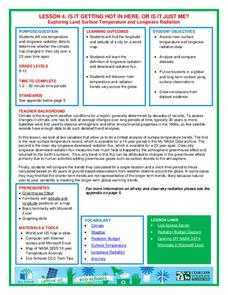
Is It Getting Hot in Here, or Is It Just Me?
Currently, only 2.1% of global warming is felt on continents, while over 93% is felt in the oceans. The fourth lesson in the series of 21 on global warming is composed of three activities that build off one another. In the first...
Roy Rosenzweig Center for History and New Media
Differences Among Colonial Regions
Classes look at and analyze primary source images to explore the differences between the colonial regions during the Revolutionary era. They break into groups to tackle each region and then present their findings to the class. A final...
Houghton Mifflin Harcourt
The Fellowship of the Ring
Here's a must-have resource for educators who use J.R.R. Tolkien's The Hobbit and/or The Lord of the Rings. Packed with materials for both tales, the packet includes both a reader's guide and an educator's guide, lesson plans, vocabulary...
Curated OER
ADULT ESOL LESSON PLAN--Environment and the World
Students locate and trace Florida on a United States map as well as their local counties and city of residence on a state map. In addition, they label all the directions north, south, east and west on each map.


