Colorado State University
How Does the Earth Cool Itself Off?
Where does all the heat go when the sun goes down? An interesting lesson has learners explore this question by monitoring the infrared radiation emitted over time. They learn that hot spots cool more quickly that cooler spots.
John F. Kennedy Presidential Library & Museum
Red States/Blue States: Mapping the Presidential Election
Young historians investigate how voting patterns have changed by comparing the outcome of the 1960 election to the outcome of the recent election. A creative final assessment has participants making a news show wherein they provide...
Curated OER
New Mexico State Quarter Printable
In this New Mexico worksheet, students study a picture of the state quarter of New Mexico. Using the information on the coin, students answer 3 short essay questions.
Curated OER
New Hampshire State Quarter
In this New Hampshire instructional activity, students study a picture of the state quarter for New Hampshire. Using the information on the coin, students answer 5 short essay questions about New Hampshire.
Curated OER
North Carolina State Quarter
In this North Carolina worksheet, students study a picture of the state quarter. Using the information on the coin, students answer 5 short essay questions.
Curated OER
Oregon State Quarter
In this state quarters worksheet, students study the picture of the state quarter of Oregon. Students use the information on the quarter to answer state fact questions.
Curated OER
Vocabulary: Early New York
In this US history and vocabulary worksheet set, students complete 55 questions based on the vocabulary used when studying Early New York. They write sentences, unscramble words, write riddles, draw word meaning, and complete...
Curated OER
Winter Holidays Around the World
How much do you know about the holidays around the world? Second graders put their knowledge to the test with a 14-day activity about global celebrations. They read informational text, employ KWL charts, and compare and contrast the many...
Curated OER
Mapping Our Home
Students explore how communities participate in census counting. In this census lesson, students recognize the absolute and relative location of a state and understand ideas about civic life and government.
Curated OER
At Your Fingertips
First graders observe a variety of different foods including kiwi, banbnas, coffee, chocolate and discuss where they come from. They discuss the terms import and export then identify the locations where the items came from and their...
Curated OER
Paris Peace Conference: Writing a Treaty to End World War I
How did World War I end? Tenth graders role play as experts from countries that were involved in World War I. They write a treaty to end the war and compare it to the Treaty of Versailles.
Curated OER
Lesson 1: Map Data and the Census
Students learn about the history of the census. In this U. S. Census lesson plan, students develop an understanding about how the United States Constitution grants and distributes power and discover how the spatial organization of...
Curated OER
International Custody Battle
Students research the relationship between the United States and Cuba by identifying key players and events in Cuban/U.S. history. They also focus on a battle waged between Cuban-Americans in Miami and a father in Cuba over the custody...
Curated OER
Heritage: Survival and the Geography of Utah
Fourth graders are introduced to the hunting and gathering techniques used by the Native American tribes living in the region that is now Utah. They prepare a role-play of hunting and gathering appropriate to specific geographical areas.
Curated OER
Cultural Anthropology Study Using the Fundamentals of Geography and GPS
Students, in groups, operate the GPS unit, plotting each head stone with accompanying description. Two other students to log in data that corresponds to the given points. One student to note general observations
Curated OER
Route 66 And Population Patterns
Students investigate the geography located along Route 66. They research how the population patterns change in certain areas along the highway. Students use the information in order to form hypotheses about how and why the population...
Curated OER
Iowa Cities Word Jumble
In this Iowa worksheet, students unscramble the letters in ten words to spell the names of cities in Iowa. There is a word bank to help.
Curated OER
New Jersey Cities Word Jumble
In this New Jersey cities worksheet, students unscramble the letters in 10 words to spell the names of cities in New Jersey. Students write the city names on the lines.
Curated OER
Exploring the USA and the World with Cartograms
Students investigate cartograms in order to explore the different countries on Earth. For this world geography lesson, students use the Internet to analyze data on different cartograms. Students compare data, such as population density,...
Curated OER
Japan and The Ring of Fire
Learners engage in a study of the volcanic forces and earthquakes associated with The Ring of Fire in the Pacific Ocean. The people of Japan are researched in how they have dealt with living in the area. Also students write in journals...
Curated OER
The Immigrant Experience
Students utilize oral histories to discover, analyze, and interpret immigration and migration in the history of the United States. A goal of the unit is fostering a discussion and encouraging students to make meaning of the bigger...
Curated OER
Max Knows Mexicao, United States and Canada
Students utilize their map skills to explore the regions of North America. They explore the physical characteristics and climates of the regions. Students label their map and prepare a presentation of their findings.
Curated OER
Pen Pal Letters to Soldiers Overseas
Students write letters to soldiers overseas with correct spelling, grammar, punctuation, and capitalization. They learn three facts about the geography of the area where the pen pal is located and about the pen pal.
Curated OER
Where In the World Are You?
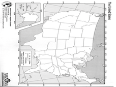
Fourth graders fill in blank copies of the United States Map and then the World Map.


