Curated OER
Treasures of Ancient Egypt
Students explore Ancient Egypt by learning about the after life, observing and discussing pictures of mummies, making jewelry, and more. In this Ancient Egypt lesson plan, students complete these activities in class and at a museum.
Curated OER
Cuban Missile Crisis in Thirteen Days
Eleventh graders explore the Cuban Missile Crisis. In this Cuban Missile Crisis lesson plan, 11th graders take notes from a PowerPoint presentation regarding the topic and then watch the film "Thirteen Days". Students participate in...
Curated OER
Following the Great Wall of China
Students explore the Great Wall of China. They participate in three activities to become familiar with the geography of China and Chinese names. Students explore the size of the wall by examining an interactive web site. They write a...
Curated OER
It's Not Easy Being Green
Students investigate the environmental costs of operating golf courses. In this current events lesson, students visit selected websites to study golf course needs and green design options.
Curated OER
Diggin' The Past
Young scholars explore the culture of Ancient Egypt. In this ancient civilizations lesson, students are divided into groups to research how aspects of culture were influenced by the Nile River. Young scholars create a slide show that...
Curated OER
Ancient Greece: Inquiring Minds Want to Know
Second graders explore world history by writing newspaper articles. In this Greek history activity, 2nd graders investigate the geography and society of Ancient Greece by utilizing the Internet as a research tool. Students collaborate...
Curated OER
Tracking Satellites Using Latitude and Longitude
High schoolers, viewing an Internet site, plot the path of several satellites using latitude and longitude over the course of an hour. They learn the four basic types of satellites and their purpose.
Curated OER
Satellite Images- Night Time
Fourth graders study the geography and population distribution of various places on earth. They utilize actual satellite images of the night sky (lights showing heavily around area of dense population) to study and make observations...
Curated OER
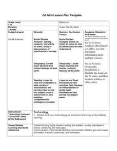
Come Visit My State!
Fourth graders conduct research on a selected state in the United States. They complete a WebQuest and conduct research on a variety of websites. Students then organize and present a visual display about their state that includes a...
Curated OER
U.S. Possessions
Ninth graders research the United States acquisition of the Philippines and their fight for independence. They locate the Philippines on a map and brainstorm how its geography has benefits. They access the Internet and complete a student...
Curated OER
Living in America (The Earliest Years)
Fifth graders work in groups to study a particular group of Native Americans. They use a study guide to guide their research and use the internet and text resources to gather information. Students post their research on a class web page.
Curated OER
Give Me The C and D Canal!!!
Students estimate the distance from Baltimore to Philadelphia via the water route before the Chesapeake and Delaware Canal was built. Students study canals and how transportation and economic necessities dictate the building of a canal.
Curated OER
Bringing Illinois into the Curriculum
Young scholars of all ages are introduced to the geography of Illinois. Depending on the grade level, they participate in different activities which allow them to discover Illinois in the past and present. They examine the animals and...
Curated OER
United Nations General Assembly
Students study China and the Chinese occupation of Tibet. They read position summaries/notes of China, Tibet and various foreign nations. Then they roleplay members of United Nations General Assembly and discuss and debate the topic.
Curated OER
Investigating Haiti
Students engage in a activity that is about the island of Haiti. They conduct research using a variety of resources. The information is used in order to help students locate the island on a map. They answer questions while participating...
Curated OER
Great Explorers
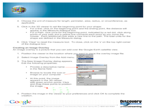
Students research an explorer and present a multimedia presentation on the explorer. In this United States explorers lesson, students watch a video about Lewis and Clark. Students use Google Earth to study their journey and keep a KWL...
Curated OER
On the Road Again": Moving People, Products, and Ideas
In this lesson students learn how to identify modes of transportation and communication for moving people, products, and ideas from place to place. Students also study the advantages and disadvantages of different modes of...
Curated OER
Cultural America
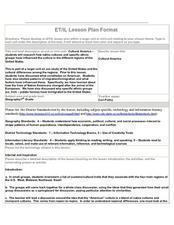
Seventh graders investigate the cultural differences that can be found in America. They discuss what it means to be called an American. The patterns of migration to America are discussed with the use of maps and geographical terms....
Curated OER
Lewis and Clark
Ninth graders study the plants and animals Lewis and Clark discovered on their expedition. There is a plant illustrator, a plant recorder, an animal illustrator, and an animal recorder. They research the plants and animals and the ...
Curated OER
War of 1812
Eighth graders examine how Andrew Jackson's decisions during The Battle of New Orleans led to victory. They study the importance of The Battle of New Orleans in the Treaty of Ghent and discuss the results of the War of 1812. Finally,...
Curated OER
Wickets & Woozles Exile Simulation
Learners divide into two groups and become Wickets and Woozles. They are separated in the classroom and then participate in a simulation activity in which one group is in "exile." They follow the activity with a class discussion and...
Curated OER
Illinois State Map
For this Illinois geography worksheet, students color and label a map of Illinois. Students study the location of the capital and where Illinois is situated in the United States. There is a black line map of the state with a grey US map...
Curated OER
Mapping Districts
Students become literate in their use of maps. In this 2010 Census lesson plan, students visualize census data on maps, use map keys to read population maps, and explore the concept of population density.
Curated OER
Mapping Districts
Students use maps to learn about the U.S. Census. For this 2010 Census lesson plan, students visualize census data on maps, use map keys to read population maps, and explore the concept of population density.


