Curated OER
Geography Tutor: Five Themes of Geography: DVD-Video Assignment
In this geography skills worksheet, learners watch the National Geographic video "Five Themes of Geography." Student then respond to 8 short answer questions about content of the video.
Curated OER
European Elevation Sort
Given a prepared database of European countries, sixth graders sort the countries in ascending order by elevation and identify the five countries with the highest elevations. This cross-curricular lesson combines elements of computer...
College Board
2011 AP® Human Geography Free-Response Questions
How have Mexico's largest cities help shape the destiny of that country? What insights can a ninteenth-century economist give us about population growth? Two essay-style questions help your learners unravel complicated relationships....
Curated OER
Maps Can Help Us
First graders explore the geography of Montana by analyzing geographic maps of the area. For this Native American reservation lesson, 1st graders discuss the similarities and differences between reservations in the state of Montana....
Curated OER
Walking with the Emperors: Exploring Imperial Rome
Students travel Rome. In this geography skills lesson, students explore famous places in Rome with Google Earth tools. Students research the city of Rome and create touring videos that feature their findings.
Curated OER
The Geography of Europe
Students examine maps of Europe. In this geography skills lesson, students interpret several maps to determine the boundaries of the European Union and respond to assessment questions about the maps.
Sharp School
US Geography Landmark Commercial
Experience famous geographical landmarks around the United States right from the comfort of your very own classroom. Learners research national landmarks, such as the Grand Canyon, Yellowstone National Park, and Niagara Falls, and then...
Curated OER
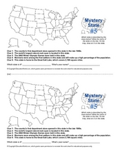
Mystery State # 5
Mystery state number five is none other than Utah! Quiz your kids on state knowledge while building deductive reasoning skills. They use each of the five clues to determine the name of the mystery state. A great warm up when studying...
Curated OER
US Geography, The Blues
This instructional activity enables teachers to use blues styles and performers to think about various geographical regions of the United States. By studying different blues styles from the Mississippi Delta, Texas, and the Piedmont...
Little 10 Robot
YodelOh™ Math Mountain
Save the yodeler from falling off the top of the mountain using basic math skills. Have endless fun while developing fluency with addition, subtraction, multiplication, and division.
Curated OER
Grocery Store Field Study
Students visit a local grocery store (not a community market) to gather information about where some commonly eaten produce items come from. Once they have collected this information, locate the countries of origin on a map and research...
Fremont Unified School District
4th Grade California Relief Map Project
Bring life to your next California geography lesson with this great project! Learners design a three-dimensional wall relief map of California, painting and decorating regions using a variety of materials and labeling major geographical...
Happy Housewife
State Notebooking Pages
When learning about US geography, it can hard to remember facts about 50 different states. Help your young scholars organize all of this information with a collection of easy-to-use note-taking guides.
Curated OER
GeoHive Information Hunt
For this geography skills worksheet, students respond to 30 short answer questions about world geographic features and locations.
Curated OER
Focus on Russia: Geography Worksheet
In this geography skills worksheet, students respond to 10 fill in the blank and short answer questions about Russia's geography.
Curated OER
Names and Places
Students explore where jobs are done. In this careers and geography instructional activity, students locate places in Canada on a map and list jobs that are done in their area of Canada. Lesson includes extension and differentiation ideas.
Curated OER
N is for Natural State
For any pupils who live in the state of Arkansas, this would be a fabulous educational experience to help them get to know their state better. Through the use of activities in literature, art, mathematics, science, social studies, and...
Curated OER
Africa: Geography Concept Map
In this geography skills instructional activity, students complete a graphic organizer where they list African countries and their geographic features, languages spoken, natural resources, and historical facts.
Curated OER
Geography/Current Events Project
Using the Balkan region as an example, fourth graders review the five themes of geography as a class. They identify the physical and human characteristics of a region before labeling the countries and landforms on a map. They then...
Curated OER
US City Quality of Life Analysis and Comparison
Students analyze US census data and criteria to compare and measure the quality of life in the country's fifty largest cities. After accessing the 2005 quality of life world report online, students conduct their study to compare three...
California Polytechnic State University
Australian Geography Unit
At the heart of this resource is a beautifully detailed PowerPoint presentation (provided in PDF form) on the overall physical geography of Australia, basic facts about the country, Aboriginal history, and Australia culture and lifestyle.
Population Connection
The Carbon Crunch
Carbon is in the air; should we care? Teach the class why it is important to pay attention to carbon levels and how the world population and various countries across the globe affect the carbon levels in the atmosphere. High schoolers...
Curated OER
The United States and Canada: Climate and Vegetation
Display U.S. and Canadian climate and vegetation through this text-companion learning exercise. Learners read about the geography of these regions, take notes, and answer 3 comprehension questions as they read the selection. A graphic...
Curated OER
Topographic Mapping Skills
In this geography worksheet, students read an excerpt about topographic maps and why they are useful for various jobs. They also respond to eleven questions that follow related to the excerpt and locating specific map points on the map...


