Curated OER
Comparing Creation Stories
Students compare and contrast creation stories in different cultures. They write a creative story and design a visual aid showing what their new civilization would look like.
Curated OER
Water in the Texas Coastal Basins
Students, after researching a Texas coastal basin, map and graph the information they collect and then translate it into a short report to be presented to their classmates. They brainstorm unique ways to maintain Texas estuaries as well...
Curated OER
Uncharted Territory
Students examine what were preconceived perceptions of the areas Lewis and Clark explored. They compare and contrast past and modern maps of North America. They accurately place route and site information on the map.
Curated OER
How Can Understanding and Helping Others Build Our Own Community?
Students examine the different cultures and disabilities people face in their community. They discuss how they can become better citizens. They answer discussion questions to finish the activity.
Curated OER
Reading a Local and National Weather Map
Learners practice reading a national and local weather map. Using this information, they work together to make predictions about the weather for the next few days. They discuss the use of symbols and maps as a class and discuss how...
Curated OER
Ecosystems: What Are They and How Do They Work?
Students explore the characteristics of major ecosystems, the interactions of the organisms within the systems, and the effects of humans on the system. Both living and non-living components are examined in this five lesson unit.
Curated OER
From Above
Students use maps and other geographic representations, tools, and technologies to acquire and report information from a spacial perspective.
Curated OER
The First Farmers
Students show how constant irrigation, with repeated evaporation of water that left salts in the soil, eventually ruined much farming land in southern Mesopotamia. They discuss the idea that with the development of irrigation people...
Curated OER
Urban and Rural Communities
Students discuss similarities and differences of urban and rural communities. In this urban and rural communities lesson, students compare urban and rural communities using a Venn Diagram. Students examine maps of each type...
Curated OER
Watershed Model
Students view a presentation of water and land and how we need to protect our water resources. In this water lesson plan, students discuss how we rely on water, and complete activities in all subjects related to water.
Curated OER
Plate Tectonic - Volcanoes (1)
Young scholars learn the different shapes of Volcanoes and discuss why volcanoes only have a few shapes.
Curated OER
The Postcard
Students listen to the book "Kate on the Coast" and plot her journey on a map. Then they decorate, address, and write a message on a postcard. They discuss where the postcards are being sent and plot the destinations on map.
Curated OER
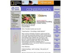
Sanctuaries-Providing a Safe Harbor
Learners investigate the role of marine sanctuaries in the conservation of oceans and the lives of plant and animal species that live there. They write poetry to exhibit what they learn.
Curated OER
Sustainable Development and Canada's Natural Resources
Learners use text information, data and graphs to explain what sustainable development is, and to investigate the rate of consumption of Canada's natural resources. In groups, they graph their findings.
Curated OER
A Day in a Life of an Arctic/Antarctic Animal
Students, through video segments, explore what types of animals live in the Arctic and Antarctica. They also clear up any misconceptions they have about penguins or polar bears.
Curated OER
Mythical Mayhem
Students explore Greek and Roman mythology in this five lessons unit. Common gods, their roles in the myth and stories of the era are surveyed as students take on the personality of a mythical character.
Curated OER
Life Giving Rivers
Students examine the world's rivers in this six lessons unit which mingles science with social studies. The dynamic forces that create erosion in nature are also seen as habitats and ecosystems that are affected by environmental and man...
Curated OER
Civil Engineering: Designing Bridges
Young scholars examine the bridges of the United States. They discuss the concept of balance. They draw their own design of a suspension bridge.
Curated OER
Comparing Temperature, Pressure, and Humidity
Students investigate data on temperature, pressure, and humidity by downloading information from the ARM Website. Working in groups, they discover how weather impacts life in each of the ARM sites. They record weather data in their...
Curated OER
Treaty Trail: Crossing the Bitterroot Mountains
Learners examine art and primary documents that depicts the Native Americans' crossing of Washington's Bitterroot Mountains to arrive at the Spokane Council. Students investigate and compare maps and other historical materials determine...
Curated OER
Mapping Lab and Lead Poisoning
High schoolers are introduced to GIS and its uses. They make predictions before viewing the actual lead poisoning cases by location of Dade County. Pupils use actual Miami-Dade County spatial data to explore basic principals. Students
Curated OER
My Community
Students engage in a lesson about the community in order to find out what different things go on within it on a daily basis. They conduct field research and look up information in order to answer some key questions addressed.
Curated OER
The Desert Alphabet Book
Students use a book to discover an interesting fact from the desert using each letter of the alphabet. Using a United States map, they identify the meanings of symbols and locate deserts within the U.S. In groups, they participate in...
Curated OER
Teaching With the Power of Objects
Students define value of an object. In this value lesson plan, students identify reasons for collecting objects, compile a personal inventory of items they find valuable, and then define why those items are valuable to them. In step two...


