New York State Education Department
TASC Transition Curriculum: Workshop 11
You'll C-E-R a difference in classroom achievement after using a helpful instructional activity. Designed for economics, civics, government, and US history classes, participants practice using the CER model to craft arguments about...
Curated OER
Canadian Provinces Quiz
In this online interactive geography quiz activity, students examine the map that includes 13 Canadian provinces. Students identify the names of the provinces in 3 minutes.
Curated OER
Country Flags Quiz
For this online interactive country flag quiz worksheet, students examine the 20 pictured country flags and try to name all of the countries represented in 4 minutes.
Curated OER
South America Map Quiz
In this online interactive geography quiz worksheet, students examine the map that includes all of South America's countries. Students identify the 13 countries in 2 minutes.
Curated OER
Middle East Map Quiz
In this online interactive geography quiz worksheet, students examine the map that includes 26 Middle Eastern countries. Students identify the names of the countries in 4 minutes.
Curated OER
Central America Map Quiz
In this online interactive geography quiz worksheet, students examine the map that includes 22 Central American countries. Students identify the names of the countries in 3 minutes.
Curated OER
Canada Map Quiz
In this online interactive geography quiz activity, students examine the map that includes 13 Canadian provinces and territories. Students identify the names of the provinces and territories in 2...
Curated OER
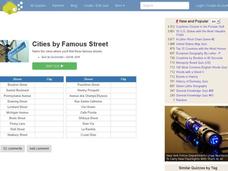
Famous Streets Quiz
In this online interactive geography quiz worksheet, students examine the chart that includes the names of 18 famous streets in the world. Students have 4 minutes to identify the names of the cities where the streets...
Curated OER
State Nicknames Quiz
In this online interactive geography quiz worksheet, learners examine the chart that includes the names of 49 states. Students identify the nicknames of the states in 6 minutes.
Curated OER
Highest Mountain Countries Quiz
In this online interactive geography quiz worksheet, learners examine the chart that includes the elevations of 20 world mountains. Students identify the names of the mountains in 4 minutes.
Curated OER
California Cities Map Quiz
In this online interactive geography quiz instructional activity, students examine the map that includes 12 California cities. Students identify the names of the cities in 3 minutes.
Curated OER
Biggest Cities in Each State Quiz
In this online interactive geography quiz instructional activity, students examine the chart that includes the names of 50 U.S. states. Students identify the names of the two largest cities in each...
Curated OER
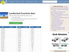
Landlocked Countries Quiz
In this online interactive geography quiz worksheet, students examine the chart that includes details about the population in 44 landlocked countries. Students identify the names of the countries in 5 minutes.
Curated OER
Famous Lakes Quiz
In this online interactive geography quiz activity, students examine the chart that includes details about 15 famous world lakes. Students identify the names of the lakes in 3 minutes.
Curated OER
Biggest Cities in India Quiz
In this online interactive geography quiz instructional activity, students examine the chart that includes the population of 20 Indian cities. Students identify the names of the largest...
Curated OER
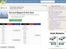
Second Biggest Cities Quiz
In this online interactive geography quiz worksheet, students examine the chart that includes details about 20 major cities in the world. Students identify the names of the cities in 4 minutes.
Curated OER
Learning About Location: Charting the Path of the George W. Elder
Young scholars acquire a working knowledge of the geographical concepts: absolute location, relative location, longitude and latitude. They analyze primary sources that shows the physical and human characteristics of the places along...
Curated OER
A Study of the United States of America
Students research information about each of the fifty states. They locate information using both the Internet and CD Roms and create databases using the research information. They insert graphics in a multimedia presentation using the...
Teachers' Curriculum Instituted
The Roman Record
Using Google Earth, Google Docs, and other Google Tools, collaborative groups of seventh graders research and then create and share online newspapers reporting on the early development, geographical features, political issues, and...
Curated OER
An Exploration of Cradle-to-Cradle Design Thinking
Introduce cradle-to-cradle design thinking. Scholars first discuss the importance of natural laws and rights. They then use a variety of online and print resources to research eco-efficiency and cradle-to-cradle design.
Curated OER
Africa 1500-present: The Big Picture
In this African history study guide worksheet, young scholars read a brief overview pertaining to the history of Africa from 1500 to the present and fill in the blanks with the appropriate words. Students also respond to 18 short answer...
Curated OER
Arkansas State Mineral: Quartz Mineral
The quartz crystals found in the mountains of Arkansas are among the purest and clearest in the world! This instructional activity has middle schoolers focus on this state mineral of Arkansas as they study the state's geography. A fun...
Baylor College
HIV/AIDS in the United States
In the final of five lessons about HIV/AIDS, groups create presentations to share data about the infection rates in the United States, examining demographic and geographic trends over the past ten years. Depending on how much time you...
CK-12 Foundation
Location and Direction: Angle from the Equator
From any angle, this interactive is helpful. Earth science super stars explore a location's angle from the equator through a hands-on activity. Questions guide learners as they test their knowledge of direction and geometry used in...


