Curated OER
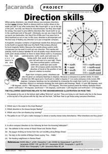
Direction Skills
In this geography worksheet, learners read an excerpt on what directions tell someone. They respond to 6 short answer questions related to the neighborhood illustration found on the second page of the worksheet.
Curated OER
General Knowledge Questions- All School Subjects Lower Intermediate
In this interactive general knowledge worksheet, students complete 24 multiple choice questions based on their knowledge in several subject areas. These subjects include science, geography, sports and music.
Curated OER
Tornado Alley-- Night of the Twisters
In this science and geography worksheet, students read 2 pages of background information about Tornado Alley which may help them understand Night of the Twisters by Ivy Ruckman.
Curated OER
Going, Going, Ghost
Third graders research ghost towns. In this geography lesson, 3rd graders locate ghost towns on a map and choose one location to research. Students construct a research paper and present it to the class.
Curated OER
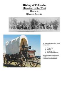
History of Colorado-Migration to the West
Fourth graders identify reasons for people moving to the Colorado Territory and examine how moving in the 1800's is different than moving today. They also practice reading maps and gathering information from maps, as well as, describe...
Curated OER
Heritage: Survival and the Geography of Utah
Fourth graders are introduced to the hunting and gathering techniques used by the Native American tribes living in the region that is now Utah. They prepare a role-play of hunting and gathering appropriate to specific geographical areas.
Curated OER
Cultural Anthropology Study Using the Fundamentals of Geography and GPS
Students, in groups, operate the GPS unit, plotting each head stone with accompanying description. Two other students to log in data that corresponds to the given points. One student to note general observations
Curated OER
Four Main Directions
Students describe directions using a globe for north, east, south and west. For this mapping lesson students identify the north and south pole. Students understand the importance of the equator and the Prime Meridian. Students explain...
Curated OER
What if the Mormons had not come to Utah?
Fourth graders use critical thinking, evaluation, and geography skills to find alternative locations that Brigham Young could have taken the Mormons to settle.
Curated OER
D'Nile Is Where It's At!
Students travel down the Nile River to survey ancient Egypt in this unit of nine lessons. Data about pharaohs, hieroglyphics, growing crops, pyramids, the geography, and the sacred rituals are explored in this unit.
Curated OER
Oklahoma
In this geography worksheet, students read a 2 page selection detailing the location, history and early statehood of Oklahoma. They answer 10 true or false questions based on the reading.
Curated OER
Mapping The Way With Lewis & Clark
Fourth graders analyze and compare maps used on the expedition of Lewis and Clark. Students write reports about the geography of the land. They answer questions about Lewis & Clark.
Curated OER
The Great American Desert
In this American deserts worksheet, students study the images and read the passages to learn about the 6 divisions in the American landscape: the Eastern lowlands, the Flood Plain, the Great Plains, the Rocky Mountains, and the Pacific...
Curated OER
I Can Compass, Can You?
Young scholars discover how to use geographic tools. In this compass lesson, students identify cardinal directions by appropriately using compasses along with a number of various maps.
Curated OER
Rapping Regions in America
Students determine what designates a place as a region. They apply their criteria for a region to the US map. They work in groups to write a rap about their region that describes its organization, type and structure.
Curated OER
Out in the Middle of Nowhere: Inevitable Lifestyle Changes
Eleventh graders examine the interaction between Utah's geography and its inhabitants. They explain how looking at cause/effect relationships is an example of historical thinking.
Curated OER
Riding With Alice
Student listen to Don Brown's, Alice's Grand Adventure before discussing cross country travel. They trace Alice's travels on an outline map of the US and focus on the state of Indiana. They color and label the counties that Alice...
Curated OER
The Expansion of The United States, 1846-1848
Students interpret historical maps,identify territories acquired by the United States in the 1840s. Also they identify states later formed from these territories. The primary sources for the lesson are the maps found in the lesson's...
Curated OER
Africa 1500-present: The Big Picture
In this African history study guide worksheet, students read a brief overview pertaining to the history of Africa from 1500 to the present.
Curated OER
Africa 1500-present: The Big Picture
In this African history study guide worksheet, young scholars read a brief overview pertaining to the history of Africa from 1500 to the present and fill in the blanks with the appropriate words. Students also respond to 18 short answer...
Curated OER
Virginia: The Land and its First Inhabitants
Learners review the five geographical regions of the state of Virginia. Using a map, they locate and label Virginia, surrounding states and the crops grown in the area. They present their map to the class and complete a worksheet to end...
Curated OER
History and Government of the United States
In this U.S. worksheet, students take notes in a graphic organizer as they read several passages, then answer four comprehension questions.
Curated OER
Mapmaker, Mapmaker, Make Me a Map
Second and third graders practice with basic map skills. They create their own map including a legend and a compass rose. This fabulous plan has many excellent websites linked which allow learners to explore maps of all kinds; including...
Curated OER
Mapping the Past
Middle schoolers study historical maps to view how the world evolved from medieval times through the Renaissance. They work in groups to examine the maps and present a report on one of the listed maps.


