Curated OER
Treasure Hunt
First graders read and follow a map in a treasure hunt to find the location of the treasure. They demonstrate their knowledge/understanding of symbols, keys on a map, and directions by following the map with ease.
Curated OER
Around the Town
Young scholars explore reading maps. In this map reading lesson, students compare distances fom place to place. Young scholars work in groups and predict the distance then find the actual distance using string or rulers.
Curated OER
People Change the Landscape
Students examine ways in which humans have brought change to the natural environment. In this ecology and literacy lesson plan, students listen to the book Island Boy by Barbara Cooney. Students observe and define map-reading vocabulary...
Curated OER
Why We Count
Students visualize census data on a map and use a map key to read a population map. For this census lesson, students use a map of the Virgin Islands and corresponding worksheets to gain an understanding of population density.
Curated OER
Places on the Planet: Latitude and Longitude
Students locate different places on globes and maps by learning about latitude and longitude lines. In this latitude and longitude lesson plan, students identify specific locations based on the degrees of latitude and longitude.
Curated OER
Arthur's Nose
Students read a story and complete a story map. In this diversity and acceptance lesson, students read Arthur's Nose, make a story map, research Aardvarks, complete a Venn Diagram comparing Arthur's nose to other animals in the...
Curated OER
Circulatory and Respiratory Systems
Eighth graders are able to write a paragraph describing each system based on the information retrieved in class. They trace a route from Holly Springs, MS to Greenwood using the maps that they were given. Students discuss the role of...
Curated OER
Maps that Teach
Students study maps to locate the states and capital on the US map. Students locate continents, major world physical features and historical monuments. Students locate the provinces and territories of Canada.
Curated OER
Reading a Map
Third graders become familiar with the vocabulary and skills related to mapping. In this guided reading lesson plan, 3rd graders find proper nouns on from the map. Students read Goldilocks. Students make...
Curated OER
Mapping My World
Students are introduced to simple maps and view a map of a classroom and compare distances of items shown.
Curated OER
Latin American Relief Map
Learners, in groups, research, design and construct a relief map of a section of Latin America using papier-mache. They show major landforms, elevations and notable bodies of water. They present their maps to the class.
Curated OER
Silk Roads Big Map
Students create an oversized map from Europe to East Asia. They include information such as Silk Roads, geographical features, major cities and cultural information on their map.
Teach Engineering
Let's Get it There Fast
Are planes the best shipping method? Using maps, pupils determine the fastest mode of transportation between two cities. Given a list of items to ship, groups decide the best shipping method to finish the 18th segment of a 22-part unit.
Curated OER
Life in Old Babylonia: The Importance of Trade
Students read maps and artifacts for information indicating the existence of a trade network in Old Babylonia and beyond. They list goods imported to and exported from Babylonia. They indicate trading centers on a map of ancient...
Curated OER
MAP Practice
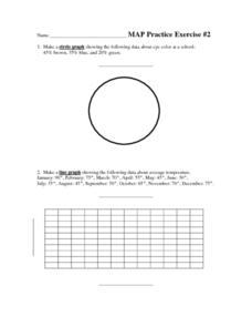
In this geometry learning exercise, students create circle, line and bar graphs using different comparisons of events. There are 24 questions with an answer key.
Teach Engineering
What's Wrong with the Coordinates at the North Pole?
Here is an activity that merges technology with life skills as individuals use Google Earth to explore the differences between coordinate systems and map projections. The self-guided worksheet is the fourth segment in a nine-part unit....
Virginia Repertory Theatre
The Town Mouse and the Country Mouse
Accompany the story, Town Mouse Country Mouse by Jan Brett with an assortment of activities designed to reinforce concepts covering story structure, comprehension, grammar, and social studies. Here, scholars identify the difference...
Columbus City Schools
What is Up Th-air? — Atmosphere
Air, air, everywhere, but what's in it, and what makes Earth's air so unique and special? Journey through the layers above us to uncover our atmosphere's composition and how it works to make life possible below. Pupils conduct...
Curated OER
From Sea to Shining Sea
Students determine the top 5 commodities for each state. In this agricultural commodities lesson, students label a map of the United States with the state capitals and the top 5 agricultural commodities for each. They compile the...
Curated OER
A Century of Expansion: America's Destiny (1763-1867)
How did we grow into such a large nation? Follow the events, wars, and treaties that led to the acquisition of major states as we expanded into the West. The slides provide maps, dates, and simplistic information to help learners...
Curated OER
Lesson 2: Mapping Our Home
Young scholars recognize the importance of community participation in the census. In this U. S. Census lesson plan, students use map-reading skills to find answers and learn the difference between senators and members of Congress.
Curated OER
Weather Map Challenge
In this weather instructional activity, students use a weather map to answer ten questions about the information found on a weather map and what the symbols mean. They find the cities with the highest and lowest temperature as well as...
Curated OER
Searching the Net
Learners create a Native American Nation flip book. In this Native American lesson, students choose one of four Native American Nations: The Iroquois, Hopi, Seminoles, Sioux. They research them on the Internet using teacher given...
Curated OER
US Policy In Somalia
Learners investigate the US policy for the country of Somalia. They conduct research using a variety of resources. They locate the country and then discuss major geographical features of the areas. Students discuss the present US...
Other popular searches
- Us Map 13 Colonies
- Us Imperialism Map Activity
- Us Map Skills
- Geography Map Skills Us
- Blank Us Maps
- Northeast Us Map
- Northeast Us Map Skills
- Map of Us
- Us Maps of States
- Us States Map Color
- Us Map Activities
- Us States Map Florida


