Curated OER
Europe 1914
In this Europe 1914 map worksheet, students note the 9 regions of the Europe labeled on the map and their relevance to World War II.
Curated OER
Westward Ho: The Difficulties of Emigrants Moving West
Students research the journey west of 19th century emigrants. In this pioneer instructional activity, students read the letters and diaries of a fictitious family traveling on the Oregon Trail. They mark their route on a US map, create a...
Curated OER
Religions of the World
In this world religions map activity, students note the 12 regions of the world and the religious beliefs practiced by the majority of people in those regions.
Curated OER
Fun With Pacific Northwest Cities and Towns
Intended for fun only, learners play with the names of cities common to their region or state. This lesson includes a list of cities in Oregon and not much else. What you and your class choose to do with your list of cities is up to you.
Curated OER
Maps
First graders look at their classroom or school setting. They use positional word to describe where things are located in the school. Students discuss a map and why they are important. They read the story "Taylor's New School" and...
Curated OER
Mapping La Salle's Travels
Middle schoolers use the internet to create a map showing the path of La Salle through North America and the Caribbean. They identify the main geographic features of the two areas and the main French forts. They also complete a timeline.
Curated OER
Mapping The Way With Lewis & Clark
Fourth graders analyze and compare maps used on the expedition of Lewis and Clark. Students write reports about the geography of the land. They answer questions about Lewis & Clark.
Curated OER
Mapping A Stream
Students participate in mapping an actual waterway. They include reach lengths, transects, compass reading, and scale determinations. They include windfalls, plant cover, types of streambed composition, and landmarks such as trees and...
Curated OER
Mapping Your Neighborhood
Students define and outline their neighborhoods using GIS (geographic information systems) or a regional map and relate their neighborhoods to the principles of Smart Growth.
Curated OER
Hit The Trail
Young historians research one of the most colorful periods in US History: the cattle drives of the 1800's. They research the three most popular trails, and complete mapping and writing assignments about each one. The lesson has many...
National Wildlife Federation
It's All in the Name: Weather Versus Climate
What goes up when rain comes down? An umbrella! Activity eight in the series of 12 explores weather and climate. In pairs, participants analyze maps, watch a short video, create a weather forecast, and complete a reading to determine the...
Polar Trec
The Amazing Antarctic Trek
This resource provides two ways to engage learners in using latitude, longitude, and research skills. In pairs, or on their own, learners will locate several Antarctic regions on a map. They will write the name of the place and a few key...
Carolina K-12
Who the People? Representative Democracy in North Carolina and Congress
Our elected officials are supposed to represent us, but what does it mean when they aren't like us? Budding citizens explore the demographic makeup of the US Congress, the role of money in political elections, and the Citizens United...
Population Connection
The Human-Made Landscape
Agriculture, deforestation, and urbanization. How have human's changed the planet and how might we mitigate the effects of human activity on the planet? To answer these questions class members research the changes in human land use from...
Benjamin Franklin Tercentenary
From Ben’s Pen to Our Lives
What would Ben do? Jumping off from the pseudonymous letters Ben Franklin fooled his older brother into publishing when he was still a teenager, young literary lovers dive into acting, writing, and addressing a local issue with wit and...
Polar Trec
Global Snow Cover Changes
Snow is actually translucent, reflecting light off its surface which creates its white appearance. Pairs or individuals access the given website and answer questions about snow cover. They analyze graphs and charts, examine data, and...
Curated OER
Life in Old Babylonia: The Importance of Trade
Students examine the trade network in Old Babylonia. They analyze maps, explore various websites, develop a list of goods imported to and exported from Babylonia, and write an essay.
Curated OER
Geography/Current Events Project
Using the Balkan region as an example, fourth graders review the five themes of geography as a class. They identify the physical and human characteristics of a region before labeling the countries and landforms on a map. They then...
CK-12 Foundation
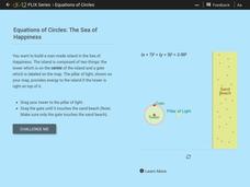
Equations of Circles: The Sea of Happiness
Map this! Help your young mathematicians draw a circular island on a map. Given specifics of the location and size of an island on a map, pupils transform a circle to meet the given requirements. They then determine the location of the...
Curated OER
The Eagle Has Landed: Aztecs Find a Home
Students investigate the Aztec civilization and locate it on a map. They explain the legend of the city of Tenochtitan and investigate the symbolism of the Mexican flag.
Smithsonian Institution
We Have a Story to Tell: Native Peoples of the Chesapeake Region
How did colonial settlement and the establishment of the United States affect Native Americans in the Chesapeake region? Your young historians will analyze contemporary and historical maps, read informational texts, and work in groups to...
Curated OER
Location on a Grid
Make coordinate pairs more engaging by having beginners color-code a grid based on given locations. The grid has numbers along the y-axis and letters along the x-axis, introducing them to the ordering of coordinate pairs with the x-axis...
Indian Land Tenure Foundation
Respect for Land
Youngsters examine how people show respect and care for the land. Specifically, learners see how the Native Americans truly did care for and respect the land, and still do so to this day! They also explore how they themselves can care...
National Geographic
Types of Volcanic Eruptions
Blow the roof off your classroom with this multimedia science lesson on volcanic eruptions. A short online video teaches young geologists about shield and composite volcanoes and explores the examples of Kilauea and Mt. Vesuvius,...
Other popular searches
- Us Map 13 Colonies
- Us Imperialism Map Activity
- Us Map Skills
- Geography Map Skills Us
- Blank Us Maps
- Northeast Us Map
- Northeast Us Map Skills
- Map of Us
- Us Maps of States
- Us States Map Color
- Us Map Activities
- Us States Map Florida


