Curated OER
Indian Women in Texas History
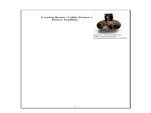
Fourth graders study Indian women in Texas. In this US history activity, 4th graders discuss what each Indian woman's contribution was by completing a timeline and table. Students examine the Caddo Women's pottery...
Curated OER
Let's Look at Legends: Oregon quarter reverse
Analyzing historical legends is a fun way to develop critical-thinking skills. Pupils will use a graphic organizer to compare and contrast two historical legends relating to volcanoes. While this lesson focuses on the image of Crater...
Curated OER
It Matters to Me: Iowa quarter reverse
What matters to your pupils? What values do they hold dear and how does that shape your classroom community? These are some the questions you'll get your class thinking about when they engage in this lesson from the US Mint. They will...
Curated OER
On The Causes of The Dust Bowl
Here's a new twist on the causes and focus of the 1930s Dust Bowl. Looking to be a part of an intense climate study, the presentation offers maps and explanations for the causes of the Dust Bowl. Global warming, drought, and...
Curated OER
Exploring the USA and the World with Cartograms
Learners investigate cartograms in order to explore the different countries on Earth. In this world geography activity, students use the Internet to analyze data on different cartograms. Learners compare data, such as population density,...
Curated OER
What if the Mormons had not come to Utah?
Fourth graders use critical thinking, evaluation, and geography skills to find alternative locations that Brigham Young could have taken the Mormons to settle.
Curated OER
Listen to the Land
Pupils discover how we use land. They gain insight into the way we use the land, both for benefit and consequence. Students explore how to 'listen to the land' as they make decisions on how it should be used and the consequences of...
Curated OER
Getting from Place to Place
Students examine modes of transportation. In this transportation lesson, students listen to their instructor present a lecture on modes of transportation over the past 300 years. Students respond to questions about...
Curated OER
Congressional Travel
Students determine the distances traveled by the members of the legislative branch of the US Government. In this travel distance lesson, students locate Washington, DC on a globe using the longitude and latitude of the city. They...
Curated OER
Head of the Class
Fourth graders complete a map according to a theme. Using Internet and word processing tools, student fill in the missing information according to the theme of the map. All maps are answers are computer based.
Curated OER
ADULT ESOL LESSON PLAN--Environment and the World
Students locate and trace Florida on a United States map as well as their local counties and city of residence on a state map. In addition, they label all the directions north, south, east and west on each map.
Curated OER
Investigating Haiti
Students engage in a lesson that is about the island of Haiti. They conduct research using a variety of resources. The information is used in order to help students locate the island on a map. They answer questions while participating in...
Curated OER
This Week's Weather
For this weather worksheet, learners fill out a weather map each day of the week and give the lows, the highs, the warm fronts and the cold fronts. They answer six questions from their weather map work.
Curated OER
MEDIEVAL SUB-SAHARAN AFRICA
Seventh graders examine the area of medieval Sub-Saharan Africa through eyes of travelers in the company of one of history's greatest travelers, Ibn Battuta. The project has been structured to include all the State standards for this unit.
Curated OER
Hoboes on Harvest
Students study the role Oklahoma's wheat fields played in the history of labor movements in the US. They write imaginary letters describing their experiences on a wheat harvest. They research on the internet or in encyclopedias to find...
Curated OER
Christmas Around the World
Students produce a factual book about customs in other countries. They produce a poem about a country/custom. They locate countries on a map. They compile and compare data about each country.
Curated OER
MALI TO MECCA, MANSA MUSA MAKES THE HAJJ
Students explore the historical event when Mansa Musa, Ruler of Mali, made the Hajj (or holy pilgrimage) to Mecca in 1324 AD. They create Web pages or PowerPoint presentations maps, charts, posters, and oral presentations with...
Curated OER
Mycenaean Trade in the Mediterranean
Students role play as scientists working for the Institute of Nautical Archaeology, Bodrum, Turkey. They locate Bodrum on a map and study the Mycenaean trade around the Mediterranean Sea. They discover what goods were traded during the...
Curated OER
Vacation Anyone?
Students locate resources on Internet, calculate expenses based on a budget, locate destinations on a map, calculate mileage for a cross country trip, and design and create a presentation that summarizes the journey.
Curated OER
The Wannsee Conference
Twelfth graders examine what occured at the Wannsee Conference during World War II. Using documents, they discover how the conference fits into the final solution of the Jewish question. They analyze the language used and the attitudes...
Curated OER
Contributions of Ancient Civilizations Applied to Multimedia
Sixth graders complete a long-term unit on ancient and early civilizations. They conduct Internet research, define key vocabulary terms, analyze maps, and create a PowerPoint presentation about a selected early civilization.
Curated OER
Genetics and Heredity: The Next Generation
Tenth graders work in teams to order events of DNA transcription and translation protein synthesis. In the second lesson, they put the steps of mitosis and meiosis in order using a concept map poster. They use modeling clay to create...
Curated OER
Digging For Dinosaurs
In this dinosaur themed worksheet, students work together as a team of paleontologists to draw the dinosaur bones they discovered at a dig site. They must label their drawing on a grid map and then provide data about the length and...
Curated OER
Early Explorers
Fifth graders study early explorers. In this World history lesson, 5th graders draw an outline of a map labeling each part, build geographical features out of dough, and paint each of the land and water features.
Other popular searches
- Us Map 13 Colonies
- Us Imperialism Map Activity
- Us Map Skills
- Geography Map Skills Us
- Blank Us Maps
- Northeast Us Map
- Northeast Us Map Skills
- Map of Us
- Us Maps of States
- Us States Map Color
- Us Map Activities
- Us States Map Florida


