Curated OER
Getting From Here To There
Students plan a driving trip using maps. Working in pairs, students receive a destination card and must create a plan for arriving at their destination using only a map. Trip plans should include, mileage, distance and time...
Curated OER
Field Trip Preparation
Students make a contingency plan in case of unexpected events such as bad weather. They discuss safety and appropriate conduct.They map out a schedule to ensure that sufficient time is allotted for all activities.
Curated OER
The Land of Immigrants
Students access information and data about US immigration using the Internet and other sources. They identify from research data the countries from which the largest number of immigrants to the US come from and create a database of these...
Curated OER
Four Color Theorem
Students identify and interpret how the Free Response questions are graded on an AP Exam. They also discuss coloring the included map, placing several examples on the board to determine the number of colors necessary to color each....
Curated OER
The Early History of Haiti
Seventh graders make list of places Columbus explored on his first journey to Americas, locate island of Hispaniola on map, examine groups of people who have inhabited island, complete blank map and key of Hispaniola, and research early...
Curated OER
Lizards
Fourth graders recall lizards from the text and report their important traits. The teacher adds the information to the map. They watch the map expand while it organizes all of the lizards and their characteristics.
Curated OER
Learning About the Equator, The Seven Continents and the Four Oceans
Students use a globe or map to locate the equator, oceans and continents. Using the internet, they spend time surfing through predetermined websites on continents and oceans. They write facts on different parts of the globe on index...
Curated OER
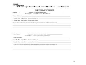
What's Up? Clouds and Your Weather
Seventh graders identify clouds and the weather that is associated with them. In this weather lesson students work in groups and design their own weather map.
Curated OER
Geography Terms
Students identify different landforms and fill out a worksheet where they explain what each landform is. In this geography lesson plan, students fill in a landform map and then use landform words as they describe the landforms.
Curated OER
Slavery Issue And Views North Versus South Around 1850s
Tenth graders compare and contrast the opinions of northerners and southerners about the issue of slavery in the 1850's. They study how the legislation that was enacted by Congress addressed the issues. As they investigate, they create a...
Curated OER
Dough Lake Topology
Students practice coordinates and measurements, develop 2D, 3D topological map, construct grid with string on real surface, establish "level" fixed point for measurements, take and record data points of elevation, and enter data on...
Curated OER
Failing Ecosystems: Haiti and the Caribbean
Ninth graders study the impact that climate has on the land. They discuss how deforestation leads to erosion and soil damage and how trees and vegetation help to stabilize the land. They draw a large map of the Caribbean and show Haiti...
Curated OER
Native People of the Caribbean
Eleventh graders use a map and locate and define the Caribbean region and then work in groups to read the passage and timeline. The groups' reader will read the passage aloud and the recorder makes a list of why colonists used slave...
Curated OER
One Grain of Rice
Students complete a Know / Want to Know / Learned chart about India. They locate India on a map and read facts about India. They access the Internet and view a slide show about India. They read "One Grain of Rice" in the Scott Foresman...
Curated OER
Friends, Romans, Countrymen...
Students research an important person or place from Ancient Roame and communicate their findings in a report that includes a map and illustration. Students may publish their reports online.
Curated OER
"Hard" Data from Space
Students use satellite images to analyze development patterns within Baltimore City. They prepare a land cover map for Baltimore indicating the prevalence of impervious surfaces and explore how these patterns affect water pollution.
Curated OER
International Research Project and Feast
Students research countries around the world. They develop and write a research paper that includes maps, photographs, and diagrams. They describe the culture, society, economy, religious beliefs, government structure, and history of...
Curated OER
Writing: Lesson 2
Eighth graders examine the English Language Arts Writer's Checklist. They practice prewriting techniques. Students use clustering as a prewriting tool. They discuss how a checklist is a lot like a map in that it guides you through the...
Curated OER
Discovering the Local Community
Third graders create a mini-atlas of the human and physical characteristics of their local community, which includes landforms, climate, vegetation, population, and economics. They use nonfiction map-related resources to obtain ...
Curated OER
Amazon Rainforest
Seventh graders complete a simulation in which they travel through the Amazon rainforest. Using their map skills, they determine the best route and where to see specific plants and animals. They develop their own database to organize...
Curated OER
Temperature Conversions
Students discuss the different between the English system of measurement and the metric system. Working ins mall groups, students read the weather map. They convert temperatures from one measurement system to another.
Curated OER
Landmarks in Paris
Third graders create a map of France. They use computers to view an "in flight" movie about Paris. They research Paris using books and the internet. Students practice using the program "Comic Life." They import illustrations for each of...
Curated OER
Volcano Research
Student demonstrates the ability to select and evaluate media. They access and organize information about volcanoes. Each student locates on a map a currently erupting volcano.
Curated OER
California Indians
Fourth graders discuss the major nations of California Indians, their geographic distribution, economic activities, legends and religious beliefs. They describe the function of Spanish missions and the influence of Catholicism. In...
Other popular searches
- Us Map 13 Colonies
- Us Imperialism Map Activity
- Us Map Skills
- Geography Map Skills Us
- Blank Us Maps
- Northeast Us Map
- Northeast Us Map Skills
- Map of Us
- Us Maps of States
- Us States Map Color
- Us Map Activities
- Us States Map Florida


