Curated OER
Geological Forces and Topography
Students discuss and research the Earth's geological processes. In this geology lesson, students study maps of Utah and the United States to learn about geological features. Students then complete the research cards for each area of...
Curated OER
Four Main Directions
Students describe directions using a globe for north, east, south and west. In this mapping activity students identify the north and south pole. Students understand the importance of the equator and the Prime Meridian. Students explain...
Curated OER
American Settlement of the Great Plains
Seventh graders examine the Great Plains. In this American settlement lesson, 7th graders create a map of the settled areas in the United States. Students discuss the struggle between settlers and the Native Americans.
Curated OER
Watersheds, Watersheds Everywhere
Students identify the watershed in which their school is located. They use maps to locate their homes and school. They define and use the correct vocabulary.
Curated OER
Uncharted Territory
Students examine what were preconceived perceptions of the areas Lewis and Clark explored. They compare and contrast past and modern maps of North America. They accurately place route and site information on the map.
Curated OER
An Introduction to the Marine Environment and Geology of City Point: A Model for Experiential Teaching
Students begin the lesson by researching the history of City Point, Connecticut. Using a map, they color areas they were asked to find and discuss why the areas are important to the community. As a class, they are shown recent slides...
Curated OER
That's NorthEastWestSouth to Me!
Pupils demonstrate north, south, east and west. In groups, students participate in games to decide what directions a specific bear must travel. They play a "Simon Says" game to develop single step directions. Pupils listen to and follow...
Curated OER
Sunrise, Sunset: Quickly Go the Days
Learners explore the concept of daylight. In this daylight lesson, students compare the amount of daylight on a particular day in Anchorage compared with daylight where they live. Learners color maps of the US according to amount of...
Curated OER
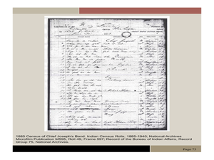
Chief Joseph and the Nez Perce
Eleventh graders explore the life of Chief Joseph and Nez Perce. In this US History instructional activity, 11th graders analyze paintings and photos detailing the flight of Nez Perce. Students create a narrative newspaper...
Curated OER
Controlling the Flow of the Colorado River: A Study of Dams
Students research and map the Colorado River and its dams and predict the effects of a dam on an area. They suggest reasons a dam would be built and compare the Colorado River system with other major river systems within the US and...
Curated OER
Rent and owner's major payments
Learners retrieve and map census data to determine the average rent and owners' payments made throughout Canada. They find out how many people are spending more than 30 percent of their income on housing.
Curated OER
"Where in the World is my School?"
Students learn new vocabulary and discuss what GPS is and does. They locate their school using the equipment.
Curated OER
Centennial: Ghost Riders And Rest Stops
Fourth graders read aged letters that describe communities or stops along the route of the early Pony Express. Each day they mark on a map where the letters come from and chart the Pony Express route. They compare to today's mail and...
Curated OER
OPEC and the Energy Crisis
Students color the Middle East Nations of OPEC on outline maps. They discuss and watch a video about the United States reliance on oil producing nations of the Middle East. They participate in a discussion of the problems of the gas...
Curated OER
Values
Students identify their personal values. They determine that values help give us direction and help us set goals for the future. They discover that we develop our values from those around us and from our experiences. They create a...
Curated OER
Africa Savanna
Students discuss the different biomes of Africa. They create a list of biomes of Africa. They color code a map of the biomes of Africa. They research interesting facts about Africa.
Curated OER
Sum It Up!
Students read the book Esperanza Rising and discover the meaning of a summary. They re-read chapter one and write down some things that they think are the most important facts about what is going on in the story. They copy a story map...
Curated OER
Place Names
Students investigate the meaning of various Native American names. In this Native American language lesson, students locate state names that come from Native American descriptions and mark them on a map. Students then suggest a name for...
Curated OER
A Look at the Population Density of the United States
Young scholars acquire census information and create maps of the population density of the United States on different scales. They role play the roles of workers of a retail company and they use the population data to market to their...
Curated OER
Ocean Currents
Fourth graders work in groups to research ocean currents and create posters with their findings. They locate the patterns and names of major ocean currents and identify them on a map. Students also use red pencil to show ocean currents...
Curated OER
Locate-a-quake
Student, use seismic readings of the same earthquake from three recording stations and locate the epicenter of an earthquake on a map.
Curated OER
African Myths and What They Teach
Students identify and locate the continent of Africa on a globe or map. They locate on a classroom map of Africa the place of origin of the myths/stories being read in class.
They discover that the peoples of Africa and their stories are...
Curated OER
The Alphabet is Historic
Students describe how the Phoenicians, Greeks and Romans passed down the alphabet through the generations. They compare and contrast the letters from early alphabets to the one of today and discuss how they are different. Using a map,...
Curated OER
What and Where is Puerto Rico?
Students explore Puerto Rico. They create K-W-L charts of their prior knowledge of Puerto Rico and observe maps of Puerto Rico. They code the map for measurements and land and water forms. They explore websites to gain background on...
Other popular searches
- Us Map 13 Colonies
- Us Imperialism Map Activity
- Us Map Skills
- Geography Map Skills Us
- Blank Us Maps
- Northeast Us Map
- Northeast Us Map Skills
- Map of Us
- Us Maps of States
- Us States Map Color
- Us Map Activities
- Us States Map Florida


