Curated OER
Our World With MapsQ
Learners examine and compare different types of maps. In this map skill activity, students look at neighborhood and national maps on the overhead projector while making comparisons of the symbols and locations. They use a T-chart to...
Curated OER
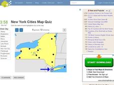
New York Cities Map Quiz
In this online interactive geography worksheet, students examine a map of New York and identify the 11 noted cities on the map using a pull down menu within 3 minutes.
Curated OER
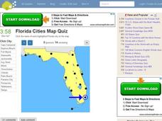
Florida Cities Map Quiz
In this online interactive geography worksheet, students examine a map of Florida and identify the 12 noted cities on the map using a pull down menu within 3 minutes.
Curated OER
Texas Cities Map Quiz
For this online interactive geography worksheet, students examine a map of Texas and identify the 15 noted cities on the map using a pull down menu within 3 minutes.
Curated OER
South America Map Quiz
In this online interactive geography quiz learning exercise, learners examine the map that includes all of South America's countries. Students identify the 13 countries in 2 minutes.
Curated OER
Middle East Map Quiz
In this online interactive geography quiz worksheet, students examine the map that includes 26 Middle Eastern countries. Students identify the names of the countries in 4 minutes.
Curated OER
Central America Map Quiz
In this online interactive geography quiz instructional activity, students examine the map that includes 22 Central American countries. Students identify the names of the countries in 3 minutes.
Curated OER
Canada Map Quiz
In this online interactive geography quiz worksheet, learners examine the map that includes 13 Canadian provinces and territories. Students identify the names of the provinces and territories in 2...
Curated OER
California Cities Map Quiz
For this online interactive geography quiz worksheet, students examine the map that includes 12 California cities. Students identify the names of the cities in 3 minutes.
Curated OER
Extreme Weather and Mapping
In this environment worksheet, students read an article about extreme weather conditions and mapping it out. They respond to 10 multiple choice questions about what they read. Then, students explain how droughts can occur and the...
Curated OER
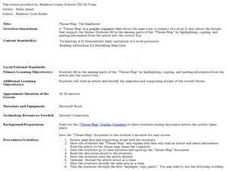
Theme Map- The Rainforest
Students use graphic organizers to relate information. They read an article and insert information from the article to the theme map using a word processing program.
Curated OER
Idea Mapping
Students generate, share and display ideas as a group. They break into small groups to work on hand-drawn maps made up of concentric circles. they come before the group and make a similar diagram by charting each other's characteristics.
Curated OER
Johnny Appleseed Walkabout
Second graders calculate mileage for a journey. In this place value and measurement lesson, 2nd graders read Johnny Appleseed, work in groups to locate his birthplace on a map, locate the other states he stopped in, and measure the...
Curated OER
South US Region
In this United States political map worksheet, students examine the Southern Region state boundaries. The map also highlights each of the state capitals denoted by stars. The states, capitals and major landforms are labeled.
Curated OER
Weather Lesson Five
Students define a weather forecast, make a forecast using a weather map, identify three prediction guidelines, and explain how computers help to make forecasts. Students make a 24-hour forecast for each of the thirteen states targeted.
Curated OER
About Life: The Photographs of Dorothea Lange Going to the Promised Land
To better understand the migrant experience during the Great Depression, pupils analyze two primary resources: photographs by Dorothea Lange and a U.S. Map that shows the Dust Bowl. They compare and contrast Lange's images to Steinbeck's...
Curated OER
The Geography of the United States
Full of bright maps and interesting information, this presentation details U.S. Geography. Slides include basic facts about size, regions, topography, and demographics, as well as fascinating trivia about the United States, including...
Curated OER
Aaaa! It's A!
Exercise phonemic awareness of the vowel /a/ to help children become successful readers. They connect spoken phonemes to written grapheme's and create a relationship between the vocal gesture of /a/ and its grapheme map in text and words.
Curated OER
The Poetry of Chinese Immigration
Numerous people from China immigrated to the US during the era of industrialization and expansion. Provide your class with a glimpse into the life of a Chinese immigrant through the poetry they left behind. They then compose a poem of...
Notion
Popplet
Add color to the mind-mapping process! Users double tap to create a bubble and everything flows quickly from there as they drag, draw, type, and more.
Curated OER
Sand Explorations
Young scholars experiment with different samples of sand from Maui leeward and windward beaches. They create a sand map to suggest at least one contributing factor for the formation of each beach sample. They test the samples to...
Curated OER
Massive Migrations
Here is an exciting exploration of a fascinating topic for your emerging ecologists: bird migration! They begin by visiting the US Fish & Wildlife Service website to discover which Arctic birds come to their areas. They are assigned...
Curated OER
Length
Without using a ruler, learners estimate the relative length of various lines in these three scenarios. The first two are set up as maps, with learners determining the shortest and longest distances from one position to another. The last...
Curated OER
Call to Arms: A Service Project
Sick of selling candy and washing cars? How about hosting a Digital Day or a Learning Lunch? The suggestions here make fund raising fun and rewarding. Raise money to preserve important maps and other primary source documents.
Other popular searches
- Us Map 13 Colonies
- Us Imperialism Map Activity
- Us Map Skills
- Geography Map Skills Us
- Blank Us Maps
- Northeast Us Map
- Northeast Us Map Skills
- Map of Us
- Us Maps of States
- Us States Map Color
- Us Map Activities
- Us States Map Florida


