Curated OER
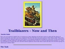
Trailblazers- Now and Then
Students examine and study the routes of trailblazers. For this American history lesson, students find a route on a map and compare that to the route of trailblazers. Students will then compare that map with a topographical map to...
Curated OER
Plan a Trip
Students plan for a trip. They use map quest and / or road maps to decide on an address for their trip. They determine the mileage, lodging, gasoline to be used, shortest distance and fastest distance.
Curated OER
Presidential Trading Cards
Students research the Internet to collect data about the US Presidents. They use the data that they collect along with available technology to produce trading cards and brochures using keyboarding skills, text boxes, acquiring photos,...
Curated OER
Ancient Rome
Students complete pre reading, writing, during reading, and interdisciplinary activities for the book Ancient Rome. In this reading lesson plan, students complete journal entries, go over vocabulary, answer short answer questions, have...
Curated OER
Cities of the World
Learners identify the symbol for cities on a political map. In this world map lesson, students identify specific cities on the World Political Map. Learners should identify the country in which the city is located. Students discuss the...
Curated OER
What About Us? Women in the Civil War
Students research the role of women in the Civil War. In this Civil War unit, students research the role women played during the war. This unit includes eight different activities including vocabulary, writing prompts and a literature...
Curated OER
Passive and Active Transport
In this transport worksheet, students compare and contrast the characteristics and examples of active transport and passive transport. This worksheet has 1 graphic organizer and 11 short answer questions.
Curated OER
Mapping the Lewis and Clark Trail
Students explore how physical and human geography features effected Lewis and Clark's expedition by using the Lewis and Clark Digital Discovery Web site.
Michigan State University
Inspecting The School
Keep your eyes peeled for pests! Here, scholars inspect their campus for signs of living things such as insects and rodents. Upon observation, class members record their findings and present the information to their peers.
Teach Engineering
Searching for Bigfoot and Others Like Him
Individuals create a GIS data layer in Google Earth that displays information about where one might find seven different cryptids. The class members research to find data on cryptid sightings they can include in their data...
Rainforest Alliance
How Do Jaguars and Howler Monkeys in Belize Depend on Us?
How does weather play a role in the lives of land and sea creatures? Find out with a lesson focused on habitats and the ways animals from different homes are connected. Here, learners explore how the life of a jaguar and howler...
National Endowment for the Humanities
Ending the War, 1783
The various peace proposals, made by both sides, to end the Revolutionary War come under scrutiny in this final lesson of a three-part series on the war. Class members read primary source documents and compare them with military...
Curated OER
Our Class Is On the Map
Second graders review map keys, symbols, and the purpose of maps, then students design a poster size map of their classroom.
Curated OER
The Geography of Europe
Students examine maps of Europe. In this geography skills lesson, students interpret several maps to determine the boundaries of the European Union and respond to assessment questions about the maps.
Curated OER
Cherstey: What was Cherstey like in the middle ages?
Students examine maps of a medieval village. For this medieval town lesson, students identify major buildings and make inferences about village life. Students could draw a modern day map of medieval Cherstey.
Curated OER
Lesson Ten: Direction
Learners explore the concept of relative location. In this map lesson, students read I Hate English by Ellen Levine and consider how maps and globes help people to familiarize themselves with an area.
Curated OER
Community Map
Pupils examine the relationship they have with the community and the location of the community in relationship to other communities. They practice using a map of their community and photographs to recongize the area.
Curated OER
Continents and Oceans
Students identify oceans and continents and their locations on a map. They color-code and label their own map of the world's continents and oceans. They play the game Continents and Oceans to identify specific areas.
Curated OER
Location, Location, Location!
Twelfth graders locate cities, states and countries on maps. They use the cardinal directions to locate places on maps. They describe where they were born by giving clues without naming the exact state. They trade papers and try to guess...
Curated OER
Changing Images of Childhood in America: Colonial, Federal and Modern England
Students compare and contrast maps of New Haven, Connecticut from today and the past. After taking a field trip, they draw sketches of the types of architecture and discuss how the buildings have changed over time. They read journal...
Curated OER
Watershed Investigations
Learners explore the components of a watershed and the factors that affect it. They read a topographical map and use geometry to determine the area of a watershed. Students estimate the volume of a body of water and perform runoff...
Curated OER
Latitude and Longitude- Online Interactive
For this maps worksheet, students learn about longitude and latitude by reading a two paragraph text and studying two maps. Students answer 9 fill in the blank questions. This is an online interactive worksheet.
Curated OER
Do You Know Your Story Grammar?
Students are introduced to the concept of story structure as a way to aid in reading comprehension. They identify the main parts of the story as they read. Students create a story map of the main plot points of their reading.
Curated OER
Tortoise and Hare Races
Students listen to the fable, The Tortoise and the Hare, and participate in various map skill activities. They manipulate magnetic tortoises and hares on metal cookie sheets to practice direction, and construct racing tortoises out of...


