Curated OER
Putting It on the Map
Students consider the purpose of various types of maps and their different uses throughout history. They create their own maps and reflect on the map-making process.
Curated OER
I Can Compass, Can You?
Students discover how to use geographic tools. In this compass lesson, students identify cardinal directions by appropriately using compasses along with a number of various maps.
Curated OER
Lesson 2: Mapping Our Home
Young scholars recognize the importance of community participation in the census. In this U. S. Census lesson plan, students use map-reading skills to find answers and learn the difference between senators and members of Congress.
Curated OER
Latin American Relief Map
Learners, in groups, research, design and construct a relief map of a section of Latin America using papier-mache. They show major landforms, elevations and notable bodies of water. They present their maps to the class.
Curated OER
Pennsylvania Walkers Club
Students participate in an school-wide walking club. Students choose a destination in Pennsylvania they would like to visit. After plotting the best way to get their using a map, the walk each day and record their distance in miles on...
The Alamo
The Alamo
Remember the Alamo! Scholars investigate the Battle of San Jacinto during the Texas Revolution. Using models, maps, quotes, biographies, and the Oath of Allegiance, the Alamo comes to life as the stories of those who fought and died in...
Curated OER
Mystery State # 28
Using clues is a great way to increase deductive and logical reasoning skills. Boost thinking skills while quizzing kids about us geography. They use five clues to determine which state is in question.
Curated OER
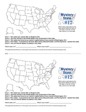
Mystery State #12
What's better than learning about US geography? Having fun while your doing it! After reviewing each of the five given clues, learners attempt to name the mystery state. A great way to reinforce geography skills and deductive reasoning...
Curated OER
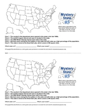
Mystery State # 5
Mystery state number five is none other than Utah! Quiz your kids on state knowledge while building deductive reasoning skills. They use each of the five clues to determine the name of the mystery state. A great warm up when studying...
Curated OER
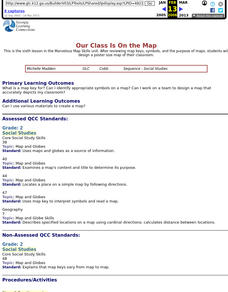
Our Class Is On the Map
Second graders review map keys, symbols, and the purpose of maps, then students design a poster size map of their classroom.
Curated OER
Making a Travel Brochure of a Louisiana Parish
Although the attachments for this travel brochure project are no longer linked, you can still use the idea here and create your own assignment sheet and rubric. Learners choose a parish in Louisiana (or a city in your state) to research,...
Curated OER
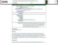
Leaf, Tree and Prairie Study
Learners are introduced to the topic of Botany and the process of photosynthesis. Using various habitats, they research the amount of destruction it is facing and how to solve the problem. They make a leaf booklet with leaves they find...
Curated OER
Fun with Summarizing
Students practice summarization by creating a story map. After reading Freckle Juice, students working in groups, create a story map of the main events of the story. Groups use their story maps to summarize a chapter of the story and...
Curated OER
Using Google Squared to Compare and Contrast Canada and the US
Sixth graders compare and contrast Canada and the United States. In this geography skills lesson, 6th graders use Google Squared to research information so that they may compare the geography of Canada and the United States.
Curated OER
Language Arts: Creating Character Maps
Third graders select characters from books they have read to create character maps. After drawing the maps, they add the characteristics around a sketch of their chosen character. In groups, 3rd graders who have read the same book,...
Curated OER
A Visit to China
Sixth graders study the history of China. They explore the Chinese people, the Great Wall of China, religions, government and Dynasties. In groups, 6th graders collect information on China. They write a report on their findings and...
Teach Engineering
Searching for Bigfoot and Others Like Him
Individuals create a GIS data layer in Google Earth that displays information about where one might find seven different cryptids. The class members research to find data on cryptid sightings they can include in their data...
Curated OER
It's About Us
Students understand ideas about civic life and government. In this census lesson, students participate in a First We Count Reader's Theater and answer reading questions about the script in order to gain a better understanding of the...
Curated OER
Mapping A Stream
Students participate in mapping an actual waterway. They include reach lengths, transects, compass reading, and scale determinations. They include windfalls, plant cover, types of streambed composition, and landmarks such as trees and...
Curated OER
Exquisite Excursions
Students locate 6 cities, one on each of the 6 major continents. They find distance for each leg of their journey, convert to percents, use a time zone map, and convert to foreign currencies.
Curated OER
Identifying Anger Triggers
Students, while in the computer lab on Inspiration, visit angermgmt.com and then brainstorm additional anger triggers on a concept map together in groups. Once completed, they identify two new anger management strategies to try out in...
Curated OER
The Korean War - A Time Line Activity
Students create a Korean War time line. They identify, describe, and label nine of the key events and turning points of the Korean Conflict. They include all nine events listed on the direction sheet, contain a title, and have at...
Curated OER
Contributions of Ancient Civilizations Applied to Multimedia
Sixth graders complete a long-term unit on ancient and early civilizations. They conduct Internet research, define key vocabulary terms, analyze maps, and create a PowerPoint presentation about a selected early civilization.
Curated OER
Ozone: The Earth's Security Blanket
Young scholars work in groups to define and research the terms: ozone, troposphere and stratosphere. Students watch videos, conduct Internet research, participate in discussion groups and complete worksheets.


