Curated OER
TE Activity: Northward Ho!
Students design a simple compass. They examine how the Earth's magnetic field has both horizontal and vertical components. They determine how a compass works and work with cardinal directions.
Curated OER
Plot Your Course
Students determine distance and direction on a nautical chart. In this nautical lesson, students identify obstacles and characteristics of common aid to navigation on a nautical chart.
Curated OER
Treaties
Sixth graders research treaties. In this treaties lesson, 6th graders go online to build knowledge about treaties. Students read information and take quizzes. Students write a comparative essay about how the Aboriginal and...
Curated OER
Bringing the U.S. into World War II
Students research and explore the cause and effects of global warfare. They assess the concept of the United States policy of isolationism as it involves the United States and Japanese relations. Each group of students prepare a time...
Curated OER
Mississippi Under British Rule
Students construct appropriate maps to depict the following information: changes in European territorial claims as a result of the French and Indian War; boundaries of British East and West Florida; significant rivers and settlements of...
Curated OER
Hit The Road Jack(or Jill)
Students find the approximate area of the court order on a current map of Delaware. They draw a layout of their school and decide where a new hallway or outside pathway would be most needed.
Curated OER
Acid Rain Keeps Falling On My Head
Students measure the pH of local rain water. Students map the location of the collected rain water according to pH levels.
Curated OER
Acid Rain Keeps Falling on My Head
Students examine the pH level of rain water in their local community. They locate each location on a map. They analyze the data and draw conclusions.
Curated OER
Where in My World Am I?
Pupils determine exactly where they are in the world by using a local map to write accurate directions to local eating establishments. They write precise directions from the school to their home which the teacher simulates driving to...
Curated OER
Anne Frank: One of Hundreds of Thousands
Students show on a map territorial changes to Germany as a result of the Treaty of Versailles, then identify European countries that came under German control before and during World War II.
Curated OER
Finding Your Way: The Underground Railroad
Students describe the difficulties faced when tying to escape using the underground railroad. Participating in an online simulation, students attempt to escape using the underground railroad. They view maps of the routes taken by the...
Curated OER
Geometry: Lesson 1: Points, Lines, Segments, Angles
Fourth graders examine the concepts of, draw, and label points, lines, segments, and angles, They draw, label, and identify horizontal, vertical, intersecting, parallel, and perpendicular lines. They complete an associated worksheet that...
Curated OER
Bison Sites of Texas
Students locate bison-related sites on a map and identify important bison-related sites. The Bison has had a profound effect on the history of Texas and studenst discover the importance of the animal to the history of the state.
Curated OER
Geometry: Classifying Angles
Students measure, construct, and classify angles as acute, right, straight, and obtuse. Once they have completed an angle worksheet, students use a map of South Carolina to locate cities by constructing the aforementioned angles.
Curated OER
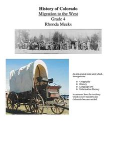
History of Colorado-Migration to the West
Fourth graders identify reasons for people moving to the Colorado Territory and examine how moving in the 1800's is different than moving today. They also practice reading maps and gathering information from maps, as well as, describe...
Curated OER
Ways We Use Water
Fourth graders write a persuasive paper after a demonstration about the properties of water and how they work. The lesson also uses a mind map to outline the paper.
Curated OER
Comparing Time Periods in U.S. History: The Ashford Project
Fifth graders use a "fact book" comparing periods in American history then students create a picture to illustrate their assigned periods. # # students use their pictures and concept maps to write expository paragraphs about their...
Curated OER
Comparing Sizes And Shapes
Students compare, resize, and check various shapes by size using a comparison mat from the MathKeys program. Working in pairs, they place three similar shapes on the screen and state which is the largest and smallest in area. They also...
Howard Hughes Medical Institute
BiomeViewer
Which holds more influence, the environment over humans or humans over the environment? Young scientists explore an online interactive that addresses this discussion. They observe changes in the natural world over time and see which...
Curated OER
End of the Line: What Happened to the Blue Ridge Railroad?
Sixth graders study the westward expansion and the role of railroad construction to the expansion. In this railroad history lesson, 6th graders complete KWL activity for the topic. Students view a PowerPoint about the growth of railroads...
Curated OER
Seven Wonders of the World
Students recognize "The Seven Wonders of the Ancient World." In this world history lesson, students research various architectures on the Internet and construct a PowerPoint presentation.
Curated OER
Riding With Alice
Student listen to Don Brown's, Alice's Grand Adventure before discussing cross country travel. They trace Alice's travels on an outline map of the US and focus on the state of Indiana. They color and label the counties that Alice...
Curated OER
How Much Further Is It?
Fifth graders use estimation to solve problems and assess the reasonableness of their answers. They may use an odometer, a map with a legend, MapQuest, or a map without a legen. They estimate 4 to 5 different scenarios.
Curated OER
The Pony Express
Fourth graders answer four math questions based on their reading of a short story on the history of the Pony Express.


