Curated OER
Do We Still Need the Electoral College?
One of the most confusing aspects of any presidential election year is the role of the Electoral College. Learners read a bit about how the Electoral College works and then they hold a mock election in their classroom. They'll redraw a...
Curated OER
Three Dimensional Geology
Here is a fine lesson plan on geology designed for high schoolers. Learners use rocks, fossils, and other geological clues to determine the geology of an area. Then, they make recommendations to a fictitious city council about the...
US Mint
Symbols in My Eyes
Explore the hidden meanings behind the images on US currency with this elementary school lesson on symbolism. Starting with a class discussion about symbols, children go on to brainstorm different objects that represent the Unites...
Curated OER
Electronic Survey Activity
Fifth graders conduct a class survey and share the results with a class in another state via an electronic bulletin board. This technology-rich lesson is an ideal way to have learners practice communicating with others through the use of...
DocsTeach
Exploring America's Diversity: Rosalia Fundaro (Beginner)
Elementary scholars learn about the life of Rosalia Fundaro, an Italian immigrant, using primary sources. They analyze documents, complete written prompts, and participate in group discussion to understand Rosalia's life in the United...
Advocates for Human Rights
Human Rights Defined
Class members continue their investigation of the factors that influence migration with a lesson on human rights. As they examine the Universal Declaration of Human Rights and selected US Constitutional Amendments, learners compare the...
Curated OER
Understanding Stereotypes
Pupils confront age-related stereotypes, explore how stereotyping impacts their lives, and discuss how they can make changes to reduce over-generalizations, unfair assumptions, and critical judgments about people groups. They use a...
Curated OER
United States Map- Rivers
Students learn about rivers. For this maps lesson, students describe rivers and what human activities take place in a river. Students use a map to locate the rivers in the United States.
Curated OER
First Grade Visits...Washington DC
Take your first graders on a virtual trip to around Washington, DC. This presentation provides illustrated slides featuring a map showing the location of Washington, DC, the White House, and some of the more famous memorials and...
Curated OER
Maps that Teach
Students study maps to locate the states and capital on the US map. Students locate continents, major world physical features and historical monuments. Students locate the provinces and territories of Canada.
National Woman's History Museum
19th Amendment
As part of a study of the women's suffrage movement and the ratification of the Nineteenth Amendment, young historians examine documents that detail when voting rights were granted to women in various countries and when US states...
Curated OER
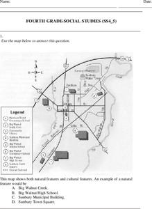
Fourth Grade Social Studies
In this social studies worksheet, 4th graders answer multiple choice questions on state maps, city maps, road maps, political maps, and more. Students complete 25 multiple choice questions.
Curated OER
Our World With MapsQ
Learners examine and compare different types of maps. In this map skill activity, students look at neighborhood and national maps on the overhead projector while making comparisons of the symbols and locations. They use a T-chart to...
Curated OER
5th grade social studies geography
In this geography worksheet, 5th graders complete multiple choice questions about hemispheres, maps, cities, ecology, and more. Students complete 25 questions.
Curated OER
Where I Live…
Second graders explore their community. In this social studies lesson plan, 2nd graders use Internet tools to locate their community on a map and then locate where they live.
Curated OER
Crossing Time Zones
Students explore the concept of differing time zones. Students refer to maps to identify the time zones in particular regions. They role play phone calls from different time zones. This lesson is intended for students acquiring English.
Curated OER
Directions, Directions
Third graders review cardinal directions, moving around the room so that they are standing in the part of the room that is nearest the north, south, east and west. They are asked what would you do if they are lost? Pupils work as a...
Curated OER
Presidential Trading Cards
Students research the Internet to collect data about the US Presidents. They use the data that they collect along with available technology to produce trading cards and brochures using keyboarding skills, text boxes, acquiring photos,...
Curated OER
The American Revolution: 1775 - 1783
Track the ins and outs and wartime strategies used by both the British and the Americans during the Revolutionary War. Multiple comparisons are made between both factions, maps, statistical data, images, and light text is used throughout...
Curated OER
The 50 States
Fifth graders use maps and music to learn the 50 states. In this US Geography lesson, 5th graders map out a region of the United States and practice singing the song, The 50 States that Rhyme.
Curated OER
Map Creation
Second graders identify a map, symbol, key, and compass rose. Students create and print a map for teacher evaluation using the computer. Students identify the symbols on their map and orally present them to the class.
Curated OER
3-D Topographic Maps
Students create a 3-D topographic map. In this map building lesson, students use cardboard to create a topographic map of the Catskills mountain region.
Curated OER
Mapping China
Students identify cities in China on a map. For this map skills lesson, students locate the continent of Asia and the country of China. Students use a blank map to label China and bordering countries.
Curated OER
Coldest US Cities Quiz
In this online interactive geography quiz worksheet, students respond to 20 identification questions about the coldest cities in the United States. Students have 4 minutes to complete the quiz.


