Curated OER
South US Region Map
In this United States regional outline map, students examine the state boundaries of the states in the Southern Region. Capital cities are denoted with stars.
Curated OER
US: Midwest Region Map
For this U. S. outline map worksheet, students examine boundaries of the Midwest Region states and the placement of the capital cities. This map is labeled.
Curated OER
Match Capitals to Their States- Internet Activity
In this state capital matching worksheet, students use a given web site to match the name of each state with its capital. They use the names of the capitals that are located in a word bank at the bottom of the page when searching for...
Curated OER
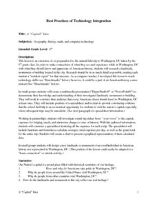
A "Capital" Idea
Eighth graders prepare for a field trip to Washington, DC by researching landmark, monument, or building in Washington. They use the information in small groups to design a multimedia presentation. They include a spreadsheet that shows...
Curated OER
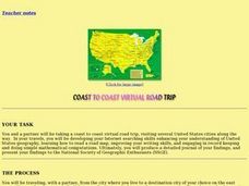
Coast to Coast Virtual Trip
Students complete a variety of exercises and activities as they plan a coast to coast trip across America. They keep a journal that includes where they went, what they did, what they saw, etc. They compare two cities they visited along...
Curated OER
Sailin' Through Time...Rhode Island, The Ocean State
Fourth graders explore the history of Rhode Island. They research famous people who brought change to the state. They explore the state song, natural resources, and colonies of the state. In groups, 4th graders create a travel brochure...
Curated OER
Keeping Up With Capitals
Students engage in a class discussion where they identify the situations where capitalization is necessary. They complete worksheets embedded in the plan where they capitalize proper nouns such as names, holidays, and special events...
Curated OER
Geography A to Z: The Letter F
The geography letter of the day is F! The class needs to determine the answer to each of the seven clues with a world location that starts with letter F. Wonderful for a daily warm up or as an exit-card activity.
Curated OER
Geography A to Z: The Letter G
Using clues to answer questions is a way to increase deductive reasoning skills. Kids answer seven geography clues with answers all starting with the letter G. A great way to test world geography or warm up the class.
Curated OER
Geography of the United States
Students examine the population growth of the United States. In this Geography lesson, students construct a map of the fifty states. Students create a graph of the population of the USA.
Curated OER
The Eagle Has Landed: Aztecs Find a Home
Students investigate the Aztec civilization and locate it on a map. They explain the legend of the city of Tenochtitan and investigate the symbolism of the Mexican flag.
Curated OER
Exploring South Carolina
If you are having your students conduct a State study this presentation could be a nice example to show them. This resource provides general information about the geography, animals, and city life one may find in South Carolina. Web...
Curated OER
Astronomy and the Cold War: How the United States Used the Moon to Target the Soviet Union
Students examine how astronomical observations were used to help target sites in the Soviet Union during Cold War and why such targeting was needed. Students then make predictions and observations of same astronomical events for their...
Curated OER
Bank On It! Worksheet Cinco de Mayo
In this Cinco de May worksheet, students read a passage about the celebration of Cinco de Mayo in the United States. Students fill in ten missing words to make the text understandable. The words will be of the student's own choice; there...
Curated OER
Cities as Transportation Centers
Middle schoolers work in small groups to identify some of the major transportation centers, recommending two as possible sites for a national political convention, based on population density and the travel networks available in 1835.
Curated OER
U.S. Quiz Questions
In this ESL United States learning exercise, students answer a set of 25 questions about the United States. The answers to each question are written beneath each.
Curated OER
U.S.-Cuba Relations
Students study the history of United State/Cuba relations. In this diplomacy activity, students research selected websites to gather information regarding various topics of significance between the U.S. and Cuba since 1868. Students...
Curated OER
Congressional Travel
Students determine the distances traveled by the members of the legislative branch of the US Government. For this travel distance lesson, students locate Washington, DC on a globe using the longitude and latitude of the city. They...
Curated OER
Names and Places
Students explore where jobs are done. In this careers and geography lesson, students locate places in Canada on a map and list jobs that are done in their area of Canada. Lesson includes extension and differentiation ideas.
Curated OER
Location, Location, Location!
Twelfth graders locate cities, states and countries on maps. They use the cardinal directions to locate places on maps. They describe where they were born by giving clues without naming the exact state. They trade papers and try to guess...
Curated OER
Get Ready for the Great Outdoors!
Learners discuss what is a map and what they already know about maps. They brainstorm together to compile a list of responses for the board and observe a map of the United States, including states, capitals, and some of the National Parks.
Curated OER
The Classification Station
Second graders identify proper nouns and categorize them by subject. They apply correct principles of grammar: they write complete sentences, use correct capital letters, use correct punctuation and apply correct rules of usage and...
Richmond Community Schools
Map Skills
Young geographers will need to use a variety of map skills to complete the tasks required on this worksheet. Examples of activities include using references to label a map of Mexico, identify Canadian territories and European...
Curated OER
Parts of a Friendly Letter
The art of writing a letter has not been lost to email and texting! Teach kids how to format a friendly letter with a presentation about the parts of a letter, as well as prompting them to write a letter about their favorite holiday.


