Curated OER
Lesson 2: Mapping Our Home
Students recognize the importance of community participation in the census. In this U. S. Census lesson plan, students use map-reading skills to find answers and learn the difference between senators and members of Congress.
Curated OER
Searching the Net
Students create a Native American Nation flip book. In this Native American lesson, students choose one of four Native American Nations: The Iroquois, Hopi, Seminoles, Sioux. They research them on the Internet using teacher given...
Curated OER
The Four Corners Region of the United States Cultures, Ruins and Landmarks
Young scholars who live in the inner city are introduced to the four corners region of the United States. In groups, they examine how the region differs compared to where they live and their culture. They develop maps of the area and...
Curated OER
Drought in Your State
In this drought instructional activity, students study the "US Drought Monitor" and complete 8 short answer questions on the causes and effects of drought.
Curated OER
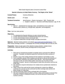
Spanish Influence on United States Currency: The Origins of the "Dollar"
Sixth graders research the Spanish influence on early colonial America and the process of establishing the present U.S. currency. They read and discuss an informational handout in small groups, and take a short quiz. Students then...
Curated OER
The Brief American Pageant: The Resurgence of Conservatism
Take a short trip back in time with this presentation, which details the political and electoral contexts of 1980's and 1990's America. Covering the Gulf War as well as domestic economics, these slides feature easy-to-read charts and...
Curated OER
The Brief American Pageant: The Eisenhower Era
Starting with the election results of Eisenhower over Stevenson in 1952, this presentation features additional maps about the elections of 1956 and 1960, with electoral votes by state. Additional slides detail the Far East (Vietnam,...
Curated OER
The Brief American Pageant: The Confederation and the Constitution
Four maps cover the tumultuous period during and after the American Revolution. Especially interesting is the first map, which details the land cessions to the United States after 1782. Think about incorporating these pictures into your...
Curated OER
The Brief American Pageant: Twenty-Three Political Paralysis in the Gilded Age
Detailing the Presidential elections of 1876, 1884, and 1892, this slideshow focuses on the final years of the 19th century in the United States. Additionally, slides include information on the changes in Southern plantations and growth...
Curated OER
The Brief American Pageant: Drifting Toward Disunion
A series of maps take viewers through the Antebellum period in American history. Focusing on the elections of Buchanan and Lincoln, as well as the Southern opposition to secession, the slideshow would make a good companion to a lecture...
Curated OER
The Brief American Pageant: The Furnace of the Civil War
The eyes of an American History teacher (or Civil War buff) will open wide with this series of maps, which detail the campaigns and battles of the Civil War. Meant to supplement chapter 21 of The American Pageant, this presentation would...
Curated OER
The Brief American Pageant: The Second War for Independence and the Upsurge of Nationalism
Use this series of bright, informative maps to illustrate important events of America's infancy. Detailing the Missouri Compromise, the Battle of New Orleans, and the Presidential Election of 1812, this presentation would be a good...
Curated OER
The Brief American Pageant: The Stormy Sixties
Intended for use with The American Pageant by David Kennedy, Lizabeth Cohen, and Mel Piehl, this slideshow includes maps and graphs that detail politics and social dynamics in 1960's America. The textbook is not necessary for...
Curated OER
The Brief American Pageant: The Duel for North America
Making its way through 18th century America, this presentation details the British and French territories through colorful and clearly labeled maps. Additionally, the maps chart the changes in said territory during and after the French...
Curated OER
The Brief American Pageant: The Rise of a Mass Democracy
Focusing on the 1828 election of Andrew Jackson, the removal of Southern Native American tribes (Trail of Tears), and the Texas Revolution, these three slides are full of good information for your lecture. Though brief, the maps featured...
Curated OER
Did You Know: Facts on Acadians in Louisiana
As an overview of Acadians in Louisiana, this resource could be useful. It could also be used as an example for students designing their own presentations relating to a state. It has an interesting way of presenting information through...
Curated OER
ADULT ESOL LESSON PLAN--Environment and the World
Students locate and trace Florida on a United States map as well as their local counties and city of residence on a state map. In addition, they label all the directions north, south, east and west on each map.
Curated OER
My Arkansas Family Tree
Here is a two-part lesson that introduces learners to genealogy by having them create family trees, and map the movements of their ancestors. While this resource is designed for kids who live in Arkansas, it certainly can be adapted for...
Echoes & Reflections
The "Final Solution"
Nazi policies shifted from deportation and imprisonment to extermination of the Jewish people in death camps in the "Final Solution." Learners examine photos of artifacts, read poetry written by survivors, analyze testimony from...
Curated OER
Where In the World Are You?
Fourth graders fill in blank copies of the United States Map and then the World Map.
Curated OER
United States Geography and Topography
Fifth graders recognize the major regions of the US while reading a map. Students study the physical features of the US. Student research and report on states and their capitols.
Curated OER
Edible Resource Maps
Third graders work in groups to create an edible resource map showing locations of at least five resources in the United States. Students research on the internet different regions and the resources that are found in those areas. They...
Curated OER
Mapping the Border
Students create maps of the borderland region. They decorate their maps with colors, pictures, icons, scenes, words that reflect their understanding of the character and history of the borderland.
Curated OER
Regions of the US: Gulf Stream, States and Their Capitals
Fifth graders identify one way of dividing the US into geographical regions and then consider alternate ways of doing the same. They locate each of the fifty states and their capitals on a map. They research the Gulf Stream region.


