Curated OER
Do You Need a Map?
Students explain ways marine navigation is important in modern society. In this map study lesson students use a retrieval tool to obtain real-time information on weather forecasts.
Curated OER
The Expansion of The United States, 1846-1848
Students interpret historical maps,identify territories acquired by the United States in the 1840s. Also they identify states later formed from these territories. The primary sources for the lesson are the maps found in the lesson's...
Curated OER
Mental Mapping Hangman
Students participate in mental mapping hangman activity. They choose the name of a country from a hat, draw that country on the board including at least one physical feature produced by nature or humans while not using any speech while...
Curated OER
Alabama Railroads: Maps as Historic Documents
Pupils identify historic documents and focus on the state of Alabama in 1860. This was during the time of the Reconstruction. The skills of comparison and analysis are used.
Curated OER
Nature and Place Names in Arkansas
Middle schoolers examine the way that many place names in Arkansas came to be. By looking at Arkansas highway maps, they find names that come from the characteristics of each of the state's six geographical divisions. This interesting...
ProCon
Sanctuary Cities
Should sanctuary cities receive federal funding, or do they defy federal laws? That is precisely the question scholars attempt to answer as they prepare for a class discussion or debate. After reading some brief background information,...
Curated OER
California Here We Come!
A highly relevant and great cross-curricular project! In teams, your class will plot a course from the East Coast to Sacramento, California passing through all of the state capital cities along the way. As part of the journey, teams...
Curated OER
Arkansas: A Changing Climate, a Changing Land
Here is a instructional activity on the climate zones and geography of Arkansas. In it, learners look at maps (embedded) of different climate zones found throughout Arkansas. They engage in discussions regarding how global warming and...
Curated OER
World War II
Offering a comprehensive overview of the beginning of World War II, this resource could be a useful addition to a unit on this topic. It could be used as a way to lead a discussion on the war, or as a review tool before a test. Either...
School Rack
Westward Expansion Project Choices
What a great list of brief research projects for reviewing the era of westward expansion in the United States! Learners are directed to choose and complete three of the projects on the given list, which includes opportunities to design...
National Endowment for the Humanities
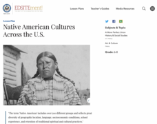
Native American Cultures Across the U.S.
Middle schoolers examine how American Indians are represented in today's society. They read stories, analyze maps, and complete a chart and create an illustration about a specific tribe.
Columbus City Schools
Diversity of Living Things
Here's a topic classes can really dig—the fossil record. Use the well-organized and thoughtful road map to take eighth graders back in time to unearth the answer. Learn how our climate has changed, and how organisms have...
Curated OER
Then and Now
Students conduct research and use census data to compare different times and places. In this census lesson plan, students interpret data from charts and graphs, comparing census information from two time periods as well as from two...
Curated OER
Geography and Culture in South Carolina
Learners explore South Carolina. In this cultural heritage lesson plan, students investigate the topography of South Carolina using maps. Learners are engaged in identifying the different regions of the state and examine the cultural...
Curated OER
Tactics in the Persian Gulf: From Diplomacy to Force
Learners trace the United States' involvement in Iraq from 1991 to today. They interpret a map of Iraq, evaluate possible causes and effects of events. They participate in, collect and analyze a poll regarding the next steps the US...
Curated OER
Absolute Location
Fifth graders examine the geographic concept of absolute location. Using a variety of resources, they create a life-size classroom grid and locate the coordinates of a point, identify latitude and longitude of different locations, and...
Curated OER
Physical Features
Students draw physical land features using ClarisWorks or Kid Pix, write their definitions, create slideshow, and create class geography book.
Curated OER
The Brief American Pageant: Girding for War
Though too short to be an adequate presentation, the solitary map in these slides would be a good visual aid to a lecture about Southern secession before and during the Civil War. The color coded states on the map make a good timeline...
Curated OER
State Match 2
In this states matching activity, learners match 4 different states named in the US to their corresponding map shown. They identify 4 different states found on the East Coast in the left column. Then, students match each of these states...
HISTORY Channel
Westward Expansion of the United States
How did early American pioneers decide what to take with them on their journeys, and what was their traveling experience like? Here you'll find a collection of activities to help you explore Westward Expansion with your young learners.
Curated OER
Introduction to Canada
Ninth graders investigate the country of Canada by examining their media in this geography lesson. They use the Internet to research Canadian newspapers and analyze a topic covered by both US and Canadian media sources. After comparing...
Curated OER
Presidents of the United States
Students gather data using the Internet to create products related to technology.
Curated OER
I Can Find that Where? - A Study of Landforms
First graders make landform maps of the United States. In this landform lessons, 1st graders participate in a discussion of local landforms and make a landform map of the United States. They follow the teacher's directions to add plains,...
Curated OER
Freedmen's Bureau
Students examine the African American experience after they received their freedom after the Civil War. They complete a Mind Map, read and analyze a poem, and write a paragraph using key vocabulary words. They analyze the impact of the...


