Curated OER
Latitude and Longitude
In this latitude and longitude learning exercise, students complete 4 activities to demonstrate understanding. Students use a protractor to measure angles on a map of the earth. Students fill out a latitude and longitude chart after...
Curated OER
Just-Us and Kindness: A Voice for Children: King Day
Eighth graders investigate philanthropy. For this service learning lesson, 8th graders read human rights literature and use information gleaned to discuss children's rights around the world. Students discuss scenarios meant to prompt...
Curated OER
The Gullah People of the Sea Islands
Eighth graders examine the lives of the Gullah-Geechee people. In this unique cultures lesson, 8th graders explore music, language, and slavery of the Gullah-Geechee people from the southern low-country in the United States. Students...
Curated OER
U.S. Geography: The Northeast
Students investigate U.S. Geography by creating a map in class. In this natural resource lesson, students create a map of the United States and research the Northeast based on their resources and recyclable materials. Students...
Curated OER
Relations
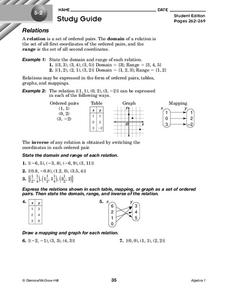
In this relations activity, 10th graders solve and complete 7 different problems that include defining various relations of number sets. First, they state the domain and range of each relation. Then, students express the relations shown...
Curated OER
The Desert Alphabet Book
Students use a book to discover an interesting fact from the desert using each letter of the alphabet. Using a United States map, they identify the meanings of symbols and locate deserts within the U.S. In groups, they participate in...
Curated OER
Relations
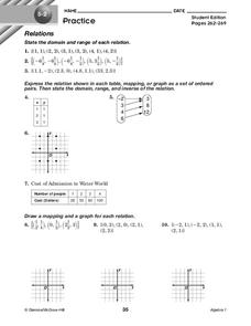
In this relations worksheet, 10th graders solve and complete 10 different problems that include defining various forms of relations. First, they state the domain and range of each relation. Then, students express the relation shown in...
Curated OER
The Columbia Exchange
The Columbia Exchange was one of the first major instances of mass international trade. Learners cut out 24 images of trade commodities and glue them on a map of the world. It'll be fun for kids to see where so many products they use...
Curated OER
Road Trip
Learners explore a state, create a travel plan for visiting that state, write postcards from an imaginary trip there, and research selected points of interest in that state.
Curated OER
Tallahassee Project
Sixth graders gather information from technological sources such as TV, radio, and Internet as well as from newspapers and maps and produce a final printed report. They use the data to create a spreadsheet and read a Florida state...
Curated OER
Wisconsin Snapshots
Fourth graders study Wisconsin's culture and heritage. They research the state's symbols and identify leaves common to the Wisconsin area. They create a leaf booklet and visit the state park. They visit local farms and create nature maps...
Curated OER
ESOL Government and Commmunity Resources
Students study vocabulary words associated with community services. They label each community service on an index card and match a phrase with the service. They identify community service buildings in the area on a local map.
Curated OER
U.S. Possessions
Ninth graders research the United States acquisition of the Philippines and their fight for independence. They locate the Philippines on a map and brainstorm how its geography has benefits. They access the Internet and complete a student...
Curated OER
Great Explorers
Students research an explorer and present a multimedia presentation on the explorer. In this United States explorers lesson, students watch a video about Lewis and Clark. Students use Google Earth to study their journey and keep a KWL...
Curated OER
Reshaping the Nation
High schoolers learn why the census makes a difference. In this U.S. Census lesson plan, students learn how to read and use a cartogram while they explore new ways to represent data.
Curated OER
Comparing School Bus Stats
Engage in a instructional activity that is about the use of statistics to examine the number of school buses used in particular states. They perform the research and record the data on the appropriate type of graph. Then they solve...
Curated OER
Japan
First graders investigate the similarities and differences between Japan and the United States. They develop a KWL chart, locate Japan and the U.S. on a globe, conduct Internet research on life in Japan, conduct an interview, and create...
Curated OER
The Brief American Pageant: American in World War II
From the home front to the middle of Europe, America's presence in World War II was forever transitioning with the strain of war. The variety of maps and charts offered in this presentation helps to contextualize the 1940's. The amount...
Curated OER
The Brief American Pageant: The Cold War Begins
With the beginning of the Cold War came numerous social and political changes around the world - many of which are featured in this series of maps and graphs. This short but informative slideshow will help to bridge the gap between a...
Curated OER
Build a U.S. Strategy for Responding to the Crisis in Sudan
Students work together in groups to discover the situation in Sudan. They discuss what problems arise from helping a foreign country. They answer questions and watch a video as well.
Curated OER
Rock River Watershed
Students discover what a watershed is and which one they live in. Using the internet, they research why watersheds are important to an ecosystem and how to keep them from getting polluted. They use a map to locate various items within a...
Curated OER
The Acadian Odyssey
The dispersion of the Acadians is outlined in this informative PowerPoint. Colorful maps help show where different Acadians settled throughout the United States. Tip: After viewing this slideshow, have students create a timeline of the...
Curated OER
Prewriting Strategies
Fourth graders explore various strategies to overcome fears of writing, and utilize a story map as a prewriting strategy. They read and discuss the steps of the writing process, follow the steps along with the teacher as they discuss the...
Curated OER
The 1927 Flood
Upper elementary and middle schoolers examine the Great Flood of 1927 in the state of Arkansas. They each prepare an oral report about this flood and the huge impact it had on the economics of that time. Additionally, learners research...


