Echoes & Reflections
Perpetrators, Collaborators, and Bystanders
After the Holocaust, the world grappled with how to bring justice to the Nazis. But what to do with the thousands—if not millions—who allowed it to happen? Young historians consider the issues of guilt, collaboration, and responsibility...
Echoes & Reflections
Antisemitism
Propaganda and anti-semitism were linked to evil ends during the Holocaust. Using video testimony of Holocaust survivors, examples of Nazi propaganda, and discussion questions, learners explore the roots of anti-semitism in Europe and...
Curated OER
Where is Shirley the Elephant?
Young animal lovers engage in a lesson that's all about elephants. They access an elephant sanctuary website and read a story about Shirley the elephant. They perform a series of activities based upon that story, and also study about the...
Howard Hughes Medical Institute
BiomeViewer
Which holds more influence, the environment over humans or humans over the environment? Young scientists explore an online interactive that addresses this discussion. They observe changes in the natural world over time and see which...
Curated OER
End of the Line: What Happened to the Blue Ridge Railroad?
Sixth graders study the westward expansion and the role of railroad construction to the expansion. In this railroad history lesson, 6th graders complete KWL activity for the topic. Students view a PowerPoint about the growth of railroads...
Curated OER
Seven Wonders of the World
Students recognize "The Seven Wonders of the Ancient World." In this world history lesson, students research various architectures on the Internet and construct a PowerPoint presentation.
Curated OER
All Aboard!
Sixth graders plan a road trip to a city in the US. They include railroad saftey messages as they write about the trip.
Curated OER
The Pony Express
Fourth graders answer four math questions based on their reading of a short story on the history of the Pony Express.
Curated OER
Food For Thought: A Geography of Minnesota Agriculture
Students participate in hands-on activities and discussions about Minnesota's agriculture. They practice reading maps and locating where certain agricultural products are found throughout the state.
Curated OER
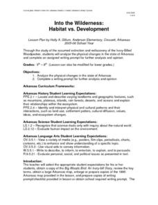
Into the Wilderness: Habitat vs. Development
By studying the once-assumed extinction, then rediscovery of the Ivory-Billed Woodpecker, learners look at the physical changes that have occured in habitats throughout Arkansas. This outstanding lesson is chock full of terrific...
Curated OER
Native Americans in Arkansas: The Quapaw
The Quapaw Indians of Arkansas are the focus of this American history lesson. Learners discover many aspects of the Quapaw culture, such as their dwellings, social organization, food, and how the tribe was eventually driven out of...
Curated OER
The Responsibility of Preservation
Upper elementary and middle schoolers study the case of the ivory-billed woodpecker, a bird that was once-thought to be extinct. Learners explore the responsibility of people to preserve habitats, and take care of the animals who live in...
Curated OER
Poverty Point: A Louisiana Treasure
A well-done and informative presentation, this resource could be used to pique interest in Lousiana's history. This presentation about Poverty Point, a mound created by Native Americans, is a fascinating exploration of this topic. What...
Curated OER
How Can We Locate Specific Places On Earth?
Second graders discover how to use longitude and latitude to locate specific sites on Earth. They compare old and new ways of locating specific places, and discover how latitude and longitude coordinates are used to locate places on Earth.
Curated OER
1862 MARYLAND CAMPAIGN, AMERICAN CIVIL WAR
Students explain why General Robert E. Lee decided to invade Maryland in September 1862; review the major events of the Maryland Campaign of 1862; describe the major events of the three phases of the Battle of Antietam; and assess the...
Curated OER
Past and Present
Students identify George Washington on the obverse of the quarter and read about George Washingington. They compare Washington to the current president and practice distinguishing between events in the past and the present.
Curated OER
The Displacement of the Native Americans
Seventh graders comprehend the interaction and conflict between Native Americans and white settlers in the years following the Civil War. They examine how those conflicts impacted the Native American way of life on the Great Plains.
Curated OER
Route 66 And Population Patterns
Students investigate the geography located along Route 66. They research how the population patterns change in certain areas along the highway. Students use the information in order to form hypotheses about how and why the population...
Curated OER
Tale of Two Speeches
Students view and read portions of John F. Kennedy's Cuban Missile Crisis speech from October 22, 1962. Later in the year, students recall what they remember about the speech and use a Venn Diagram to compare it to Patrick Henry's...
Curated OER
Get Ready for the Great Outdoors!
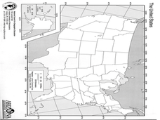
Learners discuss what is a map and what they already know about maps. They brainstorm together to compile a list of responses for the board and observe a map of the United States, including states, capitals, and some of the National Parks.
Curated OER
Riding With Alice
Student listen to Don Brown's, Alice's Grand Adventure before discussing cross country travel. They trace Alice's travels on an outline map of the US and focus on the state of Indiana. They color and label the counties that Alice...
Curated OER
Where in the Usa is Radon?
Students determine the areas of New Jersey and the US that are likely to have high radon concentrations. Students draw a map of their own neighborhood that show soil associations in their neighborhood.
Curated OER
Somewhere in Indiana
Second graders locate the United States, Indiana, their community, and their neighborhood community on a map, and a world globe 4 out of 5 times correctly. They then discuss what they have learned in the lesson.
Curated OER
The Geography of Maine Tourism
Students study topographical maps of Maine to identify the important physical features. They work in groups to create tourism pamphlet highlighting a region of the state.


