Curated OER
CASTLE ROCK PUEBLO: A TRIP THROUGH TIME
Students use a map to respond to a series of questions. They determine how much time it would take to travel to Castle Rock Pueblo from different pueblos and locate modern pueblos on the Indian Country map.
Curated OER
Running Water/Rivers-Life Cycle
Young scholars explore the parts of a river system and use topographical maps to determine the stage of the river.
Curated OER
Oral Language
Students use distances on a map to draw a route, give directions, and follow directions. In this map lesson plan, students explain their route and directions orally.
Curated OER
U.S. Geography: The Northeast
Students investigate U.S. Geography by creating a map in class. For this natural resource lesson, students create a map of the United States and research the Northeast based on their resources and recyclable materials. Students utilize...
Curated OER
From the Heights to the Depths
Students create a relief map of Asia and Australia. They work in small groups on sections of the map to make one complete map of the continents.
Curated OER
Rosie's Walk
Learners use maps and globes to locate and describe locations, directions and scale. Using the maps, they identify man made or natural features of different environments. They practice using geographical terms to describe a specific...
Curated OER
COME INTO MY PARLOR
Young scholars interpret a map scale to measure the space in a milking parlor. They reveiw the process of using a map scale to calculate distances. Students are given worksheets, they read the information in the box together. They draw...
Curated OER
Comparing Distances
Students practice estimating distances by analyzing a map. In this length measurement lesson, students view a map with a distance key and use their measurement skills to estimate the distance between two cities. Students utilize an...
Curated OER
America Will Be
Students work together to research and create different types of maps of the United States to be used as part of a geography trivia game.Groups research North American annual rainfall, climate, mountain ranges major rivers and state...
Curated OER
Learning About the Basin
Students use watershed maps to explore the Lake Pontchartrain Basin in Louisiana. In this geography lesson, students identify important features such as elevation, vegetation, cultural, historical and land use on a map of Lake...
Curated OER
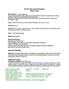
World Cities and the Olympics
Students examine the various cities in which Olympics have been held. Using a map, they describe the reasons why those cities were chosen and choose their own city for the Olympics and state the reasons why. They examine information...
Curated OER
The Middle Ages
Students read books about the Middle Ages. They discuss characteristics of the Middle Ages. In groups, students construct a castle and draw a map to scale. Pupils create a Venn diagram comparing rules in different countries in the...
Curated OER
Families and Neighborhoods
Students distinguish where their homes are in relation to the city of Pittsburgh. In this geography lesson, students read the book All Families Are Specialand find their city on a map of Pennsylvania. Students locate Pittsburgh and use a...
Curated OER
Guide Me "Home"
Students find how freedom quilts helped free slaves. In this American History lesson, students read the story Sweet Clara and The Freedom Quilt and discuss the Underground Railroad. They use their map skills to locate places that...
Curated OER
Ridgerunner
Students jog at the beginning of the class while learning about the Appalachian Trail. They integrate math into the lesson by adding up how many miles they have run, and comparing it to distances on a real trail map.
Curated OER
Landforms
Students begin their examination of landforms. Using a map, they locate and identify the major landforms on Earth. They discuss how landforms affect the lifestyle of the community and determine which goods and services the community...
Curated OER
Inches Away
Students are introduced to maps, scale representations, ratios and cartography. They plot the itinerary for their family's dream vacation or a trip across the United States. Using maps, they determine the short route and second longer...
Curated OER
Searching the Attic
Students investigate an attic or basement to "discover" family artifacts. They develop a grid map using string, create a naming system for the grid, and analyze items of interest.
Curated OER
Mapping The Way With Lewis & Clark
Fourth graders analyze and compare maps used on the expedition of Lewis and Clark. Students write reports about the geography of the land. They answer questions about Lewis & Clark.
Curated OER
CORNER CABINET
Ninth and tenth graders calculate the length, width, height, perimeter, area, volume, surface area, angle measures or sums of angle measures of common geometric figures. They solve problems involving scale drawings, models, maps or...
Curated OER
The Mekong River
Junior geographers explore the region through which the Mekong flows, its pathway, the landscape, how people depend on the Mekong, and future uncertainties. They apply the five themes of geography to examine the region. They create a...
Curated OER
Amelia the Pigeon: As a Pigeon Flies
Students follow Amelia's adventure on a satellite image. They use measuring and math skills to determine the distance she traveled.
Curated OER
A Contouring We Go
Students examine the built environment and infrastructures of their community by constructing contour equipment, using the equipment, and comparing their results to current topographical maps of the same area
Curated OER
Trash Talkin
Students investigate recycling at several scales, including local, state, national and global. They become aware of recycling, re-use, reduce efforts and policies. Students read the article Where Does Your Garbage Go. They look up where...


