Cornell University
Too Much of a Good Thing?
Continuing their study of beneficial insects, young entomologists discover where in the world some of these bugs are. By labeling, coloring, and using the scale on a map, pupils explore the territories and arrival of the Asian lady...
Curated OER
Earth's Water
If the majority of our planet is covered with water, why do we need to bother conserving it? With a thorough and varied investigation into the location and types of water on the earth, learners will gain an understanding of why this...
Inside Mathematics
Swimming Pool
Swimming is more fun with quantities. The short assessment task encompasses finding the volume of a trapezoidal prism using an understanding of quantities. Individuals make a connection to the rate of which the pool is filled with a...
National History Day
Why Did the United States Enter World War I in 1917?
World War I was the first major conflict on a global scale. Using primary documents, learners determine why the United States chose to enter World War I when it did. After analytical writing and group research, the causes of America's...
Teaching Tolerance
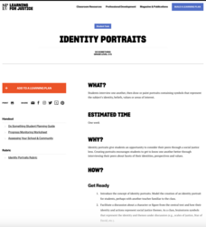
Identity Portraits
When you look at me, what do you see? Young learners answer this question by creating a portrait that reflects the identity of one of their peers. First, class members create interview questions. Then, they interview classmates to...
Curated OER
Teen America Travels New England
Students simulate the role of a travel agent to understand how to read and use road maps. They plan a bus trip through New England for a group of travelers that includes, bus travel, meals and attractions. They plan the distance that...
Curated OER
Make a Map
In this mapping activity worksheet, learners finish the map by following the 5 directions and using the map key. Students the map key, scale, and an inch ruler for help.
Curated OER
Metrics And Measurements
Students engage in a study of measuring distances between geographical locations on a map. They are able to define and use the map scale in conjunction with the metric system. For this lesson they make their own maps and measure the...
Curated OER
Places in My World
Second graders explore where they are located on the globe. In this maps and globes lesson plan, 2nd graders use a map to show where they live and show the cardinal directions. Students identify characteristics of mountains, flat...
Curated OER
Are We There Yet?
Students discover how to use maps and why they are important when using a map. They calculate distance using a map scale and time using travel speed and a map scale.
Curated OER
Map Scale
Students investigate the purpose of map scale and how it is used to measure the distance and the size of objects.
Curated OER
Plotting A Hurricane Using latitude and Longitude
High schoolers explore map and plotting skills by tracing the movement s of hurricanes through the Earth's systems. a hurricane map is developed from daily media reports.
Curated OER
Playground Mapping
Students review their physical models of the objects on their playground at school. Using the model, they convert it into a map with a scale and key. To end the lesson, they use the map to locate different objects and measure the...
K20 LEARN
Manifest Destiny: U.S. Territorial Expansion
A close examination of John Gast's painting "American Progress" launches a study of the concept of Manifest Destiny used to justify United States' policy of westward expansion. Young historians read statements from persons with different...
Teach Engineering
Identifying Possible Underground Cavern Locations
Teams continue with the Asteroid Impact challenge and determine possible locations to construct their underground shelters. Participants cut scale area models of their shelters from paper and place them on the map to find locations...
Balanced Assessment
School Zone
Find the right house within walking distance from school. The short assessment has pupils determine the houses that are a given maximum distance from a school. Individuals then determine the shortest and longest walks from the homes that...
University of Wisconsin
Follow the Drop
Young surveyors look for patterns in water flow around campus. Using a map of the school (that you will need to create), they mark the direction of the path of water. They also perform calculations for the volume that becomes runoff. The...
Curated OER
Geography Journey
Fourth graders examine the geographic features that define places and regions and answer questions about the state of California. They discuss the components of a map legend and answer worksheet questions using a map of California as a...
Curated OER
The Pilgrims
Students use distance measuring tools to follow directions and chart the path the pilgrims made from Plymouth, England to Boston, Massachusetts. In this Pilgrim voyage lesson, students use a map to chart the distance traveled by the...
Curated OER
World Projections
Students identify map projections and examine polar maps. In this map skills lesson, students use a flat world map to identify various projections and calculate the distances between locations by using a map scale.
Curated OER
The Gold Rush
Students identify the routes involved in the Gold Rush on a map. In this map skills lesson, students use a United States map to locate the routes used to travel to California during the Gold Rush. Students demonstrate how to use the map...
Curated OER
Cattle Trails
Students identify and locate cattle trails on a globe. In this map skill lesson, students use a marker to locate Texas and Montana and use the map scale to calculate the distance of the cattle trail.
Curated OER
Absolute And Relative Location
Students create a map that takes someone from school to their home using both relative and absolute locations. They assume the person using the map is unfamiliar with the area.
Curated OER
Map Maker Map Maker
Students create their own maps. In this map making lesson, students go to Microsoft Word and create a chart. They label directions, buildings, streets, and distance.


