Illustrative Mathematics
Why Does SSS Work?
While it may seem incredibly obvious to the geometry student that congruent sides make congruent triangles, the proving of this by definition actually takes a bit of work. This exercise steps the class through this kind of proof by...
Mathed Up!
Translations
Introduce translations as transformations that move figures in horizontal and vertical distances with a video that shows how to translate the figures. A second video covers how to determine the translation that has occurred. Pupils...
EngageNY
Ordered Pairs
Scholars learn to plot points on the coordinate plane. The lesson plan introduces the idea that the first coordinate of a coordinate pair represents the horizontal distance and the second coordinate represents the vertical distance.
Curated OER
Coordinate Plane Treasure Hunt
Students create a treasure map by plotting points on a coordinate plane using a computer drawing program. Students name and identify different landmasses and structures on their map. They create instructions to find the treasure that...
Curated OER
ExplorA-Pond:4th Grade Surface Area
Fourth graders estimate the surface area of a pond using the chance method and the estimation method. They complete a graph and a short report comparing the results of the two methods.
Curated OER
"Now and Then" Comparing Present Day with Medieval Times
Eighth graders compare a present-day social issue with a medieval issue. They use technology tools to conduct their research and demonstrate their new knowledge. Students present their findings to the class in the form of a PowerPoint.
Curated OER
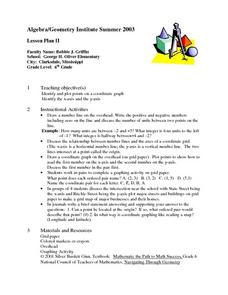
Algebra/Geometry Institute Summer 2007: Graphing Activity
Seventh graders practice identifying coordinates by examining a city map. In this graphing lesson plan, 7th graders create coordinate directions on an index card and practice locating these locations on a grid. Students read...
Curated OER
Discovering the Past Using the Future: Remote Sensing and the Lost City of Ubar
High schoolers identify and locate specific locations on the Arabian Peninsula, the Rub al Khali Desert, and present day Oman. They identify other names for the lost city of Arabia as Ubar, the Atlantis of the Sands, Iran, and the city...
Curated OER
Robot Cartography
Students identify points plotted on the coordinate plane. In this geometry lesson plan, students learn to read a map using concepts of a coordinate plane grid. They find the path given a map to tell them where to go.
Curated OER
Recycling
Students investigate landfills and the problems associated with urban and suburban areas. In this recycling lesson plan, students discuss landfills and the problems associated with landfills. They discuss the amount of waste an...
Curated OER
Absolute and Relative Location
Second graders understand the difference between relative and absolute location using the grid map as an example of an absolute location. They observe a class map showing longitude and latitude lines and learn that they provide exact...
Curated OER
Fly on the Ceiling
Fourth graders complete activities to increase their understanding of coordinates. They listen to Julie Glass' book, The Fly on the Ceiling, before playing fly tic-tac-toe and Swat the Flies, in which they use ordered pairs to state the...
Curated OER
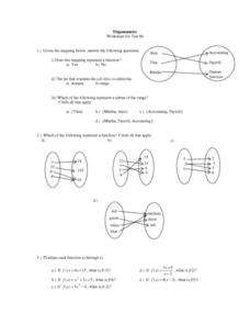
Trigonometry: Worksheet for Test #4
In this trigonometry instructional activity, students determine whether given mappings are functions. They evaluate 5 functions for a given x value. Students graph 2 functions. They determine which ordered pairs are solutions to given...
Curated OER
TE Activity: The Trouble with Topos
Students study the uses of topographical maps including the many forms that they take. They discover that the map features show its intended use such as city maps, wilderness maps, and state maps. They complete a worksheet in which they...
Curated OER
Graphing Coordinates
Sixth graders practice graphing coordinates. In this geometry lesson plan, they use the x and y axis to locate points that must be connected in the right sequence to form a straight line.
Curated OER
How Worldly Are You?
Sixth graders locate and map six components to have a working knowledge of maps. In this map skills lesson, 6th graders define the six map components and work in groups to draw a map using the components. Students read a related...
Curated OER
Native Americans and Topography at Rose Bay
Students visit a wetland ecosystem. While they are there, students explore how to read topography maps of Rose Bay.
Curated OER
Red October
Fourth graders follow directions given in bearings. They invent their own maps using them and use a protractor to help them with their designs. Students
produce their own maps with instructions for navigating the maps. The channels...
Curated OER
X Marks the Spot
Fourth graders use games and puzzles to explore co-ordinate systems and their uses. Students are given the opportunity to invent their own systems by locating counters on a sheet of paper and by finding the dead center of a set of objects.
Curated OER
Introduction to Archaeology
Students view a PowerPoint presentation called, Archaeological Terms then discuss the job of an archaeologist and new vocabulary. They view the teacher made "artifact grid" and photograph the grid from different angles. They work in...
Curated OER
Who's Got Your Power
Students examine and map local sources of energy. They conduct Internet research on their local utility company, identify where their utility company obtains energy, graph the data, and label a map of power plant locations in their state.
Curated OER
School Word Search
In this school activity worksheet, students use the 20 words in the word bank to locate and identify them in the word search puzzle.
Curated OER
"Hard" Data from Space
Students use satellite images to analyze development patterns within Baltimore City. They prepare a land cover map for Baltimore indicating the prevalence of impervious surfaces and explore how these patterns affect water pollution.
Curated OER
Creating a Database: Africa, Technology, Social Studies
Students use technology to create a database demonstrating their knowlede (in the case) of the African Continent. This project could be applied to almost any other concept studied.


