Mathematics Assessment Project
Creating Equations
Using equations to model events. The resource contains four items that prompt individuals to write and solve basic equations. They must reason abstractly and quantitatively while attending to precision when solving the problems.
Curated OER
Map Coloring
In this math worksheet, students create a map using different colors. They use a specific pattern and can use only four colors. This worksheet is a proof of the making of a map using no more than 4 colors. There is an answer key.
Curated OER
Do You Know Your 50 States?
Learners use the names and abbreviations of the 50 states to label a blank map of the United States.
Curated OER
Reduce, Re-use, Recycle
Students determine the importance of recycling to reduce waste, to employ trash in useful ways, and to save the environment. They estimate the percentages of landfill waste that items constitute, based on what they found in their own...
Curated OER
Finding Important Community Sites
Students locate community sites on a city map using the map legend and grid system.
Curated OER
Mapmaking: Colorado Quarter Reverse
Students examine the Colorado quarter reverse and draw symbols of the state's land and water features on maps. Using copies of the Colorado reverse, they color the coin design. They list reasons for the state's motto of "Colorful Colorado"
Curated OER
Reading a Map
Third graders become familiar with the vocabulary and skills related to mapping. In this guided reading lesson, 3rd graders find proper nouns on from the map. Students read Goldilocks. Students make a map...
Curated OER
Making Personal Maps
Students study maps and become familiar with how to use one. In this investigative lesson plan students create a map of an area and provide a legend.
Curated OER
Waldseemuller's Map: World 1507
Seventh graders analyze various maps. For this Geography lesson, 7th graders create a large map as a whole class. Students write a letter to Mr. Waldseemuller.
Curated OER
Teen America Travels New England
Students simulate the role of a travel agent to understand how to read and use road maps. They plan a bus trip through New England for a group of travelers that includes, bus travel, meals and attractions. They plan the distance that...
Curated OER
Orienteering 2
Students are shown the basics of map and compass work. They name the parts of a compass and comprehend the function of each part. Students define paces and tallies and use them in a real world situation. They use a map and compass to...
Curated OER
A View from Overhead
Pupils explore the concept of mapping. Using given illustrations, students observe views of a park from above the ground. They compare and contrast the different views. Pupils discuss uses for maps. Using a resource from the...
Curated OER
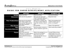
Story Mapping: Guide for Cross-Disciplinary Application
In this story mapping worksheet, students read how story mapping can apply to 3 different areas of study: history, English and science lab. The components of story mapping that are included here are setting, characters, problem/goal,...
Curated OER
Learning to Use Map Legends
Fifth graders comprehend the purpose of and use map legends. They identify and use symbols and lines from legends on a general-purpose map and four topical maps to completely and accurately answer eight questions on a geography worksheet.
Curated OER
LA CENERENTOLA (Cinderella)
Students work in groups to create a map key. The map key represents the diversity of each of the Cinderella stories previously read. They explore the cultural dimensions and contributions of the arts.
Curated OER
Mapping the Human Journey
Young scholars explore a migration of people with their surname. As a class, they define key vocabulary and identify the different types of movementbs of people in history. They examine the reasons for the migration and use the internet...
Geography 360°
Introducing Europe
Provide your learners with a comprehensive introduction to Europe with this great set of worksheets. Map activities include matching European countries to their capitals and places on a political map, as well as...
National Research Center for Career and Technical Education
Transportation, Distribution, and Logistics: Tire and Wheel Assemblies
Is bigger really better? By the end of this lesson, learners will be able to apply formulas for computing the diameter of tires and wheel assemblies. Begin by showing a slide presentation that will review definitions for radius and...
Mark Twain Media
Understanding Informational Text Features
Everything you need to know about informational text features can be found in this resource. Recognizing these types of text features and how they are used in text allows readers to better understand information. Teachers...
Syracuse University
Erie Canal
While canals are not the way to travel today, in the first half of the nineteenth century, they were sometimes the best way to move goods and people. Scholars examine primary sources, including maps and pictures, to investigate the role...
Oregon State
World Map of Plate Boundaries
Young geologists piece together the puzzle of plate tectonics in an earth science lesson. Given a physical map of the world, they search for land formations that indicate the location of different types of plate boundaries.
Smarter Balanced
Exploring the World
To prepare for the Exploring the World Performance Task, class groups generate a list of places they would like to explore, examine images of seven natural wonders of the world, and consider why these sites are wondrous. A map and images...
American Chemical Society
Development of Baking Powder
Did you know baking powder can be used to treat acne, whiten teeth, and make sugar cookies? The lesson on the development of baking powder is ready-to-go with no preparation required. Through readings, pupils answer questions, complete...
NOAA
Tracking a Drifter
Be shore to use this drifter resource. The third installment of a five-part series has learners using the NOAA's Adopt-a-Drifter website to track to movement of a drifter (buoy) in the ocean. Graphing the collected data on a map allows...


