Curated OER
Shopping for Souvenirs In the Middle East
Students participate in a role play in which they are shopping for souvenirs in the Middle East. Using maps, they locate the Middle East and identify each country within the region. They create a key map for the types of souvenirs that...
Curated OER
Where, Oh Where
Students use maps to explore several traditional regions of Native Americans. They research information on the regions' climate, resources, landforms, flora and fauna.
Curated OER
My Summer Vacation
Learners study the United States geography using Google Earth. In this U.S. geography lesson, students create travel journals about five U.S. geographical locations. Learners research the human and physical characteristics for each region.
Curated OER
What is the Population Distribution of Cartoon Characters Living On the Pages of Your Newspaper?
Students read various cartoons in their local newspaper and calculate the population demographics, spatial distribution and grouping of the characters. Using this information, they create a population distribution map and share them with...
Curated OER
Algebra/Geometry Institute Summer 2007: Graphing Activity
Seventh graders practice identifying coordinates by examining a city map. In this graphing lesson, 7th graders create coordinate directions on an index card and practice locating these locations on a grid. Students read and...
Curated OER
Prepositional Phrases
Focus on prepositions and prepositional phrases, is the goal of this game of charades. The clues are based on maps that they have drawn out of a hat, and describe how to get to a certain location in a town using prepositions. Note:...
Curated OER
Where In the World Are We?
Fifth graders read postcards and find their locations on maps. They use the pictures and text on the postcards to write about imaginary vacations. They compute the mileage and compare it to TripMaker data.
Curated OER
Country Capitals
Students define the meaning of country capital. In this country capital lesson, students identify the symbol and find country capitals. Students locate and label capital cities on a map and insert the capital symbol.
Curated OER
Locomotor Treasure Hunt
Students practice in refining their locomotor skills and developing their understanding of pathways and basic map reading skills.
Curated OER
A Birthday Basket for Tia
Students practice reading and math skills using technology. In this main idea instructional activity, students retell the important events of A Birthday for Tia in sequence using Kid Pix. Students create a bar graph...
Curated OER
Panther Scavenger Hunt
Students research a website to learn about the Florida panther. In this animal research lesson, students use the scavenger hunt directions to search a website about Florida panthers. Students also solve word puzzles within the activity.
Curated OER
Living in an Igloo
Second graders read a book entitled, "Living in an Igloo." After observing the book, 2nd graders predict what will happen in the story. They explore the steps in building an igloo. Students review strategies they can use to decode...
Curated OER
What Do We Know About Africa?
First graders explore Africa, its geography and climate. After completing a KWL chart, 1st graders locate Africa on a globe and discuss how its location on the earth affects its climate. Using the Internet and a given fact sheet,...
Curated OER
Health and Safety
Students analyze colors and the reasons they are used in preschool room setups. They examine preschool setups, safety procedures, and the immunizations required for preschool.
Curated OER
Basics of the Korean War
Learners research the key players and major events of the Korean War. Students assigned in groups, research a country involved in the Korean War. Groups then bring their information to the whole groups to explain their country's...
Curated OER
Geographic Landscapes and Interstate Freeway Development
Students investigate the topography of the United States through a discovery lesson. They create a hypothetical route for a highway across the United States. Students also conduct research major landforms and define geographic terms.
Curated OER
White Bear Lake Fitness Challenge
Students participate in fitness challenge. After choosing a destination they would like to visit, students record their mileage to their destination after riding on bikes and walking on treadmills. Students receive an incentive...
Curated OER
Food and Languages of the World
Students explore and notice how foods from different countries of the world are alike and different. In this food and languages of the world instructional activity, students examine fruit and bread from a variety of countries...
Curated OER
MEDIEVAL SUB-SAHARAN AFRICA
Seventh graders examine the area of medieval Sub-Saharan Africa through eyes of travelers in the company of one of history's greatest travelers, Ibn Battuta. The project has been structured to include all the State standards for this unit.
Curated OER
Travel-Tracer-Literature Circles
In this travel tracer literature circle worksheet, students track where the action of a story takes place by recording where the action begins, where key events happened, and where the events ended. They describe the settings in detail...
Curated OER
Text Map: The Structure of Shakespearean Drama
Young scholars identify the structure of Shakespearean Drama. In this Shakespearean drama lesson, students identify features common to Shakespearean drama and explain their purpose.
Curated OER
Using Imported Data in Excel
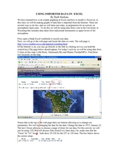
Pupils import atmospheric data from the internet. In this earth science lesson, students graph the data they collected. They complete the worksheet after the activity.
Curated OER
Nebraska: Using Pictures
Young scholars create a scrapbook about Nebraska history focusing on Post Office murals. They choose their favorite murals and write a story to go along with the mural. In groups, students present their murals to the class and visit the...
Curated OER
Magnitude vs Intensity
Students use a zipcode map to locate earthquake experiences based on the Modified Mercalli Scale. They discuss the difference of the magnitude of an earthquake compared to the intensity of the shaking it causes.


