Ms. Catsos
Ancient Rome Map Worksheet
It wasn't just the great leaders of ancient Rome that shaped their civilization—the geography of the region played a major role as well. After first identifying major land masses, bodies of water, and city states on a map of Europe,...
Howard Hughes Medical Institute
Mapping Genes to Traits in Dogs Using SNPs
Genetic analysis has gone to the dogs! Learners use real DNA information collected from dog saliva to study the relationship between genotypes and phenotypes. They analyze alleles to determine correlations to coat color, length, and...
Curated OER
Using the Library for More than Research Papers
Use the repository of resources that modern libraries hold to your advantage during National Library Week.
Curated OER
Map Skills
Students explore geography by creating a poster presentation in class. In this mapping lesson, students identify the different components featured on a modern day map and how to utilize them in order to navigate. Students read a book...
Curated OER
Where Am I: How to Read a Map
Third graders develop an understanding of maps. They explore what a map is, who uses maps, and how to use maps. Students investigate the compas rose. They create a compose rose which illustrates the cardinal directions. Students practice...
Curated OER
Mapping Perceptions
Young scholars create and read maps. In this map skills lesson, students draw a map of their neighborhood, then use skills acquired during map-making to interpret a classmates map and a map of the Ming Dynasty.
Curated OER
Edible State Map
Fourth graders, using a map of a state for reference, make an edible map that shows the major cities in that state. Once the map is shaped, have students place the M&M's where each major city would be. Now this is a lesson I could...
Curated OER
Lesson 2: Mapping Sub-districts
Learners learn more about the census. In this mapping sub-districts lesson plan, students visualize census data on a map, use a map key to read a population map, and better understand the concept of population density.
Curated OER
Archaeology- State Map
Students study state maps. In this map skills lesson, students identify the states' location and how to use a legend. Students complete photocopies of the state map.
Curated OER
Map Literacy
Students locate their home state on a map. They differentiate between physical and population sizes of states. In two groups, students "become" states with string for boundaries. They ascertain that area does not always equal large...
Curated OER
Create a Country
Learners work in small groups to list features and elements found on a variety of grade- appropriate maps. They develop a class list of map features and elements to draw from as they create a map of an imaginary country.
Teacherfiles
Basic Story Map
Here’s an all-purpose story map template that readers can use to keep track of books read for class, of independent reading, and even for stories planned. Users identify the title, author, major characters, setting, and events from the...
Curated OER
Learning About Maps
Students take a "field trip" with the teacher through the school then draw a diagram of what they saw. They bring the maps to the computer lab where they create electronic maps using the software program Neighborhood Map Machine.
Curated OER
Geography Awareness Week: Practice Mapping Skills
You won't get lost, after learning map skills during Geography Awareness Week.
Texas State Energy Conservation Office
Investigation: Concept Mapping Fuels
After reading an article, "Fuels for Everything," collaborative groups create a concept map poster of the transportation and non-transportation fuels. This makes a strong introduction to the different types of fuels used for transportion...
Curated OER
Those Who Have Come Before Me
Class members are transformed into explorers as they work in groups to locate hidden items and map their journey along the way. They then leave clues for other groups of students to follow, and ultimately discover how past explorations...
Institute for Geophysics
Understanding Maps of Earth
Here is your go-to student resource on primary geography concepts, including facts about the surface of the earth and its hemispheres, latitude and longitude, globes, types of maps, and identifying continents and oceans.
Annenberg Foundation
America's History in the Making: Using Digital Technologies
How can digital technology of today link us to the events of the past? Scholars use technology to uncover the vast number of historical resources available in lesson 12 of a 22-part America's History in the Making series. Using databases...
Raymond C. Jones
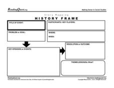
Story Mapping History Frame
Map out the conflicts throughout history with a graphic organizer. It includes a section for kids to list the participants in an event, the problems or goals, and the theme or lesson learned.
Curated OER
Map Exploration
Are you looking for a terrific instructional activity on map activities for your second graders? Then, this resource is for you! The activities range from decoding, to fill-in-the-blank, to read-and-search. There is a website activity...
Curated OER
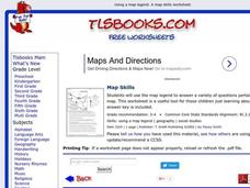
Map Skills
In this history activity, students use a map and legend to answer nine comprehension questions. Students check their answers when done.
Curated OER
Map Making/Floor Plans/Map Reading
Students apply their knowledge of scale when mapping the classroom. They determine the use of a map legend and orient a map using a compass. They create the classroom maps using transfer graph paper.
Curated OER
Map Skills
In this map worksheet, students use a map and key to complete a set of 7 questions. Answers are included on page 2, questions focus on miles and direction.
Curated OER
Understanding: Geography
Students explore their neighborhoods. In this geography lesson, students make a map of their neighborhood. They must include a key, natural terrain, buildings and streets. They also write a descriptive paragraph about their neighborhood.


