Curated OER
Reading a Local and National Weather Map
Students investigate weather maps. In this weather instructional activity, students discover the meaning of different weather icons and symbols. Working independently, students use the local forecast to correctly label a state map.
Curated OER
Reading Maps of the East Pacific Rise
Young scholars make qualitative and quantitative observations and use various maps to investigate the features of the East Pacific Rise The study actual bathymetric maps of the EPR region. They identify key features of the ridge and...
Curated OER
Mapping the Halifax Explosion
Students research the Halifax Explosion using historical maps.
Curated OER
Map Scale
Third and fourth graders are introduced to the concept of map scale. Using an illustration, they discuss if it shows the actual size of the object and why scale is used to represent areas. They use some items in the illustration to...
Curated OER
Slopes, Distances, and Map Keys
Students explore Rise and Run. In this math instructional activity, students use Rise and Run to find given slopes, they will use the slopes to calculate distances from point to point on graph paper.
Curated OER
Ecosystem Concept Map
How do ecosystems change? How do organisms keep their ecosystem going? Learners use a word bank to fill in 12 blanks that describe the functionality of ecosystems.
Beauty and Joy of Computing
Three Key List Operations
Develop an understanding of the Map, Keep, and Combine operations. The lab leads the class through the exploration of three list operations. Each task contains a self-check to measure scholars' understanding of the operation in the...
Columbus City Schools
Geological Effects of Plate Tectonics
Don't get your classes all shook up about plate movement, instead use a thorough unit that guides learners to an understanding of plate tectonics. The lessons incorporate a study of the types of plate boundaries and their effects on the...
Curated OER
MAP Practice
In this geometry activity, students create circle, line and bar graphs using different comparisons of events. There are 24 questions with an answer key.
Big History Project
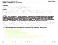
Human Migration Patterns
Humans have been on the move for millennia. Using an article from The Smithsonian, pupils chart human movement before written history on a world map. In addition, they examine the modes of transportation used by different waves of human...
Kentucky Educational Television
The Road to Proportional Reasoning
Just how big would it really be? Young mathematicians determine if different toys are proportional and if their scale is accurate. They solve problems relating scale along with volume and surface area using manipulatives. The...
Beyond Benign
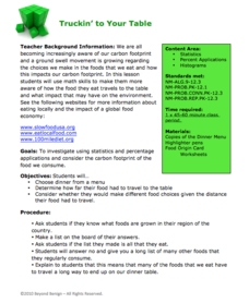
Truckin’ to Your Table
Food takes a trip to the table. Class members choose a meal from a menu and calculate the total cost of the meal including tax and tip. Using a food origin card, pupils determine how far each of the ingredients of a meal traveled to end...
Curated OER
Using Picture Mapping to Improve Student Comprehension
Students draw pictoral representations of a reading selection they read in order to recall information. For this picture mapping lesson plan, students use pictures to comprehend what they read and sequence the pictures as well.
Curated OER
Right Place, Right Time
Fourth graders complete mathematical word problems. They study the relationships among distance, speed, and time; and measure travel distances. They measure distances using a piece of string and a ruler and practice converting several...
Curated OER
We're Gonna Have A Party
First graders explore map skills. They discuss the map vocabulary and use directions to find a location on a map. Students discuss and use the components of a map to answer a variety of questions. They use the map and directions to find...
Curated OER
What's That Tree?
Fifth graders identify trees along a nature trail. Using a dichotomous key, 5th graders answer questions to aid in their identification of trees along a specified nature trail. Observations are recorded in their science journals. Sample...
Compton Unified School District
How Can We Locate Places?
How can we locate places? Maps, of course! Expose second graders to the tools available in maps and discuss how these tools can help people find locations. Students also look at communities, including what makes a community and the...
Curated OER
Exploring our National Parks
Students utilize maps/Atlases to find key spatial information, locate U.S. National Parks, characterize the geography of a specific region, and create a National Park brochure.
Curated OER
Tortoise and Hare Races
Practice basic map skills with the story of The Tortoise and the Hare. After listening to the story, class members create a map that indicates the starting line, the path the animals took, where they stopped to rest, and the finish line....
Curated OER
Forest Fun
Students explore orienteering and how to use a compass. They explore the importance of forests and identify some of the trees in a local forest.
Balanced Assessment
School Zone
Find the right house within walking distance from school. The short assessment has pupils determine the houses that are a given maximum distance from a school. Individuals then determine the shortest and longest walks from the homes that...
Curated OER
The Case of Vanishing Farmland
High schoolers consider decisions about how to use resources that are in short supply. Students role-play different perspectives in a land-use simulation, and examine land use issues around the world. This interesting lesson sheds light...
PBS
Inspector Detector
How do spacecraft detect magnetic fields? The fourth installment of a five-part unit has learners develop a device with magnets that allows for the detection of magnetic fields. They use a map of an imaginary planet to try out their...
Curated OER
Mapping Districts
Students become literate in their use of maps. In this 2010 Census lesson plan, students visualize census data on maps, use map keys to read population maps, and explore the concept of population density.


