Curated OER
Exploring Hawaiian Mountain Zones
Fourth graders watch a video that describes the climate and vegetation zones of Hawaii. They describe the different physical conditions that create vegetation zones from the sea to the mountains. In groups, they create an illustrated...
Curated OER
This is My Neighborhood
Students predict the things that they may see, smell, or hear in their neighborhood. They take part in a neighborhood walk, creating a rough map of their neighborhood as they go. Upon return to the classroom, students create a final map...
Curated OER
Mapping the Garden
Students discuss maps, the features on a map, and why maps are important. They make a map of a garden they will be planting, complete with symbols that represent the various plants they choose to plant.
NOAA
Watching in 3D
Bring the ocean floor to life! Earth science scholars discover the process of deep sea mapping in the third installment in a series of five lessons about ocean exploration. The teacher's guide includes helpful resources, worksheets, and...
Australian Centre For the Moving Image
Dreamworks Animation Character Design
Dive into animation creation using Dreamworks® animated films. Compare and contrast characters, wonder and ponder why the plot is so important, and think of background and themes as your creativity unrolls onto paper.
NOAA
Into the Deep
Take young scientists into the depths of the world's ocean with the second lesson of this three-part earth science series. After first drawing pictures representing how they imagine the bottom of the ocean to appear, students...
It's About Time
How Do Plate Tectonics and Ocean Currents Affect Global Climate?
What do plate tectonics and ocean currents have to do with global climate? This fourth installment in a six-part series focuses on how plate tectonics and ocean currents affect global climate, both now and in the past, outlines an...
Howard Hughes Medical Institute
Lesson 6: Biomes and Landscapes
Aside from the amazing animals in Gorongosa National Park, what else is there to discover? The sixth installment in an eight-part themed series contains an interactive map where scholars can learn more about the geographic features of...
Curated OER
A Tour of Jaffa
Use the age-old Traveling Salesman Problem to introduce Hamilton circuits to your young travelers. Individuals then plan an efficient route to visit all the places they want to go.
Chicago Botanic Garden
Climate Change Around the World
Look at climate change around the world using graphical representations and a hands-on learning simulation specified to particular cities around the world. Using an interactive website, young scientists follow the provided...
Mathematics Assessment Project
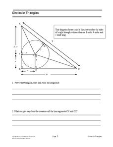
Circles in Triangles
Circles, and triangles, and tangents, oh my! In the assessment task, learners first answer questions leading to the radius of an inscribed circle for a given right triangle. They then use the result to independently determine the...
Mathematics Assessment Project
College and Career Readiness Mathematics Test B2
Use a nine-page evaluation to cover material from algebra, geometry, and algebra II. It incorporates short answer, applied reasoning, and conversion problems.
Mathematics Assessment Project
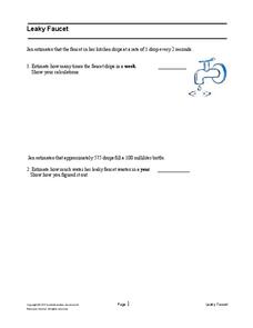
Leaky Faucet
In the assessment task, learners investigate the rate at which a faucet leaks. They use unit conversions to determine the amount of water that leaks in a year. Maybe they should just fix the leak!
Mathematics Assessment Project
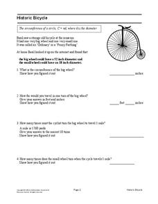
Historic Bicycle
"Ordinary" bicycles are not so ordinary. Learners use given information to determine the circumference of wheels for a historic Ordinary or Penny Farthing bicycle. Pupils then determine the number of times each wheel turns when the...
Curated OER
Story Mapping
Students prewrite a story using graphic organizers. In this prewriting lesson plan, students create a story map before they start their writing.
Curated OER
A Map Mystery
First graders solve a mystery by following map clues. In this map clues lesson plan, 1st graders follow a computer program called Neighborhood Map Machine. In this program, it gives students directional and spatial clues in order to...
Curated OER
Rivers, Maps, and Math
Learners use maps to locate and label the major rivers of North and South America. Using the internet, they identify forests, grasslands, mountain ranges and other landforms on the continents as well. They compare and contrast the...
Curated OER
Comprehension is Key!
Students observe and demonstrate how to use a story map to identify the main idea of text. They observe the teacher read an article about birds out loud, and create a story map for the article. Students then independently read another...
Curated OER
How Do Cartographers Find Points on a Map?
Ninth graders describe latitude and longitude and how they may be useful to find things on a map. In this cartography lesson students divide into groups and devise a coordinate system that can be used to communicate a position.
Curated OER
Maps, Maps, and More Maps
First graders create a map and display an understanding of the cardinal directions. In this map skills lesson, 1st graders listen to stories where a map would come in handy, create their own map, and use the cardinal directions accurately.
Curated OER
Labeling a Map of Australia
Third graders label a map of Australia. Using the internet, they research the history and maps of the continent and print a blank map. They review on how to use a compass rose and legend. In groups, they create a brochure to share...
Curated OER
Using Maps in the LCTL Classroom
Pupils review terms and prepositions of location and view a map to illustrate the meanings of the prepositions students are unfamiliar with. They play "Where am I?" game utilizing correct prepositions then they work with a partner to...
Curated OER
Map Grids
Young scholars study map grids and explore how they can be used to locate positions of objects or features on a map. They read a story and then participate in a grid activity using a large map of the setting of the story.
Curated OER
What Do Maps Show?
Students discover the uses for various types of maps. In this geography skills lesson, students discuss the type of maps that exist and what their individual features are. Students then practice using different types of maps.


